- Magdalen Islands
-
"Les Îles-de-la-Madeleine" redirects here. For the municipality, see Les Îles-de-la-Madeleine, Quebec. For the African island, see Îles des Madeleines.
The Magdalen Islands (French, Îles de la Madeleine) form a small archipelago in the Gulf of Saint Lawrence with a land area of 205.53 square kilometres (79.36 sq mi). Though closer to Prince Edward Island and Nova Scotia, the islands form part of the Canadian province of Quebec.
The islands form the territory equivalent to a regional county municipality (TE) and census division (CD) of Les Îles-de-la-Madeleine. Its geographical code is 01.
The islands also form the urban agglomeration of Les Îles-de-la-Madeleine, divided into two municipalities. These are Les Îles-de-la-Madeleine (2006 census pop. 12,560), the central municipality, and Grosse-Île (pop. 531). The current mayors are Joêl Arseneau and Rose Elmonde Clarke.
Contents
Geography
There are eight major islands: Havre-Aubert, Grande Entrée, Cap aux Meules, Grosse Île, Havre aux Maisons, Pointe-Aux-Loups, Île d'Entrée and Brion. All except the latter are inhabited. There are several other tiny islands which are also considered part of the archipelago: Rocher aux Oiseaux, Île aux Loups-marins, Île Paquet and Rocher du Corps Mort.[1]
History
Jacques Cartier was the first European to visit the islands, in 1534. However, Mi'kmaq Indians had been visiting the islands for hundreds of years as part of a seasonal subsistence round, probably to harvest the abundant walrus population. A number of archaeological sites have been excavated on the archipelago.
It was named in 1663 by the seigneur of the island, François Doublet, after his wife, Madeleine Fontaine.[2] In 1755, the islands were inhabited by French-speaking Acadians. When the British expelled the Acadians from the rest of what are now the Maritime Provinces of Canada, they did not come as far as the Magdalen Islands. To this day, many inhabitants of the Magdalen Islands (Madelinots) fly the Acadian flag and think of themselves as both Acadians and Québécois.
The islands were administered as part of the Colony of Newfoundland from 1763 until 1774, when they were joined to Quebec by the Quebec Act.
Until the 20th century, the islands were completely isolated during the winter, since the pack ice made the trip to the mainland impassable by boat. The inhabitants of the island could not even communicate with the mainland. In the winter of 1910, they sent an urgent request for help to the mainland by writing many letters and sealing them up inside a molasses barrel (or puncheon), which they set adrift. When this reached the shore, on Cape Breton Island, the government sent out an icebreaker to bring aid. Within a few years, the Magdalens were given one of the new wireless telegraph stations so that the inhabitants could at least have some communication in the winter. The puncheon is now famous, and every tourist shop sells replicas.
At one time, large walrus herds were found near the islands but they had been eliminated due to overhunting by the end of the 18th century. The islands' beaches provide habitat for the endangered Piping Plover and the Roseate Tern.
Demographics
A segment of the population are descendants from survivors of the over 400 shipwrecks on the islands. The islands are the location of some of Quebec's oldest English-speaking settlements, and although the majority of anglophones have since been assimilated with the francophone population or migrated elsewhere, there are still English-speaking settlements at Old Harry, Grosse-Ile, and Entry Island. As well as the English-speaking settlements, the islands are known for their world famous children's French camp. Activities include sand-castle competitions and a night alone in the woods.
Lighthouses were eventually set up, and this reduced the number of shipwrecks, but there are still many old hulks on the beaches and under the waters.
In the 2001 Census, the archipelago was found to support a population of 12,818, down from 13,991 in 1991 – the official 2006 census figure is 13,091 – whose main occupations include lobster fishing.[3][4]
Tourism
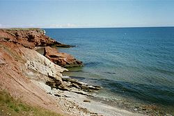
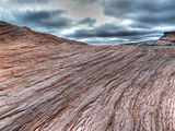
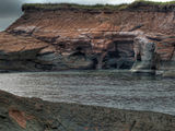
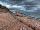
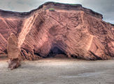
Tourism is a major industry on the Magdalen Islands. The islands have many kilometres of white sand beaches, along with steadily eroding sandstone cliffs. It is an excellent destination for bicycle camping, sea kayaking, windsurfing and kitesurfing. During the winter months, beginning in mid-February, eco-tourists visit to observe new-born and young harp seal pups on the pack ice in the Gulf of St. Lawrence surrounding the islands.
Industry
The island is home to Canadian Salt Company Seleine Mines, which produces road salt for use in Quebec, Atlantic Canada and the United States eastern seaboard.[5] Opened in 1982, the salt mine and plant is located in Grosse-Île and extracts salt from an underground mine 30 metres (98 ft) below Grande-Entrée Lagoon, produces 1 million tons of salt, and employs 200 people.
Transportation
The Coopérative de transport maritime et aérien (Groupe C.T.M.A.) operates a ferry service between terminals in Souris, Prince Edward Island and Cap-aux-Meules. Groupe C.T.M.A. also operates a seasonal cruise ferry service between the islands and Montreal.[6]
The Magdalen Islands Airport at Havre-aux-Maisons offers scheduled air service to the Maritimes and mainland Quebec.
Gallery
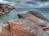
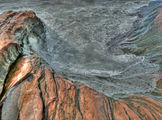
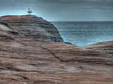
Click on the images to access the camera location. Magdalen Islands HDR 1. Magdalen Islands HDR 2. Magdalen Islands HDR 3. Magdalen Islands HDR 4. Magdalen Islands HDR 5. Magdalen Islands HDR 6. Magdalen Islands HDR 7. See also
- Quebec Route 199, the only provincial highway on the islands
- Coopérative de transport maritime et aérien, the ferry company serving the Magdalen Islands
- Municipal reorganization in Quebec
- List of Quebec regions
- Coins of the Magdalen Islands (numismatic history).
References
- ^ The Archipelago
- ^ Toponymie du Québec
- ^ Community Profile: Les Îles-de-la-Madeleine Regional County Municipality, Québec Statistics Canada
- ^ Les Îles-de-la-Madeleine Census Division, Quebec Statistics Canada
- ^ Windsor Salt
- ^ Schedule and rates - Ferry - Sea links crossing Îles de la Madeleine and Prince Edouard Island ferry, cruise on St-Lawrence
External links
- Municipalité des Îles-de-la-Madeleine
- Municipalités et villes de la Gaspésie
- Magdalen Islands tourist association
- The official tourist site of the islands
- Quebec tourism information on the Magdalen Islands including a map (with the French names)
- Rochers-aux-Oiseaux Migratory Bird Sanctuary, Environment Canada
- Satellite view of Magdalen Islands
 Administrative divisions of Gaspésie-Îles-de-la-Madeleine (Region 11)
Regional county municipalities
and equivalent territoriesLes Îles-de-la-Madeleine · Le Rocher-Percé · La Côte-de-Gaspé · La Haute-Gaspésie · Bonaventure · Avignon
Municipalities Administrative divisions of Quebec  Administrative divisions of Quebec
Subdivisions Communities Major cities Montreal · Quebec · Laval · Gatineau · Longueuil · Sherbrooke · Saguenay · Lévis · Trois-Rivières
Regions Abitibi-Témiscamingue · Bas-Saint-Laurent · Capitale-Nationale · Centre-du-Québec · Chaudière-Appalaches · Côte-Nord · Estrie · Gaspésie–Îles-de-la-Madeleine · Laval · Lanaudière · Laurentides · Mauricie · Montérégie · Montréal · Nord-du-Québec · Outaouais · Saguenay–Lac-Saint-Jean
Coordinates: 47°26′54″N 61°45′08″W / 47.44833°N 61.75222°W
Categories:- Islands of Quebec
- Territories equivalent to a regional county municipality
- Census divisions of Quebec
- Archipelagoes of the Atlantic Ocean
- Gaspésie–Îles-de-la-Madeleine
Wikimedia Foundation. 2010.


