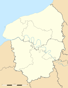
- Ouville-la-Rivière
-
Ouville-la-Rivière
Administration Country France Region Upper Normandy Department Seine-Maritime Arrondissement Dieppe Canton Offranville Intercommunality Saâne et Vienne Mayor Jacques Thelu
(2008–2013)Statistics Elevation 7–74 m (23–243 ft)
(avg. 9 m/30 ft)Land area1 6.34 km2 (2.45 sq mi) Population2 602 (2006) - Density 95 /km2 (250 /sq mi) INSEE/Postal code 76492/ 76860 1 French Land Register data, which excludes lakes, ponds, glaciers > 1 km² (0.386 sq mi or 247 acres) and river estuaries. 2 Population without double counting: residents of multiple communes (e.g., students and military personnel) only counted once. Coordinates: 49°52′25″N 0°57′37″E / 49.8736111111°N 0.960277777778°E
Ouville-la-Rivière is a commune in the Seine-Maritime department in the Haute-Normandie region in northern France.
Contents
Geography
A village of farming and light industry situated by the banks of the river Saâne in the Pays de Caux at the junction of the D27, D54 and the D925 roads, some 6 miles (9.7 km) southwest of Dieppe.
Population
Population history 1962 1968 1975 1982 1990 1999 2006 610 642 645 609 634 602 602 Starting in 1962: Population without duplicates Places of interest
- A yew tree nearly 1000 years old.
- The eighteenth century château de Tous-les-Mesnils, open to visitors on weekend afternoons in the summer.
- The manorhouse du Tessy, now a guesthouse.
- The château d'Ouville, damaged during World War II, and not yet completely rebuilt.
- The church of St. Gilles, dating from the eleventh century.
- A sixteenth century stone cross.
See also
References
External links
Categories:- Communes of Seine-Maritime
- Dieppe geography stubs
Wikimedia Foundation. 2010.


