- Sussex, New Jersey
-
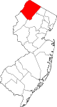
Sussex, New Jersey — Borough — Map of Sussex County highlighting Sussex Borough. Inset: Location of Sussex County in the State of New Jersey. Census Bureau map of Sussex, New Jersey
Coordinates: 41°12′35″N 74°36′29″W / 41.20972°N 74.60806°WCoordinates: 41°12′35″N 74°36′29″W / 41.20972°N 74.60806°W Country United States State New Jersey County Sussex Incorporated October 14, 1891 as Deckertown Renamed March 2, 1902 as Sussex Government – Type Borough (New Jersey) – Mayor Christian Parrott (2011) Area – Total 0.6 sq mi (1.6 km2) – Land 0.6 sq mi (1.5 km2) – Water 0.0 sq mi (0.1 km2) Elevation[1] 443 ft (135 m) Population (2010) – Total 2,130 – Density 3,447.9/sq mi (1,331.3/km2) Time zone Eastern (EST) (UTC-5) – Summer (DST) EDT (UTC-4) ZIP code 07461 Area code(s) 973 FIPS code 34-71670[2][3] GNIS feature ID 0885414[4] Website http://www.sussexboro.com Sussex is a borough in Sussex County, New Jersey, United States. As of the 2010 census, the borough population was 2,130.[5]
Sussex was incorporated as a borough by an act of the New Jersey Legislature on October 14, 1891, as Deckertown, from portions of Wantage. The borough was renamed Sussex on March 2, 1902.[6]
In 2008, Sussex Borough considered consolidation with surrounding Wantage Township.[7]
Contents
Geography
Sussex is located at 41°12′34″N 74°36′25″W / 41.209485°N 74.606878°W (41.209485, -74.606878).[8] It is approximately 400 to 450 feet (120 to 140 m) above sea level.
According to the United States Census Bureau, the borough has a total area of 0.6-square-mile (1.6 km2), of which 0.04-square-mile (0.10 km2), or 3.23%, is water.
Sussex borough is in the watershed of the Wallkill River (which flows north, and empties into the Rondout Creek, which flows into the Hudson River near Kingston, New York) and its tributary Glen Brook, which near Sussex forms a small body of water called Clove Lake, part of which is within the borough.
Demographics
Historical populations Census Pop. %± 1930 1,415 — 1940 1,478 4.5% 1950 1,541 4.3% 1960 1,656 7.5% 1970 2,038 23.1% 1980 2,418 18.6% 1990 2,201 −9.0% 2000 2,145 −2.5% 2010 2,130 −0.7% Population 1930 - 1990.[9][5] As of the census[2] of 2000, there were 2,145 people, 903 households, and 512 families residing in the borough. The population density was 3,598 people per square mile (1,380/km2). There were 961 housing units at an average density of 1,612/sq mi (618/km2). The racial makeup of the borough was 96.32% White, 1.12% African American, 0.09% Native American, 1.21% Asian, 0.37% from other races, and 0.89% from two or more races. Hispanic or Latino of any race were 2.56% of the population.
There were 903 households out of which 28.3% had children under the age of 18 living with them, 38.9% were married couples living together, 12.6% had a female householder with no husband present, and 43.2% were non-families. 35.1% of all households were made up of individuals and 12.6% had someone living alone who was 65 years of age or older. The average household size was 2.36 and the average family size was 3.12.
In the borough the population was spread out with 23.9% under the age of 18, 8.5% from 18 to 24, 32.9% from 25 to 44, 22.0% from 45 to 64, and 12.7% who were 65 years of age or older. The median age was 36 years. For every 100 females there were 91.5 males. For every 100 females age 18 and over, there were 91.8 males.
The median income for a household in the borough was $36,172, and the median income for a family was $45,250. Males had a median income of $37,009 versus $22,475 for females. The per capita income for the borough was $18,866. About 6.9% of families and 11.0% of the population were below the poverty line, including 15.6% of those under age 18 and 8.4% of those age 65 or over.
Government
Local government
Sussex is governed under the borough form of New Jersey municipal government. The government consists of a Mayor and a Borough Council comprising six council members, with all positions elected at large. A Mayor is elected directly by the voters to a four-year term of office. The Borough Council consists of six members elected to serve three-year terms on a staggered basis, with two seats coming up for election each year. One council member is elected by their fellow council as the Council President and Deputy Mayor.[10]
As of 2011[update], the Mayor of Sussex Borough is Christian Parrott (R, term ends December 31, 2011). Members of the Sussex Borough Council are Council President Edward Meyer (2012), Frank Dykstra (2013), James Fransen (2012), Bruce LaBar (2013), Katherine Little (2011) and Jonathan Rose (2011).[11]
Previous Mayors and Council President/Deputy Mayors include Mayor Kathy Little, Mayor Peter Horvath with Deputy Mayor Donald Jacobs, and Mayor Peter Horvath with Deputy Mayor Kathy Little.
Federal, state and county representation
Sussex Borough is in the Fifth Congressional District and is part of New Jersey's 24th state legislative district.[12]
New Jersey's Fifth Congressional District is represented by Scott Garrett (R, Wantage Township). New Jersey is represented in the United States Senate by Frank Lautenberg (D, Cliffside Park) and Bob Menendez (D, Hoboken).
24th Legislative District of the New Jersey Legislature, which is represented in the New Jersey Senate by Steve Oroho (R, Franklin) and in the New Jersey General Assembly by Gary R. Chiusano (R, Augusta) and Alison Littell McHose (R, Franklin).[13] The Governor of New Jersey is Chris Christie (R, Mendham).[14] The Lieutenant Governor of New Jersey is Kim Guadagno (R, Monmouth Beach).[15]
Sussex County is governed by a Board of Chosen Freeholders whose five members are elected at-large on a staggered basis, with one or two seats coming up for election each year. As of 2011, Sussex County's Freeholders are Freeholder Director Richard A. Zeoli (R, term ends December 31, 2012; Byram Township)[16], Deputy Director Susan M. Zellman (R, 2012; Stanhope)[17], Phillip R. Crabb (R, 2011; Franklin)[18], Parker Space (R, 2013; Wantage Township)[19] and Richard Vohden (R, 2013; Green Township).[20][21]
Politics
As of March 23, 2011, out of a 2010 Census population of 2,130 in Sussex, there were 1,143 registered voters (53.7% of the population, vs. 65.8% in all of Sussex County). Of registered voters, 193 (16.9% vs. 16.5% countywide) were registered as Democrats, 428 (37.4% vs. 39.3% countywide) were registered as Republicans and 521 (45.6% vs. 44.1% countywide) were registered as Undeclared. There was one voter registered to another party, the Green Party.[22]
On the national level, Sussex leans toward Republican Party. In the 2004 presidential election, Republican George W. Bush received 62% of the vote here, defeating Democrat John Kerry, who received 36%.[23] In the 2008 presidential election, Republican John McCain received 57% of the vote here, defeating Democrat Barack Obama, who received 40%.[24] This gives Sussex a Cook PVI of R+12.
Education
Students in public school for kindergarten through eighth grade attend the Sussex-Wantage Regional School District, together with children from Wantage Township. The three schools in the district (with 2008-09 enrollment data from the National Center for Education Statistics[25]) are Clifton E. Lawrence School in Wantage (506 students; grades Kingergarten to 2), Wantage Elementary School in Sussex (543; 3 - 5) and Sussex Middle School in Sussex (485; 6 - 8).
For grades 9 - 12, students attend High Point Regional High School, located in Sussex. Attending the school are students from Branchville, Frankford Township, Lafayette Township, Sussex and from Wantage Township.[26]
Students from New Jersey, Pennsylvania, and New York travel to and attend the private (day) school Sussex Christian School, an inter-denominational Christian School that was founded in 1958 by members of the Sussex Christian Reformed Church.[27]
Transportation
Sussex is located at the intersection of Route 23 and Route 284. Sussex Airport is located one mile southwest of Sussex.
References
- Notes
- ^ U.S. Geological Survey Geographic Names Information System: Borough of Sussex, Geographic Names Information System. Accessed January 4, 2008.
- ^ a b "American FactFinder". United States Census Bureau. http://factfinder.census.gov. Retrieved 2008-01-31.
- ^ A Cure for the Common Codes: New Jersey, Missouri Census Data Center. Accessed July 14, 2008.
- ^ "US Board on Geographic Names". United States Geological Survey. 2007-10-25. http://geonames.usgs.gov. Retrieved 2008-01-31.
- ^ a b "Profile of General Population and Housing Characteristics: 2010 Demographic Profile Data (DP-1) - Sussex borough, New Jersey". U.S. Census Bureau American Factfinder. http://factfinder2.census.gov. Retrieved November 8, 2011.
- ^ "The Story of New Jersey's Civil Boundaries: 1606-1968", John P. Snyder, Bureau of Geology and Topography; Trenton, New Jersey; 1969. p. 229, 232.
- ^ "Merger talks alive in Sussex, Wantage". (registration required) New Jersey Herald. Accessed March 2, 2011.
- ^ "US Gazetteer files: 2010, 2000, and 1990". United States Census Bureau. 2011-02-12. http://www.census.gov/geo/www/gazetteer/gazette.html. Retrieved 2011-04-23.
- ^ New Jersey Resident Population by Municipality: 1930 - 1990, Workforce New Jersey Public Information Network. Accessed March 1, 2007.
- ^ 2005 New Jersey Legislative District Data Book, Rutgers University Edward J. Bloustein School of Planning and Public Policy, April 2005, p. 110.
- ^ Mayor and Council, Sussex Borough. Accessed April 2, 2011.
- ^ 2010 New Jersey Citizen's Guide to Government, New Jersey League of Women Voters, p. 65. Accessed May 19, 2011.
- ^ "Legislative Roster: 2010-2011 Session". New Jersey Legislature. http://www.njleg.state.nj.us/members/roster.asp. Retrieved 2010-08-04.
- ^ "About the Governor". New Jersey. http://www.nj.gov/governor/about/. Retrieved 2010-01-21.
- ^ "About the Lieutenant Governor". New Jersey. http://www.nj.gov/governor/lt/. Retrieved 2010-01-21.
- ^ Richard A. Zeoli, Sussex County, New Jersey. Accessed January 6, 2011.
- ^ Susan M. Zellman, Sussex County, New Jersey. Accessed January 6, 2011.
- ^ Phillip R. Crabb, Sussex County, New Jersey. Accessed January 6, 2011.
- ^ Parker Space, Sussex County, New Jersey. Accessed January 6, 2011.
- ^ Richard A. Vohden, Sussex County, New Jersey. Accessed January 6, 2011.
- ^ Sussex County Board of Chosen Freeholders, Sussex County, New Jersey. Accessed January 6, 2011.
- ^ "http://www.state.nj.us/state/elections/election-results/2011-sussex-co-summary-report.pdf
- ^ http://www.state.nj.us/state/elections/election-results/presidential_sussex_co_2004.pdf
- ^ http://www.state.nj.us/state/elections/election-results/08-gen-elect-presidential-results-sussex.pdf
- ^ Data for the Sussex-Wantage Regional School District, National Center for Education Statistics. Accessed April 2, 2011.
- ^ School Info, High Point Regional High School. Accessed April 2, 2011. "High Point Regional High School is located in rural Sussex County, New Jersey, where approximately 1,200 students attend from the five municipalities of Branchville, Frankford, Lafayette, Sussex and Wantage."
- ^ Our Heritage, Sussex Christian School. Accessed May 19, 2011.
External links
- Sussex borough official website
- Sussex County webpage for Sussex Borough
- Sussex-Wantage Regional School District
- Sussex-Wantage Regional School District's 2009–10 School Report Card from the New Jersey Department of Education
- Data for the Sussex-Wantage Regional School District, National Center for Education Statistics
- High Point Regional High School
- The Advertiser-News, community newspaper
Municipalities and communities of Sussex County, New Jersey Boroughs Andover | Branchville | Franklin | Hamburg | Hopatcong | Ogdensburg | Stanhope | Sussex
Town Townships CDPs Unincorporated
communitiesCategories:- Boroughs in Sussex County, New Jersey


Wikimedia Foundation. 2010.