- Manville, New Jersey
-
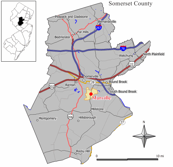
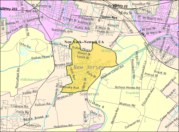
Manville, New Jersey — Borough — Map of Manville in Somerset County. Inset: Location of Somerset County highlighted in the State of New Jersey. Census Bureau map of Manville, New Jersey
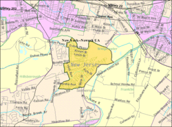
Coordinates: 40°32′20″N 74°35′36″W / 40.53889°N 74.59333°WCoordinates: 40°32′20″N 74°35′36″W / 40.53889°N 74.59333°W Country United States State New Jersey County Somerset Incorporated April 18, 1929 Government[1] – Type Borough (New Jersey) – Mayor Lillian M. Zuza (term ends 2011)[2] – Administrator Gary P. Garwacke[3] Area – Total 2.5 sq mi (6.4 km2) – Land 2.5 sq mi (6.4 km2) – Water 0.0 sq mi (0.0 km2) Elevation[4] 59 ft (18 m) Population (2010 Census)[5] – Total 10,344 – Density 4,137.6/sq mi (1,616.3/km2) Time zone Eastern (EST) (UTC-5) – Summer (DST) EDT (UTC-4) ZIP code 08835 Area code(s) 908 FIPS code 34-43620[6][7] GNIS feature ID 0885291[8] Website http://www.manvillenj.org Manville is a Borough in Somerset County, New Jersey, United States. As of the 2010 United States Census, the borough population was 10,344.[5] Manville was named after the Johns-Manville Corporation, which maintained a large manufacturing facility in the borough for decades.
Historically, many of Manville's residents are of Slavic — mostly eastern Polish (23.1% of the borough's population[9]) and western Ukrainian - descent — with many businesses and restaurants geared towards the Polish-American community located along County Route 533.
Manville was formed by an act of the New Jersey Legislature on April 1, 1929, with a referendum held on April 18, 1929.[10]
Contents
Geography
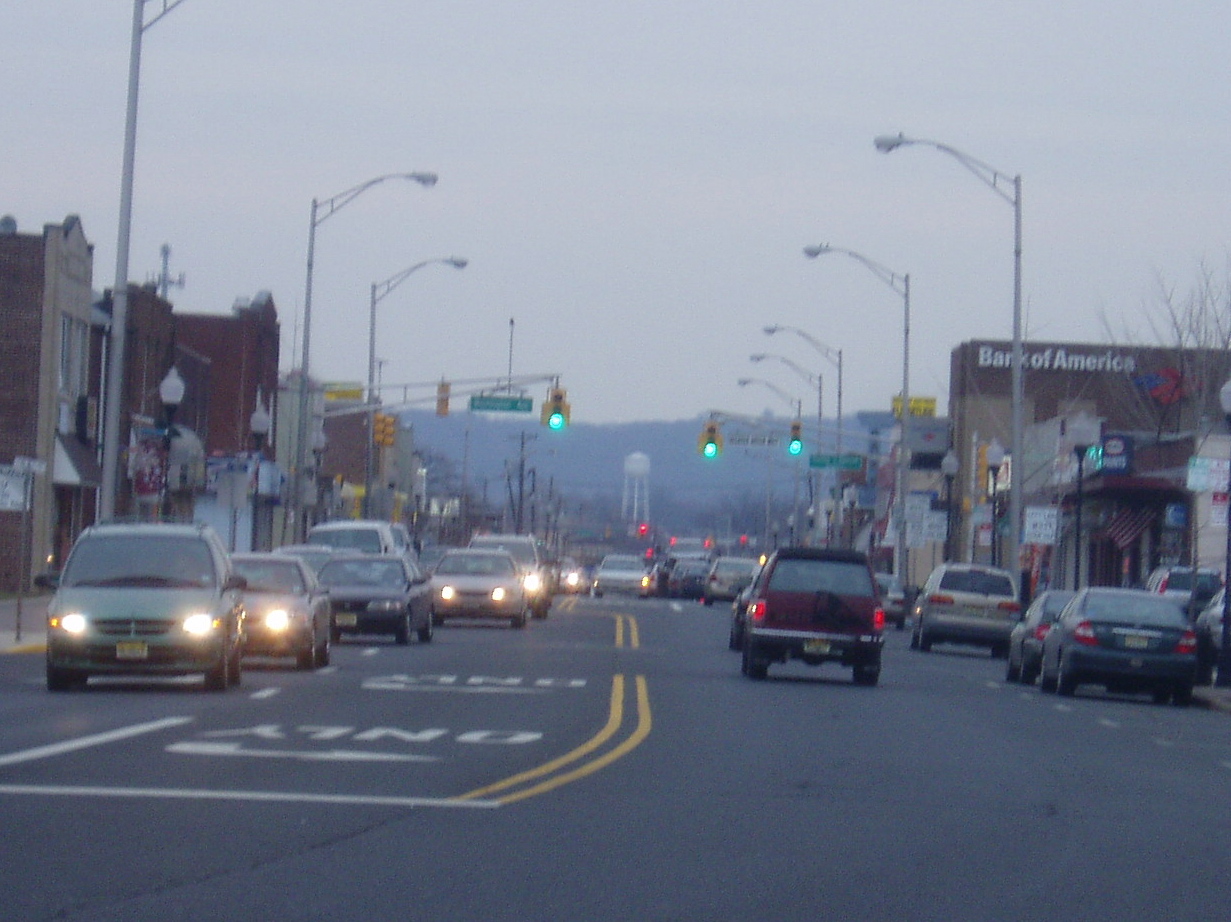
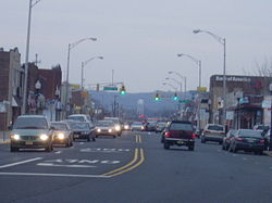 Main Street in Manville, New Jersey, with the Watchung Mountains in background
Manville is located at 40°32′20″N 74°35′36″W / 40.539003°N 74.593450°W (40.539003, -74.593450).[11]
According to the United States Census Bureau, the borough has a total area of 2.5 square miles (6.5 km2), all of it land.
Much of Manville is in a low-lying flood plain and is surrounded by rivers and streams on all but the western side which borders neighboring Hillsborough Township by land. The Raritan River forms the northern boundary of the borough and is met by the Millstone River which forms the eastern boundary of the borough, where a weir exists at the confluence of the rivers which is used for water intake purposes by New Jersey American Water.
Demographics
Historical populations Census Pop. %± 1930 5,441 — 1940 6,065 11.5% 1950 8,597 41.7% 1960 10,995 27.9% 1970 13,029 18.5% 1980 11,278 −13.4% 1990 10,567 −6.3% 2000 10,343 −2.1% 2010 10,344 0% Population 1930 - 1990.[12] As of the census[6] of 2000, there were 10,343 people, 4,115 households, and 2,757 families residing in the borough. The population density was 4,167.5 people per square mile (1,610.3/km2). There were 4,296 housing units at an average density of 1,731.0 per square mile (668.8/km2). The racial makeup of the borough was 95.99% White, 0.45% African American, 0.07% Native American, 1.31% Asian, 0.03% Pacific Islander, 1.14% from other races, and 1.01% from two or more races. Hispanic or Latino of any race were 5.40% of the population.
23.1% of Manville's residents identified themselves as being of Polish ancestry, the second-highest in New Jersey (behind Wallington's 45.5%), for all places with 1,000 people listing their ancestry.[9]
There were 4,115 households out of which 26.5% had children under the age of 18 living with them, 50.3% were married couples living together, 11.9% had a female householder with no husband present, and 33.0% were non-families. 26.7% of all households were made up of individuals and 12.3% had someone living alone who was 65 years of age or older. The average household size was 2.51 and the average family size was 3.05.
In the borough the population was spread out with 20.7% under the age of 18, 7.2% from 18 to 24, 31.9% from 25 to 44, 22.5% from 45 to 64, and 17.7% who were 65 years of age or older. The median age was 40 years. For every 100 females there were 96.2 males. For every 100 females age 18 and over, there were 94.0 males.
The median income for a household in the borough was $51,258, and the median income for a family was $61,151. Males had a median income of $40,902 versus $32,030 for females. The per capita income for the borough was $23,293. About 2.1% of families and 3.8% of the population were below the poverty line, including 3.8% of those under age 18 and 4.8% of those age 65 or over.
Government
Local government
Manville is governed under the Borough form of New Jersey municipal government. The government consists of a Mayor and a Borough Council comprising six council members, with all positions elected at large. A Mayor is elected directly by the voters to a four-year term of office. The Borough Council consists of six members elected to serve three-year terms on a staggered basis, with two seats coming up for election each year.[1]
As of 2011[update], the Mayor of Manville is Lillian Zuza (term ends December 31, 2011), who was elected to replace Angelo Corradino. Members of the Manville Borough Council are Council President Sherri Lynn (2012), Susan Asher (2011), Lou Fischer (2011), Richard Onderko (2012), Lou Petzinger (2013) and Stephen Szabo (2011).[13] In November 2011, Angelo Corradino was elected to a fifth non-consecutive term of office, defeating Republican candidate Susan Asher. Corradino was the only four-term Mayor in Manville's history, was the first Manville Mayor to be elected as the President of the New Jersey Conference of Mayors and the first Manville Mayor to be elected into the New Jersey Mayors Hall of Fame.[14]
Federal, state and county representation
Manville is in the 7th Congressional district and is part of New Jersey's 16th State legislative District.[15]
New Jersey's Seventh Congressional District is represented by Leonard Lance (R, Clinton Township). New Jersey is represented in the United States Senate by Frank Lautenberg (D, Cliffside Park) and Bob Menendez (D, Hoboken).
16th Legislative District of the New Jersey Legislature, which is represented in the New Jersey Senate by Christopher "Kip" Bateman (R, Neshanic Station) and in the New Jersey General Assembly by Peter J. Biondi (R, Hillsborough Township) and Denise Coyle (R, Basking Ridge).[16] The Governor of New Jersey is Chris Christie (R, Mendham).[17] The Lieutenant Governor of New Jersey is Kim Guadagno (R, Monmouth Beach).[18]
Somerset County is governed by a five-member Board of Chosen Freeholders, whose members are elected at-large to three-year terms of office on a staggered basis, with one or two seats coming up for election each year.[19] As of 2011, Somerset County's Freeholders are Freeholder Director Robert Zaborowski (Franklin Township, term ends December 31, 2011)[20], Freeholder Deputy Director Patricia L. Walsh (Green Brook Township, 2013)[21], Jack Ciattarelli (Hillsborough Township, 2012)[22], Peter S. Palmer (Bernardsville, 2011)[23] and Patrick Scaglione (Bridgewater Township, 2012).[24][25]
Education
The Manville School District serves public school students in kindergarten through twelfth grade. Schools in the district (with 2009-10 enrollment data from the National Center for Education Statistics[26]) are Weston Elementary School (grades K-3; 398 students), Roosevelt Intermediate School (4&5; 188), Alexander Batcho Intermediate School (6-8; 281) and Manville High School (9-12; 378).
Christ the King School, a Catholic school, serves Pre-K - 8th grade. The School, which operates as part of the Roman Catholic Diocese of Metuchen is run by Rev. Stanislaw Slaby CSsR and the school's current principal is Christine Benson.[27]
Redevelopment
While known for decades as the host community for a large manufacturing facility (Johns-Manville Corporation) that utilized asbestos in its manufacturing processes, Manville has begun to leave behind its industrial past and the lingering asbestos pollution that was a legacy of the manufacturing that took place in the borough. The asbestos dumps have been removed or capped in compliance with environmental laws, and the former manufacturing land has been redeveloped into a large movie theater complex known as Reading Cinemas, a medium-sized retail outlet with a Walmart anchor store and a used car wholesale auction company called ADESA New Jersey. Main Street in Manville is once again lively and a place people from all around come for entertainment, dining and shopping.
Other areas of the borough are also undergoing redevelopment. The Federal Superfund project called The Federal Creosote Site was cleaned up by the United States Environmental Protection Agency (EPA) with $250 Million of public funds. The Superfund cleanup project was performed in a 35-acre (140,000 m2) residential section of town called Claremont Development and in a 15-acre (61,000 m2) commercial area called the Rustic Mall, and was officially declared complete by the EPA on March 7, 2008.[28] The borough plans to redevelop the former Superfund site into a town center with shops and housing as soon as EPA approval of the redevelopment plans is received.
Flooding problems
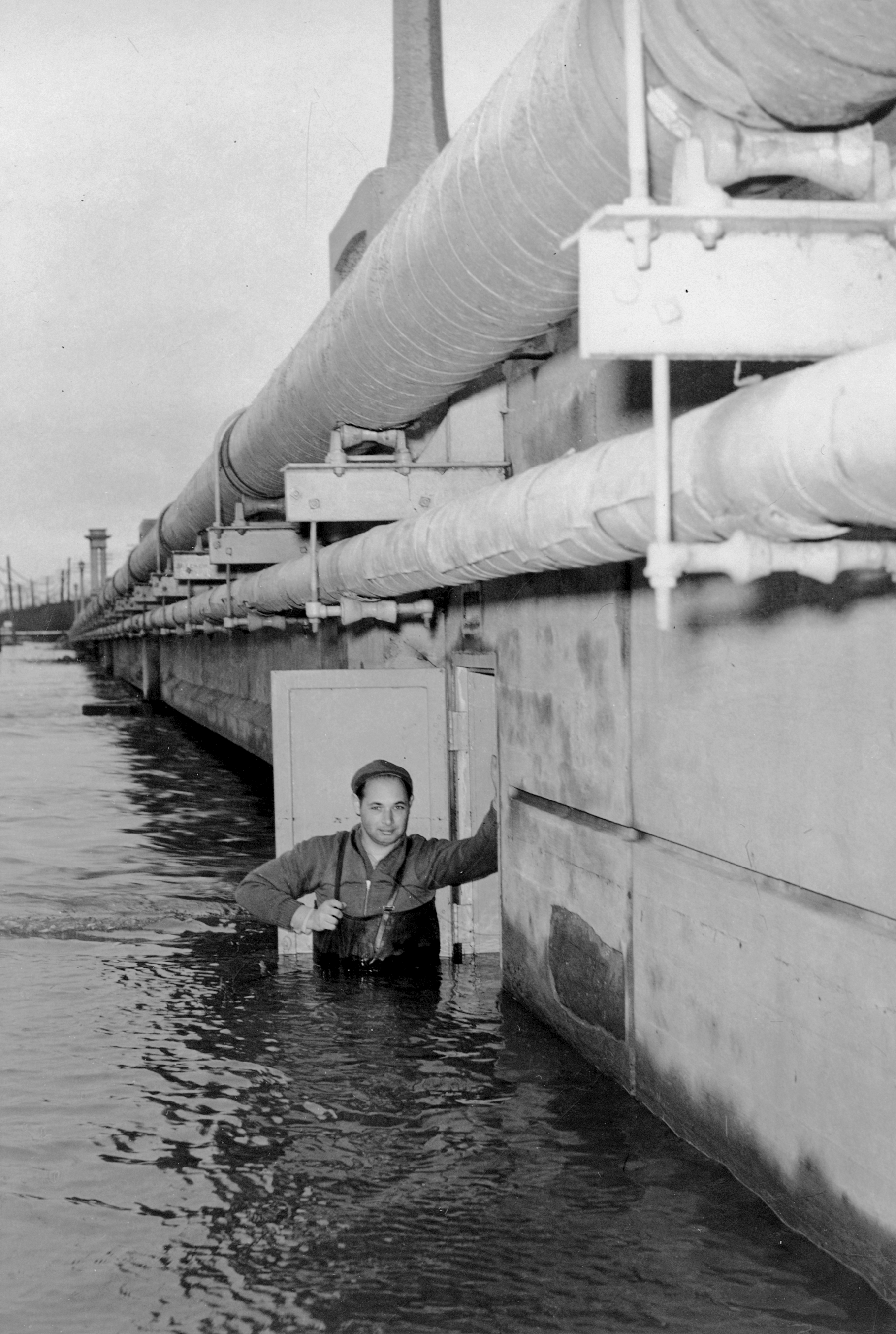
 Photo of a gauge inspector and the Manville, New Jersey gage house built into the North Main Street/CR-533 bridge abutment during the Raritan River flood of December 31, 1948.
Manville suffers from occasional flooding events that occur after prolonged heavy rainfall events, when the Raritan River and Millstone River overflow their banks into the northern section (Raritan) and the Lost Valley section (Millstone) of the borough. The southern parts of Main Street also suffered from the flooding, due to the presence of the stream that backs up with water from the nearby Millstone River in which it empties.
There are studies being undertaken to address the flooding problems in the Millstone River basin and Manville; however, none of the flood control ideas in the Millstone River basin have gotten beyond the initial study stages as of late 2006.
See Flood Control Feasibility Study for Manville, NJ by the United States Army Corps of Engineers for more information on flood control proposals for the borough.
Hurricane Floyd Flood of 1999
Manville was severely hit by a flood in the wake of Hurricane Floyd in September 1999, which dropped ten to twelve inches (305 mm) of rain in the areas surrounding the borough. The floods devastated the Lost Valley section, some of the South side area along Main Street and a large portion of the North side. Water levels reached between 12 feet (3.7 m) and 17 feet (5.2 m) in parts of the borough on September 17, 1999. The only way residents could get help was by boat or helicopter. There was also a large amount of fuel oil floating on the flood water which further damaged homes, many of which came off their foundations.
The North side was hit by a wall of water coming from the Raritan at Dukes Parkway that inundated the streets with floodwaters from Main Street to North 13th Avenue. The water reached the freight tracks that run through the center of the borough, and spilled over, flooding some on the South Street side, but leaving tons of water dammed in on the North Street side, where people had to be rescued from rooftops, or second floor windows and landings, by boat.
The problem was doubled in the Lost Valley section, as floodwaters backed up where the Raritan and Millstone rivers meet near the dam. All trapped and injured people had to be taken out by helicopter, as there was no way to get in or out of the Lost Valley section. The September 1999 flood disaster was the worst ever to hit Manville, although it had been flooded in 1971 during Tropical Storm Doria, when many of the Lost Valley houses were destroyed and their foundations lost, and previously before that in the 1950s. Because of the railroad tracks being so much higher than the Lost Valley land, Manville's Lost Valley will always be a number one target for flooding. Through research of Manville's history, Lost Valley was never to be built for this reason.
Lost Valley flooding
Manville has the distinction of being the location where the slow moving Raritan River (which passes to the north) and the tributary Millstone River (which passes to the east) join together, in the far northeastern corner of the borough. The Lost Valley section in eastern Manville is situated on the natural flood plain between the Raritan and Millstone Rivers, and bears the brunt of occasional flooding events which affect the river basins. The Lost Valley section is named so because it is generally disconnected from the rest of the borough with only a tunnel at Kyle Street and a bridge at Bridge Street crossing the railroad tracks to the neighborhood.[29] Hurricane Floyd in September 1999 produced a particularly severe flood (a record for the river basins) in Manville, especially in the Lost Valley section of the borough, which experienced flooding all the way to the railroad tracks, with twelve feet or more water on many properties, which inundated houses with damaging flood waters. Another severe and devastating flood event occurred in Lost Valley during the April 2007 Nor'easter. It also left many homes and businesses underwater and was the worst flood since Hurricane Floyd. The most recent flooding event to hit Manville was on March 14, 2010. With rivers running already high due to recent snow melt along with three to four inches (102 mm) of rain that feel on the area on March 13, flooding was inevitable.
Hurricane Irene, 2011
Extensive flooding affected Manville in August, 2011 when Hurricane Irene passed through New Jersey.[30][31]
Flood Gauge on Raritan River
NOAA Flood gauge in Manville, NJ on Raritan River - Realtime river level data. Flooding occurs at a 14-foot (4.3 m) stage, and severe flooding occurs when the water reaches 18 feet (5.5 m).
Notable residents
Notable current and former residents of Manville include:
- Cheryl Chase (born 1958), voice actress.[32]
- Edward Rogalski (born 1942), 12th president of St. Ambrose University in Davenport, Iowa, named in 1987.[33]
References
- ^ a b 2005 New Jersey Legislative District Data Book, Rutgers University Edward J. Bloustein School of Planning and Public Policy, April 2005, p. 77.
- ^ 2011 New Jersey Mayors Directory, New Jersey Department of Community Affairs. Accessed November 9, 2011.
- ^ Administrative / Clerk's Offices, Borough of Manville. Accessed May 29, 2011.
- ^ U.S. Geological Survey Geographic Names Information System: Borough of Manville, Geographic Names Information System, accessed January 4, 2008.
- ^ a b 2010 Census Data, accessed February 11, 2011.
- ^ a b "American FactFinder". United States Census Bureau. http://factfinder.census.gov. Retrieved 2008-01-31.
- ^ A Cure for the Common Codes: New Jersey, Missouri Census Data Center. Accessed July 14, 2008.
- ^ "US Board on Geographic Names". United States Geological Survey. 2007-10-25. http://geonames.usgs.gov. Retrieved 2008-01-31.
- ^ a b Polish Ancestry, EPodunk. Accessed May 3, 2007.
- ^ "The Story of New Jersey's Civil Boundaries: 1606-1968", John P. Snyder, Bureau of Geology and Topography; Trenton, New Jersey; 1969. p. 223.
- ^ "US Gazetteer files: 2010, 2000, and 1990". United States Census Bureau. 2011-02-12. http://www.census.gov/geo/www/gazetteer/gazette.html. Retrieved 2011-04-23.
- ^ New Jersey Resident Population by Municipality: 1930 - 1990, accessed March 1, 2007
- ^ Government, Borough of Manville. Accessed May 29, 2011.
- ^ Paik, Eugene. "Longtime Manville mayor takes back his seat", The Star-Ledger, November 8, 2011. Accessed November 9, 2011. "Voters in Manville tonight returned former Mayor Angelo Corradino to the office that made him one of the borough's political heavyweights. Corradino, who steered Manville for 16 years before an election loss in 2007, defeated Republican Councilwoman Susan Asher 1,007 to 990, according to unofficial results."
- ^ 2011 New Jersey Citizen's Guide to Government, New Jersey League of Women Voters, p. 60. Accessed May 29, 2011.
- ^ "Legislative Roster: 2010-2011 Session". New Jersey Legislature. http://www.njleg.state.nj.us/members/roster.asp. Retrieved 2010-06-26.
- ^ "About the Governor". New Jersey. http://www.nj.gov/governor/about/. Retrieved 2010-01-21.
- ^ "About the Lieutenant Governor". New Jersey. http://www.nj.gov/governor/lt/. Retrieved 2010-01-21.
- ^ Somerset County Government: At Your Service, Somerset County, New Jersey. Accessed January 6, 2011.
- ^ Robert Zaborowski, Somerset County, New Jersey. Accessed January 9, 2011.
- ^ Patricia Walsh, Somerset County, New Jersey. Accessed January 9, 2011.
- ^ Jack Ciattarelli, Somerset County, New Jersey. Accessed January 9, 2011.
- ^ Peter S. Palmer, Somerset County, New Jersey. Accessed January 9, 2011.
- ^ Patrick Scaglione, Somerset County, New Jersey. Accessed January 9, 2011.
- ^ 2011 Somerset County Board of Chosen Freeholders, Somerset County, New Jersey. Accessed January 9, 2011.
- ^ Data for the Manville School District, National Center for Education Statistics. Accessed May 29, 2011.
- ^ School Directory, Roman Catholic Diocese of Metuchen. Accessed May 29, 2011.
- ^ "Cleanup Completed at Federal Creosote Superfund Site", United States Environmental Protection Agency press release dated March 7, 2008. Accessed March 8, 2008.
- ^ Craven, Laura. "Manville Residents Still Fear Flooding 10 Years After Hurricane Floyd". nj.com new. September 13, 2009.
- ^ Stephen Stirling (August 29, 2011). "Hurricane Irene leads to historic flooding after month's record rainfall".
- ^ http://videos.nj.com/star-ledger/2011/08/hurricane_irene_produces_massi.html
- ^ Bonko, Larry. "VOICE TALENTS" TOILS ANONYMOUSLY, The Virginian-Pilot, July 20, 2001, accessed April 13, 2007. "Cheryl Chase, a native of Manville, N.J., is probably the biggest TV star you never heard of."
- ^ Flansburg, Susan. "The Rogalski Generation", SCENE Magazine of St. Ambrose University, Summer 2007. Accessed January 11, 2008."Born Feb. 16, 1942, to Polish immigrants in Manville, N.J., Ed Rogalski was the youngest of eight children."
External links
- Manville official web site
- Manville School District
- Manville School District's 2009–10 School Report Card from the New Jersey Department of Education
- Data for the Manville School District, National Center for Education Statistics
- Manville Police Department
- Manville Business and Professional Association
- Manville's web portal*
- Manville History
- Manville Democratic Club and Committee
Municipalities and communities of Somerset County, New Jersey Boroughs Bernardsville | Bound Brook | Far Hills | Manville | Millstone | North Plainfield | Peapack-Gladstone | Raritan | Rocky Hill | Somerville | South Bound Brook | Watchung
Townships Bedminster | Bernards | Branchburg | Bridgewater | Franklin | Green Brook | Hillsborough | Montgomery | Warren
CDPs Communities Basking Ridge | Flagtown | Franklin Park | Gladstone | Griggstown | Harlingen | Kingston | Lamington | Liberty Corner | Lyons | Martinsville | Middlebush | Neshanic | Neshanic Station | North Branch | Pleasant Plains | Pottersville | Six Mile Run | Skillman | South Branch | Weston | Zarephath
Categories:- Boroughs in Somerset County, New Jersey

Wikimedia Foundation. 2010.