- South Bound Brook, New Jersey
Infobox Settlement
official_name = South Bound Brook, New Jersey
settlement_type = Borough
nickname =
motto =
imagesize =
image_caption =
image_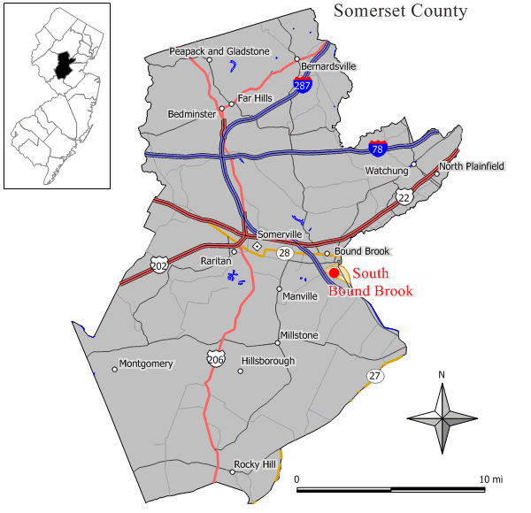
mapsize = 250x200px
map_caption = Map of South Bound Brook in Somerset County. Inset: Location of Somerset County highlighted in the State of New Jersey.
mapsize1 = 250x200px
map_caption1 = Census Bureau map of South Bound Brook, New Jerseysubdivision_type = Country
subdivision_name =United States
subdivision_type1 = State
subdivision_name1 =New Jersey
subdivision_type2 = County
subdivision_name2 = Somerset
government_footnotes =
government_type =Borough (New Jersey)
leader_title =
leader_name =
leader_title1 =
leader_name1 =
established_title =
established_date =unit_pref = Imperial
area_footnotes =
area_magnitude =
area_total_km2 = 2.0
area_land_km2 = 2.0
area_water_km2 = 0.0
area_total_sq_mi = 0.8
area_land_sq_mi = 0.8
area_water_sq_mi = 0.0population_as_of = 2000
population_footnotes =
population_total = 4492
population_density_km2 = 2226.0
population_density_sq_mi = 5765.3timezone = Eastern (EST)
utc_offset = -5
timezone_DST = EDT
utc_offset_DST = -4
elevation_footnotes =
elevation_m = 16
elevation_ft = 52
latd = 40 |latm = 33 |lats = 14 |latNS = N
longd = 74 |longm = 31 |longs = 47 |longEW = Wpostal_code_type =
ZIP code
postal_code = 08880
area_code = 732
blank_name = FIPS code
blank_info = 34-68730GR|2 [ [http://mcdc2.missouri.edu/webrepts/commoncodes/ccc_nj.html A Cure for the Common Codes: New Jersey] , Missouri Census Data Center. AccessedJuly 14 ,2008 .]
blank1_name = GNIS feature ID
blank1_info = 0880707GR|3
website = http://www.southboundbrook.com
footnotes = USCensusPop
1930=1763
1940=1928
1950=2905
1960=3626
1970=4525
1980=4331
1990=4185
2000=4492
estimate= 4524
estyear=2006
estref= [http://factfinder.census.gov/servlet/SAFFPopulation?_event=Search&geo_id=06000US3402734980&_geoContext=01000US%7C04000US34%7C05000US34027%7C06000US3402734980&_street=&_county=south+bound+brook&_cityTown=south+bound+brook&_state=04000US34&_zip=&_lang=en&_sse=on&ActiveGeoDiv=geoSelect&_useEV=&pctxt=fph&pgsl=060&_submenuId=population_0&ds_name=null&_ci_nbr=null&qr_name=null®=null%3Anull&_keyword=&_industry= Census data for South Bound Brook borough] ,United States Census Bureau . AccessedMarch 1 ,2007 .]
footnote=Population 1930 - 1990. [ [http://www.wnjpin.net/OneStopCareerCenter/LaborMarketInformation/lmi01/poptrd6.htm New Jersey Resident Population by Municipality: 1930 - 1990] , Workforce New Jersey Public Information Network. AccessedMarch 1 ,2007 .]South Bound Brook is a Borough in Somerset County,
New Jersey ,United States . As of theUnited States 2000 Census , the borough population was 4,492.What is now South Bound Brook was originally formed as a town within Franklin Township. On
March 16 ,1869 , the name of the community was changed to Bloomington, which lasted untilMay 29 ,1891 , when the name reverted back to South Bound Brook town. South Bound Brook was incorporated as an independent borough by an Act of theNew Jersey Legislature onApril 11 ,1907 , based on the results of a referendum held onMay 1 ,1907 ."The Story of New Jersey's Civil Boundaries: 1606-1968", John P. Snyder, Bureau of Geology and Topography; Trenton, New Jersey; 1969. p. 225.]Geography
South Bound Brook is located at coor dms|40|33|14|N|74|31|47|W|city (40.553803, -74.529761)GR|1.
According to the
United States Census Bureau , the borough has a total area of 0.8square mile s (2.0km² ), all of it land.Demographics
As of the
census GR|2 of 2000, there were 4,492 people, 1,632 households, and 1,103 families residing in the borough. Thepopulation density was 5,765.3 people per square mile (2,223.6/km²). There were 1,676 housing units at an average density of 2,151.1/sq mi (829.6/km²). The racial makeup of the borough was 78.01% White, 7.77% African American, 0.27% Native American, 4.10% Asian, 0.04% Pacific Islander, 6.57% from other races, and 3.25% from two or more races. Hispanic or Latino of any race were 22.89% of the population.There were 1,632 households out of which 31.3% had children under the age of 18 living with them, 51.0% were married couples living together, 10.8% had a female householder with no husband present, and 32.4% were non-families. 25.1% of all households were made up of individuals and 8.0% had someone living alone who was 65 years of age or older. The average household size was 2.75 and the average family size was 3.31.
In the borough the population was spread out with 23.5% under the age of 18, 8.8% from 18 to 24, 36.2% from 25 to 44, 21.1% from 45 to 64, and 10.5% who were 65 years of age or older. The median age was 35 years. For every 100 females there were 105.2 males. For every 100 females age 18 and over, there were 100.4 males.
The median income for a household in the borough was $48,984, and the median income for a family was $58,214. Males had a median income of $36,955 versus $30,082 for females. The
per capita income for the borough was $21,131. About 3.6% of families and 6.7% of the population were below thepoverty line , including 5.5% of those under age 18 and 10.1% of those age 65 or over.Government
Local government
South Bound Brook is governed under the Borough form of New Jersey municipal government. The government consists of a Mayor and a Borough Council comprising six council members, with all positions elected at large. A Mayor is elected directly by the voters to a four-year term of office. The Borough Council consists of six members elected to serve three-year terms on a staggered basis, with two seats coming up for election each year."2005 New Jersey Legislative District Data Book",
Rutgers University Edward J. Bloustein School of Planning and Public Policy , April 2005, p. 77.]The
Mayor of South Bound Brook is Terry Warrelmann (R). Members of the Borough Council are Council President Tamas 'Tom' Ormosi (R), Kathleen Conner (D), Dennis Quinlan (R), Caryl Shoffner (D), Tony Godleski (R), and Robert Alenovitch (D) [ [http://www.co.somerset.nj.us/_towninfo/sbound_brook.htm Somerset County page for South Bound Brook] ,Somerset County, New Jersey . AccessedJune 5 ,2007 .]Federal, state and county representation
South Bound Brook is in the Seventh Congressional District and is part of New Jersey's 16th Legislative District. [ [http://www.lwvnj.org/pubs/CG06.pdf 2006 New Jersey Citizen's Guide to Government] , New Jersey
League of Women Voters , p. 64. AccessedAugust 30 ,2006 .]Education
The
South Bound Brook School District serves public school students in kindergarten through eighth grade. Robert Morris School had an enrollment of 490 students as of the 2005-06 school year. [ [http://nces.ed.gov/ccd/schoolsearch/school_list.asp?Search=1&DistrictID=3415180 Data for the Robert Morris School] ,National Center for Education Statistics . AccessedJuly 5 ,2008 .]For grades 9-12, public school students attend
Bound Brook High School in Bound Brook, as part of asending/receiving relationship with theBound Brook School District .Emergency services
The South Bound Brook Police Department is a 13 person department consisting of one Chief, one Lieutenant, One Sergeant, One K9 officer, and eight officers on patrol. The Chief is William King. The Police Department does not have their own dispatchers; South Bound Brook currently uses Somerset County Communications for all
9-1-1 and non-emergency calls.The South Bound Brook Fire Department has been in existence for over 100 years. They currently have four pieces of apparatus at their Edgewood Terrace Headquarters: One E-One Engine, one E-One 75' ladder, a new Seagrave Rescue/Pumper and one Chevy Blazer for a Chief's vehicle. Their Chief is currently Matthew Tomaro.
The South Bound Brook First Aid Squad has seen many changes over the past several years. The squad was initially incorporated by their current name, then in 1990 became South Bound Brook/Franklin Township Rescue Squad. In 2002 the service area was cut back to just South Bound Brook, and the squad's name reverted to South Bound Brook First Aid Squad. They currently run two ambulances from their Garfield Ave headquarters, two E-One Type III Ambulances. They are no longer capable of rescue; all water rescue and extrication equipment was sold after the 2002 change. Their Chief is currently Richard Ungerleder.
The South Bound Brook Office of Emergency Management is a growing department of five personnel. Originally the Civil Defense Board, the Office of Emergency Management is charged with Emergency Preparedness and Planning. They are also responsible for the emergency operations plan, which is updated yearly by all departments of the borough. During major emergencies, they play a significant role in recovery efforts. They are also charged with borough compliance in the
National Incident Management System . Their coordinator is Paul Kaminsky.History
Originally part of Franklin Township and named Bloomington, South Bound Brook was incorporated as a borough by the
New Jersey Legislature in 1907.The area was originally a Dutch community with apple orchards and just west peach orchards. The Von Steuben house (1600?), located on the south side of Main Street, served as the headquarters of Baron Von Steuben during the
American Revolutionary War . The house today is privately owned.The Reformed Church, also on Main Street (near borough hall) was built in 1848 and has been declared a local historical site by the borough council. Originally called the Dutch Reformed Church of Bound Brook it has gone through very few changes over the years. The one sad removal was a pipe organ received from
Andrew Carnegie ; and the stained glass windows, which had been added well after the original construction.In the mid-1970s a teen from the town created a plan for an environmental commission and presented it to the council. James Manning got his commission and the first order of business was to find out what the white piles of waste on the tow path between the
Delaware and Raritan Canal andRaritan River consisted of. It turned out to be 17% crystalasbestos by volume. Since there was no New Jersey State regulation for the disposal, this became a landmark case. The waste was hauled in dump trucks through Bound Brook to thefloodplain south of West Main Street and dumped. A trail of asbestos dust led from the old dump site to the new dump location.Redevelopment
The main downtown street in South Bound Brook, known as Main Street, has been refurbished with new sidewalks, lighting, signage and a number of newly renovated stores.
A roofing material manufacturing facility known as GAF Manufacturing was located in South Bound Brook for over a century along Main Street. The site was dormant for about two decades and sat as an eyesore and reminder of the town's industrial past. New
townhomes have been built on the GAF Manufacturing site, along the Delaware and Raritan Canal, which provide the downtown area a new modern look and many new residents.Part of the redevelopment is being held up by a lawsuit by John Fanaro of Fanaro Carpeting over the right of
eminent domain , as the town tries to seize property along Main Street that is in front of the new townhomes. The redevelopment plan called for the older stores to be razed and replaced with new stores that had parking in back and a dozen rental apartments on the second floor.A new 55 and older condominium development is also being built along Elizabeth Avenue in the central part of town.
Points of Interest
The main attraction in South Bound Brook is the
Delaware and Raritan Canal , which forms the northern and eastern boundaries of the town. The canal and itsD&R Canal Trail are used for numerous recreational purposes from light boating to hiking and biking. Also of note is theRaritan River which lies on the far side of the canal and provides further recreational opportunities such as boating and fishing. The Queens Bridge crosses the canal and river, connecting to Bound Brook.The
Raritan River Greenway is a proposed path that would link Branchburg Township to theEast Coast Greenway with the Delaware and Raritan Canal trail in South Bound Brook.Ukrainian Orthodox Church of the USA is headquartered in South Bound Brook.St. Sophia Ukrainian Orthodox Theological Seminary , St. Andrew's Memorial Church, and a large Ukrainian Orthodox cemetery, where graves of many politicians from theUkrainian People's Republic era can be visited, are located on the south side of the town. [ [http://www.uocofusa.org/history/ AN OUTLINE HISTORY OF THE METROPOLIA CENTER OF THE UKRAINIAN ORTHODOX CHURCH OF THE USA] ,Ukrainian Orthodox Church of the USA . AccessedJuly 10 ,2007 .]Flooding issues
While South Bound Brook does not have the legacy of
flood ing that its sister town Bound Brook on the north bank of the Raritan River has, flooding can be a problem in South Bound Brook during major river flooding events, such as a100-year flood event. In September 1999, the remnants ofHurricane Floyd caused a record flood crest on the Raritan River. While escaping the worst flooding, due to its elevated perch above the Raritan River, South Bound Brook did experience flood waters in the two to three foot range near the canal, including in portions of the downtown area along Main Street.Transportation
Interstate 287 , which provides access and connections to large parts of New Jersey and New York is located very near the western boundary of South Bound Brook and provides two local interchanges.New Jersey Transit provides frequent train service on theRaritan Valley Line to/from Newark and New York via the nearby Bound Brook Train Station, which is about a five to ten minute walk from downtown South Bound Brook.NJ Transit bus service to the
Port Authority Bus Terminal inMidtown Manhattan is provided on the 114 and 117 routes, with service to Newark available on the 65 and 66 bus lines. [ [http://www.njtransit.com/sf_tp_rc_somerset.shtml Somerset County Bus/Rail Connections] ,New Jersey Transit . AccessedJuly 5 ,2007 .]References
External links
* [http://www.sbbfd.com/ South Bound Brook Fire Department Official Web Site]
* [http://www.sbbfas.org/ South Bound Brook First Aid Squad Official Web Site]
* [http://www.sbbpd.org/ South Bound Brook Police Department Official Web Site]
* [http://www.rmschool.com/ Robert Morris School]
*NJReportCard|35|4850|0|Robert Morris School
* [http://nces.ed.gov/ccd/schoolsearch/school_list.asp?Search=1&DistrictID=3415180 Data for the Robert Morris School] ,National Center for Education Statistics
Wikimedia Foundation. 2010.