- Noordwijkerhout
-
Noordwijkerhout — Municipality — 
Flag
Coat of arms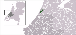
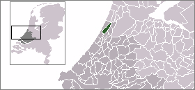
Coordinates: 52°16′N 4°30′E / 52.26°N 4.50°ECoordinates: 52°16′N 4°30′E / 52.26°N 4.50°E Country Netherlands Province South Holland Area(2006) - Total 23.40 km2 (9 sq mi) - Land 22.60 km2 (8.7 sq mi) - Water 0.80 km2 (0.3 sq mi) Population (1 January, 2007) - Total 15,299 - Density 677/km2 (1,753.4/sq mi) Source: CBS, Statline. Time zone CET (UTC+1) - Summer (DST) CEST (UTC+2) Website www.noordwijkerhout.nl Noordwijkerhout (
 pronunciation (help·info)) is a town and municipality in the western Netherlands, in the province of South Holland. The municipality covers an area of 23.40 km² (of which 0.80 km² water) and had a population of 15,121 in May 2006. The town is in the bulb growing region (the Duin- en Bollenstreek) of the Netherlands, famed for its tulips.
The municipality of Noordwijkerhout also includes the following towns, villages and townships: De Zilk.
History
The coastal dunes where Noordwijkerhout is located have been inhabited since prehistoric times. Archaeological digs in the area just north outside of town have found items and implements from before Christ. During the Roman era, this region was inhabited by a Germanic tribe, called Cananefates by the Roman writer Tacitus.
Recreation and tourism
Noordwijkerhout is about 5 kilometers from the North Sea and provides access to the beach and nearby hiking opportunities through the dunes. Just north of town is the Oosterduinse meer (Eastern Dune's Lake) which is used for swimming and windsurfing.
Noordwijkerhout is located in an area called the "Dune and Bulb Region" (Duin- en Bollenstreek). In the spring when the bulb flower fields are in bloom, many tourist come to the region to admire them. The town's fair is held during the first week of September.
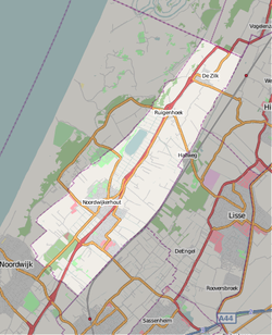 Map of Noordwijkerhout
External links
Categories:- Municipalities of South Holland
- Populated places in South Holland


Wikimedia Foundation. 2010.