- Oud-Beijerland
-
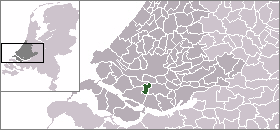
Oud-Beijerland — Municipality — 
Flag
Coat of arms
Coordinates: 51°49′N 4°25′E / 51.82°N 4.42°ECoordinates: 51°49′N 4°25′E / 51.82°N 4.42°E Country Netherlands Province South Holland Area(2006) - Total 19.61 km2 (7.6 sq mi) - Land 18.76 km2 (7.2 sq mi) - Water 0.85 km2 (0.3 sq mi) Population (1 January, 2007) - Total 24,056 - Density 1,282/km2 (3,320.4/sq mi) Source: CBS, Statline. Time zone CET (UTC+1) - Summer (DST) CEST (UTC+2) Website www.oud-beijerland.nl Oud-Beijerland (
 pronunciation (help·info)) is a town and municipality in the western Netherlands, in the province of South Holland. With a population of 23,797 in 2005, it is the most populated town on the Hoekse Waard island, located on the Oude Maas and Spui Rivers.
The municipality of Oud-Beijerland also includes the communities Vuurbaken and Zinkweg.
History
After the St. Elizabeth's flood (1421), large parts of the islands Putten and Grote Waard were lost and became clay banks and salt marshes which would be inundated at high tide and be unsuitable for habitation. In subsequent centuries, portions of land would be reclaimed.
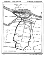 Oud-Beijerland in 1866
Oud-Beijerland was formed in 1559 as "Beijerland" by Lamoral, Count of Egmont. He was granted the rights to this area in 1557 and had the land reclaimed. This new polder was named Beijerland, Moerkerken, Cromstrijen en de Group. Circa 1624 the smaller polders Bosschenpolder and Nieuwlandpolder were added to it. Beijerland was named after Sabina of Bavaria (Dutch: Beijeren), wife of the Count of Egmont.
In 1582 the name was changed to Oud-Beijerland, in order to distinguish it from Nieuw-Beijerland which was formed several kilometers to the west.
In 1604 the village got its churchtower from Sabina van Beijeren, and in 1622 the town hall was built. Oud-Beijerland then became one of the most important market places of the Hoekse Waard. Its economy was dependent on trade, industry, agriculture, and fishing. This brought prosperity which is still reflected in the elegant mansions along the Vliet.
From the end of the 19th century until ca. 1955, a tram connected Oud-Beijerland with Rotterdam. The tram was nicknamed "het moordenaartje" (the little murderer) because of the high rate of casualties involved with its operation.[1][2]
External links
- Official website (mainly in Dutch)
- Map (in Dutch)
References
- ^ (Dutch) De tramwegen en stoombootveren van de RTM rondom Rotterdam, Engelfriet.net
- ^ (Dutch) Herinnering aan de RTM, Rotterdam010.nl
Categories:- Municipalities of South Holland
- Populated places in South Holland
- Populated places established in 1559


Wikimedia Foundation. 2010.