- Graafstroom
Infobox Settlement
official_name = Graafstroom
flag_size = 120x100px
image_shield = Graafstroom wapen.gif
shield_size = 120x100px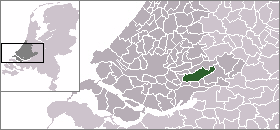
mapsize = 280px
subdivision_type = Country
subdivision_name =Netherlands
subdivision_type1 = Province
subdivision_name1 =South Holland
area_footnotes = (2006)
area_total_km2 = 69.32
area_land_km2 = 67.11
area_water_km2 = 2.21
population_as_of =1 January ,2007
population_note = Source: CBS, [http://statline.cbs.nl/ Statline] .
settlement_type = Municipality
population_total = 9757
population_density_km2 = 145
timezone = CET
utc_offset = +1
timezone_DST = CEST
utc_offset_DST = +2
latd = 51.88
latNS = N
longd = 4.80
longEW = E
website = [http://www.graafstroom.nl www.graafstroom.nl]. The municipality covers an area of 69.32 km² (26.76 mile²) of which 2.21 km² (0.85 mile²) is water.
The municipality of Graafstroom consists of the following population centres:
Bleskensgraaf en Hofwegen ,Brandwijk ,Goudriaan ,Molenaarsgraaf ,Ottoland ,Oud-Alblas ,Wijngaarden .External links
* [http://www.graafstroom.nl Official website]
* [http://www.sdu.nl/staatscourant/gem/gem177zh.htm Basic data]
* [http://www.cbs.nl/nl/publicaties/publicaties/nederland-regionaal/gom/2002/pdf/g/Graafstroom.pdf Statistics in Dutch] (pdf) - with (towards the end) a map showing the neighborhoods and (a few pages further) the population figures etc. as well as the grouping into quarters*
Arriva Region West: [http://www.arriva.nl/asp/dienstregeling.asp?dienst=0®io=0&home=0&onderdeel=0&header=1] - select bus line 151

Wikimedia Foundation. 2010.