- Nederlek
-
Nederlek — Municipality — 
Flag
Coat of arms
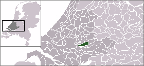
Coordinates: 51°54′N 4°39′E / 51.9°N 4.65°ECoordinates: 51°54′N 4°39′E / 51.9°N 4.65°E Country Netherlands Province South Holland Area(2006) - Total 31.44 km2 (12.1 sq mi) - Land 27.84 km2 (10.7 sq mi) - Water 3.61 km2 (1.4 sq mi) Population (1 January, 2007) - Total 14,531 - Density 522/km2 (1,352/sq mi) Source: CBS, Statline. Time zone CET (UTC+1) - Summer (DST) CEST (UTC+2) Website www.nederlek.nl Nederlek (
 pronunciation (help·info)) is a municipality in the western Netherlands, in the province of South Holland. The municipality had a population of 14,831 in 2004, and covers an area of 31.44 km² (of which 3.60 km² is covered by water). It was formed on January 1, 1985, by the amalgamation of the municipalities Krimpen aan de Lek and Lekkerkerk. Its name means "Lower Lek", a reference to its location on the Lek River.
There is no town called Nederlek but the municipality consists of the population centres Krimpen aan de Lek and Lekkerkerk. The last town gained notoriety in 1980 when a large amount of toxic waste was found underneath a residential area built in the 1970s. The cost of cleaning up the mess ran up to 188 million guilders (approximately 90 million US dollars).

External links
Categories:- Municipalities of South Holland
- South Holland geography stubs


Wikimedia Foundation. 2010.