- Teylingen
Infobox City
official_name = Teylingen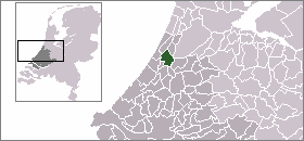
mapsize = 280px
subdivision_type = Country
subdivision_name =Netherlands
subdivision_type1 = Province
subdivision_name1 =South Holland
area_footnotes = (2006)
area_total_km2 = 33.63
area_land_km2 = 28.65
area_water_km2 = 4.98
population_as_of =1 January ,2007
population_note = Source: CBS, [http://statline.cbs.nl/ Statline] .
settlement_type = Municipality
population_total = 35060
population_density_km2 = 1224
timezone = CET
utc_offset = +1
timezone_DST = CEST
utc_offset_DST = +2
latd = 52.22
latNS = N
longd = 4.50
longEW = E
website = [http://www.teylingen.nl www.teylingen.nl]Teylingen is a municipality in the province of
South Holland , the Netherlands. It was created on January 1, 2006, through the amalgamation ofSassenheim ,Voorhout , andWarmond . It is named after Castle Teylingen, located on the northern edge of Sassenheim, in Voorhout.The municipality is bordered by
Noordwijkerhout andLisse to the north,Haarlemmermeer andAlkemade to the east,Leiderdorp andLeiden to the south, andOegstgeest andKatwijk to the west. It is located in an area called the "Dune and Bulb Region" (Duin- en Bollenstreek ). The Kaag Lakes (Kagerplassen ) lie just to the east of Sassenheim.Population centres
*Sassenheim - location of city hall
*Teijlingen
*Voorhout
*WarmondPublic transportation
Wikimedia Foundation. 2010.