- Papendrecht
Infobox Settlement
official_name = Papendrecht
flag_size = 120x100px
image_shield = Papendrecht wapen.gif
shield_size = 120x100px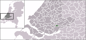
mapsize = 280px
subdivision_type = Country
subdivision_name =Netherlands
subdivision_type1 = Province
subdivision_name1 =South Holland
area_footnotes = (2006)
area_total_km2 = 10.77
area_land_km2 = 9.47
area_water_km2 = 1.30
population_as_of =1 January ,2007
population_note = Source: CBS, [http://statline.cbs.nl/ Statline] .
settlement_type = Municipality
population_total = 31394
population_density_km2 = 3315
timezone = CET
utc_offset = +1
timezone_DST = CEST
utc_offset_DST = +2
latd = 51.83
latNS = N
longd = 4.69
longEW = E
website = [http://www.papendrecht.nl www.papendrecht.nl]. The municipality covers an area of 10.77 km² (of which 1.30 km² water).
Although Papendrecht is first mentioned in documents dating back to 1105, it remained a small settlement until the 1950s. In the 1960s its development accelerated and almost its entire area is now urbanized.
Waterbus:
*Dordrecht Merwekade - Dordrecht Hooikade - Zwijndrecht Veerplein - Papendrecht Veerdam - Papendrecht Oosteind - HollandseBiesbosch -Sliedrecht MiddeldiepExternal links
* [http://www.papendrecht.nl Official Website]
*http://www.plattegronden.nl/papendrecht/
* [http://www.cultureleraadpapendrecht.nl Culturele Raad Papendrecht, the Local Arts Council]
* [http://www.papendrecht.net Papendrecht News in Dutch]
* [http://www.theaterdewillem.nl/ Theater De Willem]

Wikimedia Foundation. 2010.