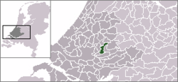
- Ouderkerk
-
Ouderkerk — Municipality — 
Flag
Coat of armsCoordinates: 51°58′N 4°40′E / 51.97°N 4.67°ECoordinates: 51°58′N 4°40′E / 51.97°N 4.67°E Country Netherlands Province South Holland Area(2006) – Total 28.53 km2 (11 sq mi) – Land 27.11 km2 (10.5 sq mi) – Water 1.42 km2 (0.5 sq mi) Population (1 January, 2007) – Total 8,197 – Density 302/km2 (782.2/sq mi) Source: CBS, Statline. Time zone CET (UTC+1) – Summer (DST) CEST (UTC+2) Website www.ouderkerk.nl  Ouderkerk (population: 8,100 in 2005) is a municipality in the western Netherlands, in the province of South Holland. The municipality covers an area of 28.53 km² (of which 1.42 km² water). It was formed on January 1, 1985, after a municipal reorganization.
The municipality of Ouderkerk consists of the population centres Gouderak, Lageweg, Ouderkerk aan den IJssel, and IJssellaan, all situated along the Hollandse IJssel river.
External links
Categories:- Municipalities of South Holland
- South Holland geography stubs
Wikimedia Foundation. 2010.


