- Sliedrecht
Infobox Settlement
official_name = Sliedrecht
flag_size = 120x100px
image_shield = Coat_of_arms_of_Sliedrecht.png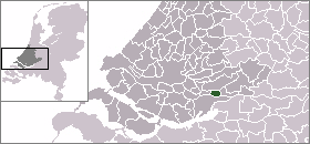
mapsize = 280px
subdivision_type = Country
subdivision_name =Netherlands
subdivision_type1 = Province
subdivision_name1 =South Holland
area_footnotes = (2006)
area_total_km2 = 14.00
area_land_km2 = 12.78
area_water_km2 = 1.22
population_as_of =1 January ,2007
population_note = Source: CBS, [http://statline.cbs.nl/ Statline] .
settlement_type = Municipality
population_total = 23797
population_density_km2 = 1862
timezone = CET
utc_offset = +1
timezone_DST = CEST
utc_offset_DST = +2
latd = 51.82
latNS = N
longd = 4.77
longEW = E
website = [http://www.sliedrecht.nl www.sliedrecht.nl]The first IKEA store in The Netherlands opened in Sliedrecht in 1978, but it closed in 2006.
Site of the "Nationaal Baggermuseum" (National Dredging Museum - featuring
dredging andsalvage ).Public transportation
Waterbus:
*Dordrecht Merwekade - Dordrecht Hooikade - Zwijndrecht Veerplein -Papendrecht Veerdam - Papendrecht Oosteind - HollandseBiesbosch - Sliedrecht MiddeldiepExternal links
* [http://www.sliedrecht.nl Sliedrecht council]
*http://www.plattegronden.nl/sliedrecht/
* [http://www.baggermuseum.nl/ Nationaal Baggermuseum]

Wikimedia Foundation. 2010.