- Chain of Rocks Bridge
-
Chain of Rocks Bridge 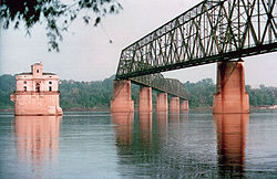
Carries Pedestrians and bicycles Crosses Mississippi River Locale St. Louis, Missouri / Madison, Illinois Maintained by Trailnet Design Cantilever through-truss Total length 5,353 feet (1,632 m) Width 24 feet (7 m) Opened 1929 Coordinates 38°45′38″N 90°10′35″W / 38.76056°N 90.17639°W Chain of Rocks BridgeLocation: West Chain of Rocks Rd., Madison, Illinois Area: 12.6 acres (5.10 ha) Built: 1929 Architect: Brown, Baxter L.; et.al. Architectural style: Warren Truss Governing body: Local MPS: Route 66 through Illinois MPS NRHP Reference#: 06001091[1] Added to NRHP: December 01, 2006 - This article is about the bridge built in 1929 which used to carry U.S. Route 66, and currently carries pedestrian and bicycle traffic. For the bridge built in 1966 which carries I-270 traffic, see New Chain of Rocks Bridge.
The Chain of Rocks Bridge spans the Mississippi River on the north edge of St. Louis, Missouri. The eastern end of the bridge is on Chouteau Island, (part of Madison, Illinois), while the western end is on the Missouri shoreline.
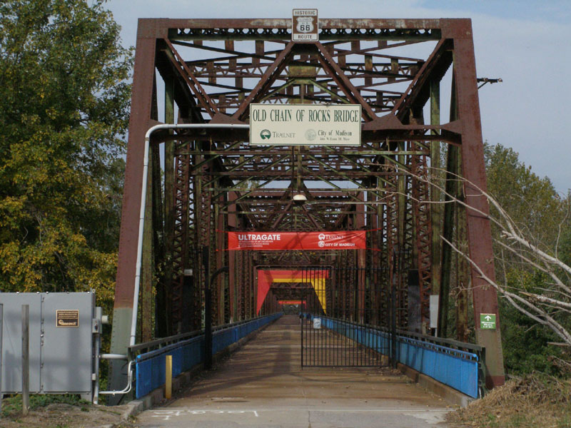
The bridge was for a time the route used by U.S. Route 66 to cross over the Mississippi. Its most notable feature is a 22-degree bend occurring at the middle of the crossing. Originally a motor route, the bridge now carries walking and biking trails over the river. The bridge was added to the National Register of Historic Places in 2006.[2]
The bridge's name comes from a large shoal, or rocky rapids, called the Chain of Rocks, which made that stretch of the Mississippi extremely dangerous to navigate.[3] Because of a low-water dam built by the Corps of Engineers in the 1960s, little of the Chain of Rocks is visible today except during extreme low water conditions.[4] After 1940, only a single impediment prevented the maintenance of a safe and reliable 9-foot (2.7 m) navigation channel on the Mississippi River from St. Paul, Minnesota, to New Orleans. This impediment, known as the Chain of Rocks Reach, was a 17-mile (27 km) series of rock ledges that began just north of St. Louis and was extremely difficult and dangerous to navigate. In the late 1940s and early 1950s the U.S. Army Corps of Engineers built a 8.4-mile (13.5 km) long canal to bypass this treacherous reach. To ensure adequate depths in the pool below the old Lock and Dam 26, a non-movable, low water dam was constructed just below the north end of the canal and a lock was installed at the south end of the canal. Known respectively as Dam No. 27, a.k.a. Chain of Rocks Dam, and Locks No. 27, a.k.a. Chain of Rocks Lock.[3][5]
Contents
History
The area was chosen as a site for the St. Louis waterworks in 1865, with construction beginning in 1887, and the water plant opened in 1894. A filter plant was added in 1915, which at the time of its construction was the largest filter plant in the world.[4] The Chain of Rocks bridge was privately built as a toll bridge in 1929 at a cost of $3 million and later turned over to the city of Madison, Illinois, the current owner of the bridge. Though engineers predicted ten fatalities during the creation of the bridge, only one worker, was killed. In the late 1930s, bypass U.S. 66 was designated over this bridge and around the northern and western parts of St. Louis to avoid the downtown area (city U.S. 66 continued to cross the Mississippi River over the MacArthur Bridge). On August 2, 1966, the tolls were suspended by the city of Madison, which marked an end of the struggle with the state of Missouri over tolls.[6] In 1966, the New Chain of Rocks Bridge was built immediately to the bridge's north in order to carry I-270; the Chain of Rocks Bridge was subsequently closed on February 25, 1970.[7]
For nearly three decades the fate of the bridge was uncertain, though demolition seemed its most likely end. The high cost of demolition, however, indefinitely delayed that outcome until a new use was found. During this time, the bridge developed a reputation for crime and violence, including the April 1991 murder of sisters Julie and Robin Kerry. It was used as a filming site for Escape from New York in 1981, with the bridge being used as the "69th Street Bridge".[8]
In 1998, the bridge was leased to Trailnet, a local trails group, to operate.[1] Four-and-a-half million dollars have been spent on renovating the bridge for pedestrian and cycling use.[2]
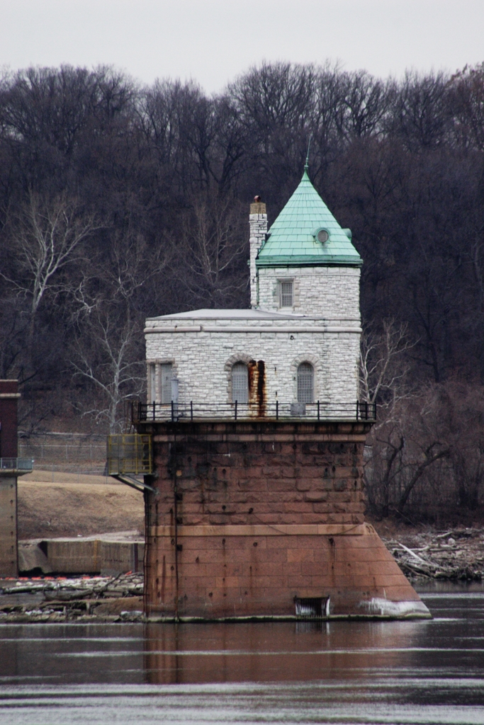
From the Illinois side of the bridge, signs marked "HISTORIC ROUTE 66 SPUR" take travelers to the Illinois side of the bridge and a "HISTORIC ROUTE 66" sign marks the Missouri side of the bridge. The Gateway Arch is visible downriver, and immediately downstream from the bridge, two water intakes for the St. Louis Waterworks are visible (see Gallery). One is vaguely Gothic Revival in style; the other closely echoes Roman ruins from Trier in modern Germany.
See also
Gallery
-

Water Intake with one span of the Chain of Rocks Bridge
-

Water Intake near Chain of Rocks Bridge
-
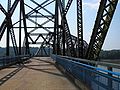
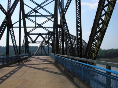
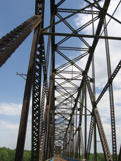
View on the bridge
-
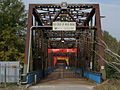
Illinois Entrance to Bridge
-

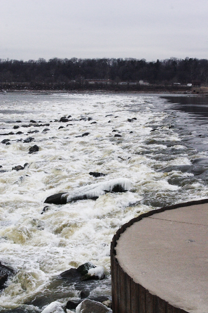
Low-water River Dam #27
-
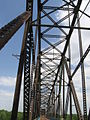
Just inside Illinois entrance to bridge
References
- ^ "National Register Information System". National Register of Historic Places. National Park Service. 2009-03-13. http://nrhp.focus.nps.gov/natreg/docs/All_Data.html.
- ^ "National Register of Historic Places Registration Form" (pdf). mostateparks.com. April 4, 2006. https://www.mostateparks.com/shpo/nps-nr/06001091.pdf. Retrieved January 17, 2010.
- ^ a b "Locks 27 and the Chain of Rocks Dam". U.S. Army Corps of Engineers, St. Louis District. June 7, 2006. http://www.mvs.usace.army.mil/navigation1/L27.html. Retrieved January 17, 2010.[dead link]
- ^ a b "The Chain of Rocks Plant". City of St. Louis Water Division. 2005. http://www.stlwater.com/chain.php. Retrieved January 17, 2010.
- ^ "Locks #27 and Chain of Rocks Dam". greatriverroad.com. http://www.greatriverroad.com/somadco/granite/lockdam27.htm. Retrieved January 17, 2010.
- ^ Alton Evening Telegraph, August 2, 1966
- ^ Alton Evening Telegraph, February 26, 1970
- ^ Granite City Press Record, August 28, 1980
External links
- Trailnet (organization which operates the Bridge)
- High resolution panoramic image taken from the bridge deck
- Chain of Rocks Bridge at Structurae
Bridges of the Mississippi River Upstream
New Chain of Rocks Bridge

Chain of Rocks Bridge

Downstream
Merchants BridgeU.S. National Register of Historic Places Topics Lists by states Alabama • Alaska • Arizona • Arkansas • California • Colorado • Connecticut • Delaware • Florida • Georgia • Hawaii • Idaho • Illinois • Indiana • Iowa • Kansas • Kentucky • Louisiana • Maine • Maryland • Massachusetts • Michigan • Minnesota • Mississippi • Missouri • Montana • Nebraska • Nevada • New Hampshire • New Jersey • New Mexico • New York • North Carolina • North Dakota • Ohio • Oklahoma • Oregon • Pennsylvania • Rhode Island • South Carolina • South Dakota • Tennessee • Texas • Utah • Vermont • Virginia • Washington • West Virginia • Wisconsin • WyomingLists by territories Lists by associated states Other  Category:National Register of Historic Places •
  Portal:National Register of Historic Places
Bridges, tunnels, and viaducts in Greater St Louis Bridges Eads Bridge • Poplar Street Bridge • New Mississippi River Bridge • McKinley Bridge • Martin Luther King Bridge • Merchants Bridge • Chain of Rocks Bridge • New Chain of Rocks Bridge • Lewis Bridge • Clark Bridge • Bellefontaine Bridge • MacArthur Bridge • Jefferson Barracks Bridge • Discovery Bridge • Wabash Bridge • Old St. Charles Bridge (now demolished) • Blanchette Memorial Bridge • Veterans Memorial Bridge • Daniel Boone Bridge • Washington Bridge • Bellerive BridgeTunnels Lindbergh Boulevard Tunnel • St. Louis Freight Tunnel • Tucker Boulevard Tunnel (now disused)Viaducts Tucker Boulevard Viaduct • Grand Boulevard Viaduct • Jefferson Avenue Viaduct • 18th Street Viaduct • 14th Street Viaduct • Kingshighway Boulevard Viaduct • South Kingshighway Boulevard Viaduct • Hampton Avenue Viaduct • Poplar Street Rail Viaduct • Lesperance Street Rail Viaduct • Westbelt Rail ViaductOperators Categories:- Transportation in Greater St. Louis
- Former road bridges in the United States
- Bridges completed in 1929
- Road bridges in Illinois
- Bridges in Madison County, Illinois
- Bridges over the Mississippi River
- Pedestrian bridges in Illinois
- Bridges in Greater St. Louis
- Bridges on U.S. Route 66
- Bridges on the National Register of Historic Places in Missouri
- Bridges in St. Louis, Missouri
- National Register of Historic Places in Madison County, Illinois
- Road bridges in Missouri
- Pedestrian bridges in Missouri


Wikimedia Foundation. 2010.