- Martin Luther King Bridge (St. Louis)
-
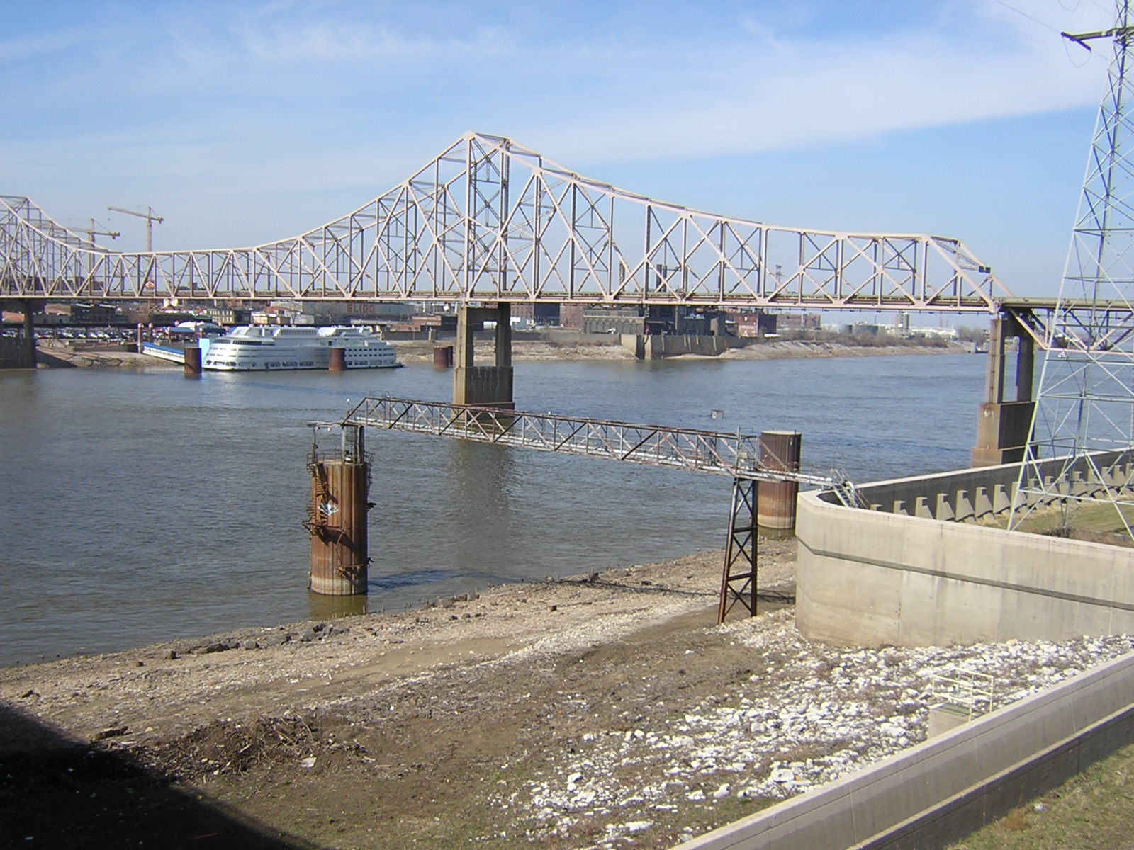
Martin Luther King Bridge 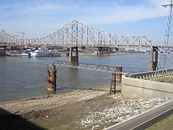
MLK bridge from Eads Bridge Metro station, IL sideOther name(s) Veterans Bridge Carries 3 lanes (1 westbound and 2 eastbound) of Route 799 Crosses Mississippi River Locale St. Louis, Missouri and East St. Louis, Illinois Maintained by MoDOT, IDOT Design Cantilever bridge Total length 4,009 feet (1,222 m) Width 40 feet (12 m) Longest span 962 feet (293 m) Vertical clearance 19.4 feet (6 m) Clearance below 98 feet (30 m) Opened 1951 Coordinates 38°37′52″N 90°10′46″W / 38.63111°N 90.17944°W The Martin Luther King Bridge (formerly known as the Veterans Bridge) in St. Louis is a cantilever truss bridge of about 4,000 feet (1,200 m) in total length across the Mississippi River, connecting St. Louis with East St. Louis, Illinois. The bridge serves as traffic relief connecting the concurrent freeways of Interstate 55, Interstate 70, Interstate 64, and U.S. Route 40 with the downtown streets of St. Louis.
Contents
History
The bridge was built in 1951 as the Veterans' Memorial Bridge to relieve congestion on the MacArthur Bridge to the south and was built as a toll bridge and was owned by the City of East St. Louis. At one time, it carried U.S. Route 40 and U.S. Route 66 across the river. In 1967, the bridge fell into disrepair when the (free) Poplar Street Bridge was constructed, and traffic began to use that route, leading to declining toll revenues.
Eventually, ownership was transferred dually to the Missouri and Illinois Departments of Transportation and the bridge was renamed after Martin Luther King, Jr. In 1987, the toll was removed. A bi-state project for about 24,000,000 USD to renovate the bridge at the behest of local civic and government leaders was carried out in the late 1980s. In the spring of 1989, the rebuilt bridge was reopened. In June 1990, the lighting of the bridge was completed by the St. Louis Port Authority. It is now an important contributor to the transportation needs of the region and the ambiance of the historic St. Louis riverfront.
On October 12, 2009 the bridge was closed in order to reduce the old four-lane configuration down to three wider lanes, install a waterproofing membrane over the bridge surface [1], and to install a concrete barrier to separate eastbound traffic from westbound. Over the previous six years there had been 38 serious accidents, including several involving multiple fatalities.[2] The $1.4 million project was aimed at eliminating these head-on collisions in the future. The bridge re-opened on October 21, 2009.
Gallery
-
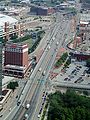
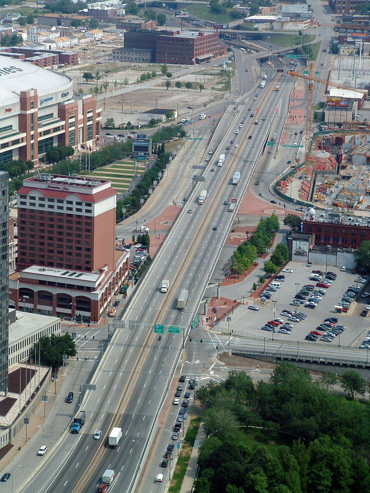
Looking north along Interstate 70, with the interchange for the west end of the bridge in the middleground
-
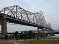
Martin Luther King, Jr. Bridge
Route 799
Route 799 Location: Illinois state line to I-70 in St. Louis Length: 0.5 mi (0.8 km) The Missouri half of the bridge is designated as unsigned Route 799 by MoDOT.[1]
See also
References
- ^ Missouri Department of Transportation, General Highway Map: St. Louis City, Revised - September 2005
External links
- Bridge info at Historic Bridges of the Midwest.
- maps.google.com zoomed in, hybrid mode
Bridges of the Mississippi River Upstream
McKinley Bridge

Martin Luther King Bridge
25pxDownstream
Eads Bridge
St. Louis MetrolinkBridges, tunnels, and viaducts in Greater St Louis Bridges Eads Bridge • Poplar Street Bridge • New Mississippi River Bridge • McKinley Bridge • Martin Luther King Bridge • Merchants Bridge • Chain of Rocks Bridge • New Chain of Rocks Bridge • Lewis Bridge • Clark Bridge • Bellefontaine Bridge • MacArthur Bridge • Jefferson Barracks Bridge • Discovery Bridge • Wabash Bridge • Old St. Charles Bridge (now demolished) • Blanchette Memorial Bridge • Veterans Memorial Bridge • Daniel Boone Bridge • Washington Bridge • Bellerive BridgeTunnels Lindbergh Boulevard Tunnel • St. Louis Freight Tunnel • Tucker Boulevard Tunnel (now disused)Viaducts Tucker Boulevard Viaduct • Grand Boulevard Viaduct • Jefferson Avenue Viaduct • 18th Street Viaduct • 14th Street Viaduct • Kingshighway Boulevard Viaduct • South Kingshighway Boulevard Viaduct • Hampton Avenue Viaduct • Poplar Street Rail Viaduct • Lesperance Street Rail Viaduct • Westbelt Rail ViaductOperators Categories:- Transportation in Greater St. Louis
- Cantilever bridges
- Road bridges in Illinois
- Bridges over the Mississippi River
- East St. Louis, Illinois
- Bridges on U.S. Route 66
- Bridges completed in 1951
- Bridges in St. Louis, Missouri
- Memorials to Martin Luther King, Jr.
- Buildings and structures in St. Clair County, Illinois
- Road bridges in Missouri
-

Wikimedia Foundation. 2010.