- Marks' Mills State Park
-
Marks' Mills Battlefield Park
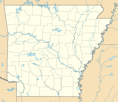

Location: Cleveland County, Arkansas Nearest city: Fordyce, Arkansas Coordinates: 33°47′28″N 92°15′27″W / 33.79111°N 92.2575°WCoordinates: 33°47′28″N 92°15′27″W / 33.79111°N 92.2575°W Built: 1864 Governing body: State NRHP Reference#: 70000119 Significant dates Added to NRHP: January 21, 1970[1] Designated NHL: April 19, 1994[2] Marks' Mills State Park in Arkansas preserves the battleground of the Civil War Battle of Marks' Mills.
It was listed on the National Register of Historic Places in 1970, and, with other sites, is part of the Camden Expedition Sites National Historic Landmark.
It was declared part of the National Historic Landmark in 1994.[2],[3],[4]
References
- ^ "National Register Information System". National Register of Historic Places. National Park Service. 2007-01-23. http://nrhp.focus.nps.gov/natreg/docs/All_Data.html.
- ^ a b "Camden Expedition Sites". National Historic Landmark summary listing. National Park Service. 2007-09-26. http://tps.cr.nps.gov/nhl/detail.cfm?ResourceId=896&ResourceType=District.
- ^ ["Camden Expedition Sites", November 29, 1993, by Edward C. Bearss and James H. CharletonPDF (2.55 MB) "National Historic Landmark Nomination"]. National Park Service. 1993-11-29. "Camden Expedition Sites", November 29, 1993, by Edward C. Bearss and James H. CharletonPDF (2.55 MB).
- ^ [Camden Expedition Sites--Accompanying 62 photos, from 1992-1993: Old U.S. Arsenal (6 photos), Confederate State Capitol (5 photos), Prairie de Ann Battlefield (7 photos), Jenkins' Ferry Battlefield (4 photos), Marks' Mills Battlefield (10 photos), Fort Southerland (5 photos), Poison Spring Battlefield (7 photos), Fort Lookout (9 photos), Elkin's Ferry Battlefield (9 photos).PDF (16.2 MB) "National Register of Historic Places Inventory-Nomination"]. National Park Service. 1993-11-29. Camden Expedition Sites--Accompanying 62 photos, from 1992-1993: Old U.S. Arsenal (6 photos), Confederate State Capitol (5 photos), Prairie de Ann Battlefield (7 photos), Jenkins' Ferry Battlefield (4 photos), Marks' Mills Battlefield (10 photos), Fort Southerland (5 photos), Poison Spring Battlefield (7 photos), Fort Lookout (9 photos), Elkin's Ferry Battlefield (9 photos).PDF (16.2 MB).
External links
U.S. National Register of Historic Places Topics Lists by states Alabama • Alaska • Arizona • Arkansas • California • Colorado • Connecticut • Delaware • Florida • Georgia • Hawaii • Idaho • Illinois • Indiana • Iowa • Kansas • Kentucky • Louisiana • Maine • Maryland • Massachusetts • Michigan • Minnesota • Mississippi • Missouri • Montana • Nebraska • Nevada • New Hampshire • New Jersey • New Mexico • New York • North Carolina • North Dakota • Ohio • Oklahoma • Oregon • Pennsylvania • Rhode Island • South Carolina • South Dakota • Tennessee • Texas • Utah • Vermont • Virginia • Washington • West Virginia • Wisconsin • WyomingLists by territories Lists by associated states Other Categories:- National Historic Landmarks in Arkansas
- Arkansas state parks
- Protected areas of Cleveland County, Arkansas
- Arkansas geography stubs
- Arkansas Registered Historic Place stubs

Wikimedia Foundation. 2010.