- DeGray Lake
-
DeGray Lake 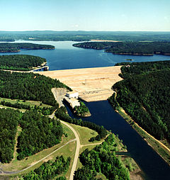
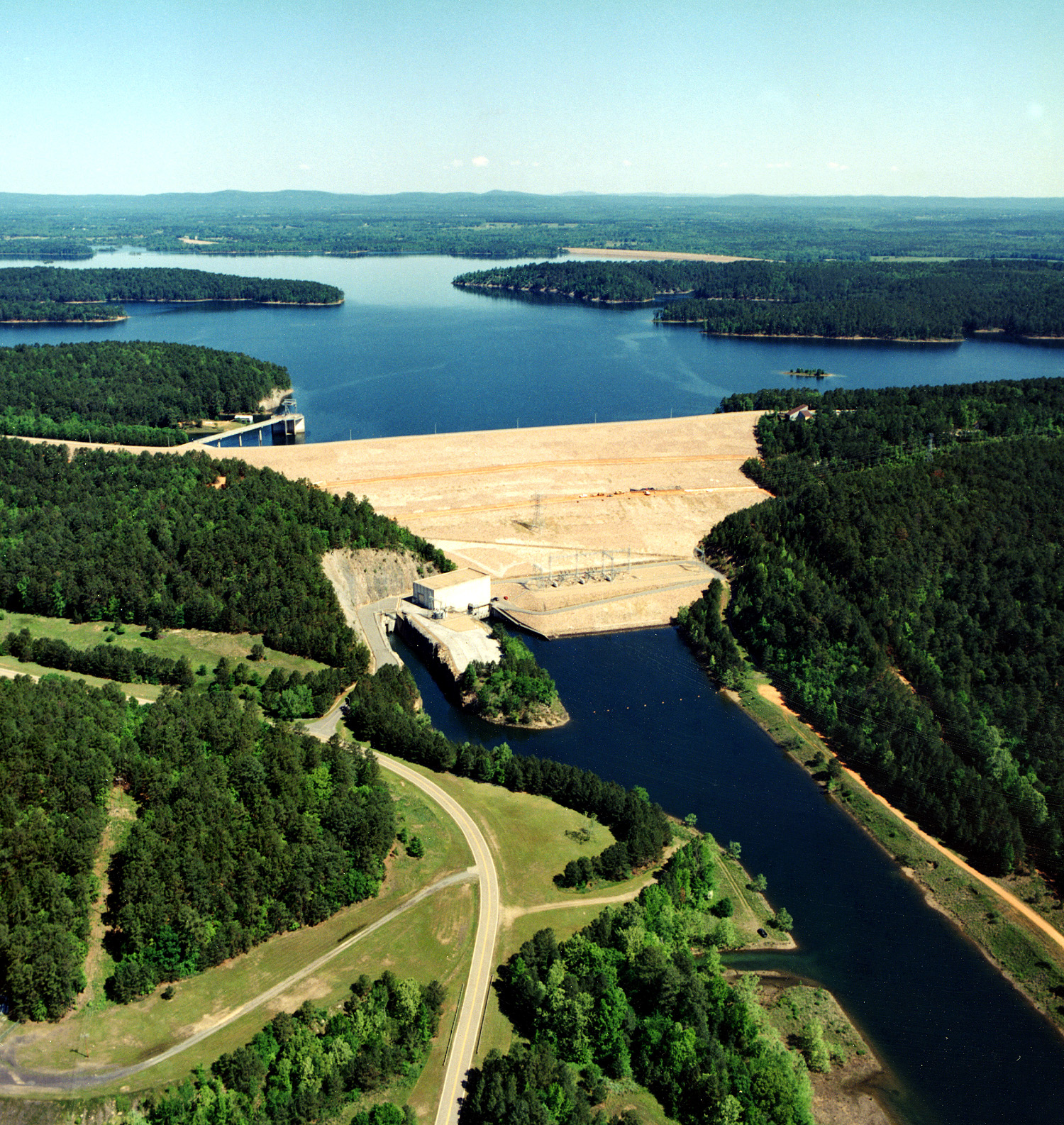
Dam and Lake Location Clark / Hot Spring counties, Arkansas, USA Coordinates 34°14′12″N 93°07′27″W / 34.236535°N 93.124237°WCoordinates: 34°14′12″N 93°07′27″W / 34.236535°N 93.124237°W Lake type reservoir Primary inflows Caddo River Primary outflows Caddo River Basin countries United States Surface area 13,800 acres (5,600 ha) DeGray Lake is a reservoir on the Caddo River, 8 miles (13 km) from Arkadelphia. DeGray Lake offers a huge span of recreational area and spectacular views. Arkansas Scenic Byway 7 is located on the eastern shore of the lake, and provides views of the lake, and also places to stay down the road.
Contents
Overview
DeGray lake and dam were authorized by Congress in the River and Harbor Act of 1950. Congress passed the Water Supply Act of 1958, which provided for the inclusion of municipal and industrial water supply as one of the project purposes. Construction on the dam began in 1962 and was completed in 1972 at a cost of $63,800,000. A 40 MW hydraulic turbine and a 28 MW turbine generate electricity for the Southwestern Power Administration of Arkansas, Texas, and Oklahoma. DeGray dam impounds the waters of the Caddo River to form a flood control lake that covers 13,400 acres (5,400 ha), and a shoreline of 207 miles (333 km).
Many of the long-time residents recall families in the area who were "bought out" in order to fill area behind the dam. Residents were offered money for their property, so that the lake could be built. The eventual damming of the Caddo River forced many people to move elsewhere in the area. Brick and concrete structures from former homesteads still stand on the bottom of the lake.
History
The history of the DeGray area dates back to AD 700 when the area was inhabited by the Caddo Indians. Hernando de Soto then came and explored this area in 1541, after discovering hot springs. The Caddo Indians' way of life was changed forever when coming in contact with the Spanish explorers; the Indians were introduced to the horse. In the 18th century French fur trappers brought trade to the area with their extensive trapping methods. DeGray Lake was in fact named after a French fur trader, DeGraff, who settled this region. Several artifacts have been found near the dam site, and many have been brought to a local university, Henderson State University.
DeGray Lake Resort State Park
Situated on the north shore of 13,800-acre (5,600 ha) DeGray Lake, this recreational retreat in the foothills of the Ouachita Mountains offers resort amenities combined with the outdoor adventures of an Arkansas state park. This state park is one of Arkansas' most popular parks, offering fishing and water sports, campgrounds for both tent and RV camping, and an 18-hole golf course. The 94-room DeGray Lodge and Convention center is also available for family reunions, retreats, board meeting, conventions and stunning lake front weddings. The Shoreline Restaurant and DeGray Day Spa are located at the lodge.
DeGray's challenging 18-hole championship-rated public course stretches 7,100 yards (6,500 m). The course offers opportunities to view the birds and other wildlife that abound here. The front nine offers wide, expansive fairways with elevated, undulating and sloping greens, tee boxes and hidden water hazards. The back nine are carved out of the woodlands leaving little room for stray shots. The course offers a driving range, practice green, chipping area and lessons, from the blue tees the course is 7,100 yards (6,500 m), from the white-6,560 yards (6,000 m), gold-6,200 yards (5,700 m) and red-5,800 yards (5,300 m). The course rating is 72.7 and the slope is 134. Water comes into play on seven holes. The Pro Shop offers a snack bar, cart and club rentals, golf equipment and a wide selection of brand name golf apparel and accessories for purchase.
See also
External links
Federal Fort Smith • Little Rock Central High SchoolOuachita • Ozark-St. FrancisBald Knob • Big Lake • Cache River • Felsenthal • Holla Bend • Logan Cave • Overflow • Pond Creek • Wapanocca • White RiverState Arkansas Museum of Natural Resources • Arkansas Post Museum • Bull Shoals-White River State Park • Cane Creek State Park • Conway Cemetery Historic State Park • Cossatot River State Park-Natural Area • Crater of Diamonds State Park • Crowley's Ridge State Park • Daisy State Park • DeGray Lake Resort State Park • Delta Heritage Trail State Park • Devil's Den State Park • Hampson Museum State Park • Herman Davis State Park • Historic Washington State Park • Hobbs State Park-Conservation Area • Jacksonport State Park • Jenkins' Ferry State Park • Lake Catherine State Park • Lake Charles State Park • Lake Chicot State Park • Lake Dardanelle State Park • Lake Fort Smith State Park • Lake Frierson State Park • Lake Ouachita State Park • Lake Poinsett State Park • Logoly State Park • Louisiana Purchase State Park • Lower White River Museum State Park • Mammoth Spring State Park • Marks' Mills State Park • Millwood State Park • Moro Bay State Park • Mount Magazine State Park • Mount Nebo State Park • Old Davidsonville State Park • Ozark Folk Center State Park • Parkin Archeological State Park • Petit Jean State Park • Pinnacle Mountain State Park • Plantation Agriculture Museum • Poison Spring State Park • Powhatan Courthouse State Park • Prairie Grove Battlefield State Park • Queen Wilhelmina State Park • South Arkansas Arboretum • Toltec Mounds Archeological State Park • Village Creek State Park • White Oak Lake State Park • Withrow Springs State Park • Woolly Hollow State ParkPoison Springs State ForestCategories:- Reservoirs in Arkansas
- Protected areas of Clark County, Arkansas
- Protected areas of Hot Spring County, Arkansas
- Arkansas state parks
- Buildings and structures in Clark County, Arkansas
- Buildings and structures in Hot Spring County, Arkansas
Wikimedia Foundation. 2010.