- Muchalls
-
Coordinates: 57°01′16″N 2°09′40″W / 57.021°N 2.161°W
Muchalls 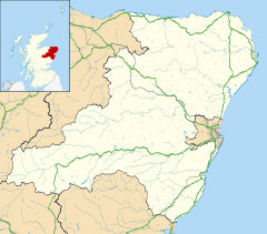
 Muchalls
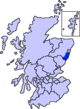
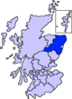
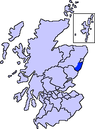
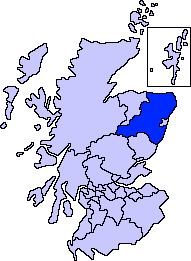
Muchalls shown within AberdeenshirePopulation 500 (approx) OS grid reference NO902922 - Edinburgh 115 mi (185 km) SSW - London 510 mi (820 km) SSE Council area Aberdeenshire Lieutenancy area Aberdeenshire Country Scotland Sovereign state United Kingdom Post town STONEHAVEN Postcode district AB39 Dialling code 01569 Police Grampian Fire Grampian Ambulance Scottish EU Parliament Scotland UK Parliament West Aberdeenshire and Kincardine Scottish Parliament West Aberdeenshire and Kincardine List of places: UK • Scotland • Muchalls is a small coastal ex-fishing village in Kincardineshire, Scotland, south of Newtonhill and north of Stonehaven.[1][2] Muchalls is situated slightly north of a smaller hamlet known as the Bridge of Muchalls. At the western edge of Muchalls is the historic Saint Ternan's Church. The rugged North Sea coastline near Muchalls features numerous cliffs, sea stacks and headlands, not infrequently in haar. The Grim Brigs headland is situated at Muchalls southern edge and Doonie Point headland is approximately 1.5 kilometres south.
Charles Dickens visited Muchalls in its heyday as a Victorian resort and declared that Muchalls was a remarkably beautiful place. Footage was recorded in Muchalls for the 1990 film Hamlet.[3] Muchalls is the birthplace of Richard Henry Brunton,[4] considered the father of Japanese lighthouses.
Contents
History
Muchalls is situated slightly to the east of the ancient Causey Mounth trackway, which was constructed on high ground to make passable this only available medieval route from coastal points south from Stonehaven to Aberdeen. This ancient passage specifically connected the River Dee crossing (where the present Bridge of Dee is situated) via Gillybrands, Muchalls Castle and Stonehaven to the south.[5] The route was that taken by William Keith, 7th Earl Marischal and the Marquess of Montrose when they led a Covenanter army of 9000 men in the battle of the Civil War in 1639.[6] From Muchalls Castle to the sea is a secret cave about one mile long which smugglers once used. The cave is said to be haunted by the green lady. The cave has been boarded up at the castle end and at the sea and (near the bridge of Muchalls) it has collapsed just below the railway line.
References
- ^ Muchalls. Gazetteer for Scotland.
- ^ Muchalls. History. Gazetteer for Scotland.
- ^ Where did they film that?
- ^ Centenary memorial service for Richard Henry Brunton
- ^ C.Michael Hogan, Causey Mounth, Megalithic Portal, ed. by A. Burnham, Nov 3, 2007
- ^ Watt, Archibald, Highways and Byways around Kincardineshire, Stonehaven Heritage Society (1985)
External links
- Muchalls on the Kincardineshire Coast - A Health Resort, By William Paul, 1896
- Solar Eclipse 2003 at Muchalls
See also
Settlements and places of interest in Kincardine and Mearns, Aberdeenshire Primary settlements Auchenblae · Drumoak · Fettercairn · Gourdon · Inverbervie · Johnshaven · Laurencekirk · Newtonhill · Portlethen · St Cyrus · Stonehaven
Other settlements Arbuthnott · Banchory-Devenick · Bridge of Muchalls · Cammachmore · Catterline · Cookney · Downies · Drumlithie · Findon · Fordoun · Glenbervie · Kinneff · Kirkton of Durris · Maryculter · Marykirk · Muchalls · Netherley · Portlethen Village
Places of interest Causey Mounth · Crawton · Drum Castle · Dunnottar Castle · Fetteresso Castle · Fowlsheugh Nature Reserve (Craiglethy) · Monboddo House · Muchalls Castle · Normandykes · Portlethen Moss · Raedykes · Stonehaven Open Air Pool · Stonehaven Tolbooth
Areas and primary settlements in Aberdeenshire
(see also: Aberdeen City)in Banff and Buchan Aberchirder · Banff · Fraserburgh · Gardenstown · Inverallochy and Cairnbulg · Macduff · Portsoy · Rosehearty · Sandhaven · Whitehills
in Buchan Boddam · Crimond · Cruden Bay · Fetterangus · Hatton · Longside · Maud · Mintlaw · New Deer · New Pitsligo · Peterhead · St Combs · St Fergus · Strichen · Stuartfield
in Formartine Balmedie · Cuminestown · Ellon · Fyvie · Newburgh · Oldmeldrum · Pitmedden · Potterton · Rothienorman · Tarves · Turriff
in Garioch in Kincardine and Mearns Drumoak · Fettercairn · Gourdon · Inverbervie · Johnshaven · Laurencekirk · Newtonhill · Portlethen · St Cyrus · Stonehaven
in Marr Coordinates: 57°01′N 2°10′W / 57.017°N 2.167°W
Categories:- Hamlets in Scotland
- Villages in Aberdeenshire
- Aberdeenshire geography stubs

Wikimedia Foundation. 2010.