- Newtonhill
-
Coordinates: 57°03′N 2°06′W / 57.05°N 2.1°W
Newtonhill 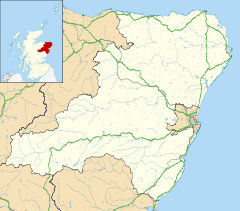
 Newtonhill
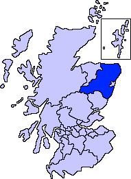
Newtonhill shown within AberdeenshirePopulation 3,284 (2010 Estimate) [1] Council area Aberdeenshire Lieutenancy area Kincardineshire Country Scotland Sovereign state United Kingdom Post town STONEHAVEN Postcode district AB39 Dialling code 01569 Police Grampian Fire Grampian Ambulance Scottish EU Parliament Scotland UK Parliament West Aberdeenshire & Kincardine Scottish Parliament Aberdeen South and North Kincardine List of places: UK • Scotland •  Newtonhill village in the snow taken from the railway bridge to the north of the village
 Newtonhill railway viaduct
Newtonhill is a farming village in Aberdeenshire, Scotland. It has been popular with farm workers and tradesmen for decades for its cheap housing and location, just six miles south of Aberdeen.
Contents
Facilities
The village, originally called Skateraw and then Finntown, has three commercial outlets; A Tesco Metro Store, a convenience store - Morning, Noon and Night (Convenience Store) and a pharmacy. There are also two pubs in the village, Quoiters and The Newton Arms. Local events centre around the Community Centre, The Bettridge Centre.
Newtonhill Primary School serves the village and surrounding hamlets of Muchalls and Cammachmore.
Historic features
Historically, there was a railway station in the older quarters of Newtonhill but this has now become defunct, operating as a signalling station only. Skateraw became most noticed historically for its fishing industry; the old smoke house is still visible in the lower village, though this is also not in operation.
Transport links
Newtonhill today is accessed by the A90 road and functions primarily as a commuter town to Aberdeen and other business hubs in the Aberdeenshire area. The village is also well served by buses run by Stagecoach Group providing regular services to Aberdeen, Stonehaven and Montrose.
Community groups and activities
Newtonhill has a successful Boys Brigade chess team which has won the Scottish tournament many times and have won the British grand finals the most out of all British teams.[citation needed] There is an active community spirit in Newtonhill and many events are organised through the [2] Newtonhill and District Village Association, with wider planning issues being discussed by the Community Council.
Natural features
 The Bay at Newtonhill, which features several caves
The Burn of Elsick, which drains agricultural lands from the west, flows into the North Sea at Newtonhill. The White Wife is a rock formation which allows sea angling. Newtonhill also has a great scenic views of the cliffs onlooking onto the pebble shore, where fishing still accustomed to many.
History
Newtonhill is situated about one kilometre east of the ancient Causey Mounth road, which was built on high ground to make passable this only available medieval route from coastal points south to Aberdeen. This ancient passage specifically connected the Bridge of Dee via Portlethen Moss, Muchalls Castle and Stonehaven to the south.[1] The route was that taken by William Keith, 7th Earl Marischal and the Duke of Montrose when they led a Covenanter army of 9000 men in the first battle of the First Bishop's War in 1639.[2]
Geography
Newtonhill is located on the North-East coast of Scotland, approximately 9 miles south of Aberdeen and 6 miles north of Stonehaven.
Destinations from Newtonhill 
Cammachmore, Portlethen Cookney 
The North Sea  Newtonhill

Muchalls, Stonehaven Local Radio
Alongside the commercial enterprise of the local newspaper, The Mearns Leader, Newtonhill has a Local Community Radio Station in Mearns FM.[3] Broadcasting from nearby Stonehaven in the Townhall, Mearns FM helps to keep Newtonhill up to date with local and charity events, as well as playing a wee bit of music. Staffed completely by volunteers, Mearns FM is run as a not for profit organisation, broadcasting under a Community Radio licence, with a remit to provide local focus news events and programming. Jointly funded by local adverts and local and national grants. Mearns FM has one of the largest listening areas of any Community Radio Station owing to the Mearns' distributed population, Mearns FM was setup to try and bring these distant communities together.[4]
See also
References
- ^ C.Michael Hogan, Causey Mounth, Megalithic Portal, ed. by Andy Burnham, 2007
- ^ Archibald Watt, Highways and Byways around Kincardineshire, Stonehaven Heritage Society (1985)
- ^ http://mearnsfm.org.uk/
- ^ Mearns FM launch release
Settlements and places of interest in Kincardine and Mearns, Aberdeenshire Primary settlements Auchenblae · Drumoak · Fettercairn · Gourdon · Inverbervie · Johnshaven · Laurencekirk · Newtonhill · Portlethen · St Cyrus · Stonehaven
Other settlements Arbuthnott · Banchory-Devenick · Bridge of Muchalls · Cammachmore · Catterline · Cookney · Downies · Drumlithie · Findon · Fordoun · Glenbervie · Kinneff · Kirkton of Durris · Maryculter · Marykirk · Muchalls · Netherley · Portlethen Village
Places of interest Causey Mounth · Crawton · Drum Castle · Dunnottar Castle · Fetteresso Castle · Fowlsheugh Nature Reserve (Craiglethy) · Monboddo House · Muchalls Castle · Normandykes · Portlethen Moss · Raedykes · Stonehaven Open Air Pool · Stonehaven Tolbooth
Areas and primary settlements in Aberdeenshire
(see also: Aberdeen City)in Banff and Buchan Aberchirder · Banff · Fraserburgh · Gardenstown · Inverallochy and Cairnbulg · Macduff · Portsoy · Rosehearty · Sandhaven · Whitehills
in Buchan Boddam · Crimond · Cruden Bay · Fetterangus · Hatton · Longside · Maud · Mintlaw · New Deer · New Pitsligo · Peterhead · St Combs · St Fergus · Strichen · Stuartfield
in Formartine Balmedie · Cuminestown · Ellon · Fyvie · Newburgh · Oldmeldrum · Pitmedden · Potterton · Rothienorman · Tarves · Turriff
in Garioch in Kincardine and Mearns Drumoak · Fettercairn · Gourdon · Inverbervie · Johnshaven · Laurencekirk · Newtonhill · Portlethen · St Cyrus · Stonehaven
in Marr Coordinates: 57°02′N 2°09′W / 57.033°N 2.15°W
Categories:- Villages in Aberdeenshire
- Aberdeenshire geography stubs


Wikimedia Foundation. 2010.