- Cockfosters
-
Coordinates: 51°39′10″N 0°09′22″W / 51.6527°N 0.1560°W
Cockfosters 
 Cockfosters
Cockfosters shown within Greater LondonOS grid reference TQ275965 London borough Enfield Barnet Ceremonial county Greater London Region London Country England Sovereign state United Kingdom Post town BARNET Postcode district EN4 Dialling code 020 Police Metropolitan Fire London Ambulance London EU Parliament London UK Parliament Enfield Southgate Chipping Barnet London Assembly Enfield and Haringey Barnet and Camden List of places: UK • England • London Cockfosters is a suburb of North London, lying partly in the London Borough of Enfield and partly in the London Borough of Barnet. The counties of Hertfordshire and Middlesex respectively (in which Cockfosters was located pre-1965) are still used in postal addresses.
The name has been recorded as far back as 1524, and is thought to be either the name of a family, or that of a house which stood on Enfield Chase. One suggestion is that it was "the residence of the cock forester (or chief forester)".[1]
Of note in Cockfosters is Trent Park which serves as a country park.
Christ Church, Cockfosters was founded in 1839. The Piccadilly line of the London Underground reached Cockfosters in 1933.
The Cock & Dragon Pub (formerly the Cock), offset from Cockfosters Road on Chalk Lane, opened in 1798.
Contents
Geography
Neighbouring areas 
New Barnet Hadley Wood Trent Park East Barnet 
Oakwood  Cockfosters

Oakleigh Park Osidge Southgate Education
There are two campuses of Middlesex University nearby:
- One in Trent Park
- At the top of Cat Hill, next to the large roundabout.
The Museum of Domestic Design and Architecture is also located on the Cat Hill campus.
Southgate School is located in Sussex Way.
Trent C of E Primary School is located in Chalk Lane.
Theatre and the Arts
The Chickenshed Theatre Company , aka Chickenshed, is located in Cockfosters. It was founded in 1975 in a chicken shed, and has since moved to its current site. It now produces many shows, most recently "Badjelly's Bad Christmas", "The Kings Web", "Slender Threads", "Duty" and "The Rain that Washes". It is an inclusive theatre compnany, and started the concept of "inclusive theatre", which means anyone, regardless of background, race, gender, age or disability, is allowed to both watch and perform in theatre.
Sport
Saracens used to play at Chase Side (also known as Clocktower Park). ("Chase Side" is the name of a road between Cockfosters and Southgate). However, they moved to and currently reside in Watford. The ground is still used for Enfield F.C. training and for the Saracens' 'B' team, Saracens Storm. It is also used as Saracens Amateurs' training ground. Cockfosters Cricket Club, Southgate Compton Cricket Club and Cockfosters Football Club play at Chalk Lane on fields adjacent to Christ Church.
Local newspapers
The local newspapers are as of 20011-
Newspaper Link Enfield Independent [2] Enfield Advertiser [3] The Jewish Chronicle ("The JC") [4] People
The MP for Southgate, David Burrowes, was born in Cockfosters. George Baillie Duncan ministered at Christ Church, Cockfosters and the cricketer Andrew Wingfield Digby was a curate there. Cameron McVey grew up in Cockfosters. The poet John Betjeman, who taught at Heddon Court School in 1929-30, wrote "The Cricket Master" about his experiences there. Other transient residents have included the footballers Tommy Docherty and George Eastham and Dave Davies of the Kinks.
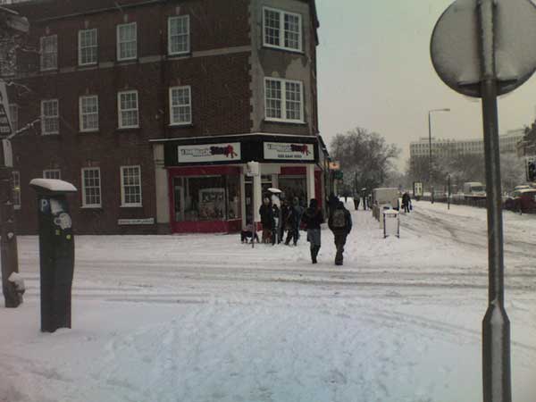
 Cockfosters Road, Cockfosters
Transport
Nearby Stations
- Cockfosters tube station
- New Barnet railway station - about 2 miles west
References
- ^ Harris, Cyril M.. What's in a name?. London: Capital Transport. ISBN 1-85414-241-0.
- ^ http://www.enfieldindependent.co.uk/
- ^ http://www.mediauk.com/newspapers/41848/the-enfield-advertiser
- ^ http://www.thejc.com/news
London Borough of Enfield Districts Arnos Grove · Botany Bay · Bowes Park · Brimsdown · Bulls Cross · Bush Hill Park · Clay Hill · Cockfosters · Crews Hill · Edmonton · Enfield Chase · Enfield Highway · Enfield Island Village · Enfield Lock · Enfield Town · Enfield Wash · Forty Hill · Freezywater · Grange Park · Hadley Wood · Lower Edmonton · New Southgate · Oakwood · Palmers Green · Picketts Lock · Ponders End · Southgate · Upper Edmonton · Winchmore Hill · World's End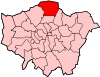
Attractions Parks and open spaces Arnos Park · Broomfield Park · Durants Park · Oakwood Park · Pymmes Park · Trent Country Park · Whitewebbs ParkConstituencies Tube and rail stations Arnos Grove · Brimsdown · Bush Hill Park · Cockfosters · Crews Hill · Edmonton Green · Enfield Chase · Enfield Lock · Enfield Town · Gordon Hill · Grange Park · Hadley Wood · Oakwood · Palmers Green · Ponders End · Silver Street · Southbury · Southgate · Turkey Street · Winchmore HillOther topics Major holdings Lancashire SurveyBowland · Lancaster Castle · Myerscough · Salwick · Whitewell · Winmarleigh · WyresideYorkshire SurveyCloughton · Goathland · Knaresborough Castle · Pickering Castle · Pontefract Castle · Scalby · The Stray · Tickhill CastleCrewe and South SurveyNeedwood SurveyUrban SurveyCockfosters · Hadley Wood · Savoy Chapel · StrandSection 16: London Outer Orbital Path Section 17: Elstree Cockfosters Enfield Lock Categories:- Districts of London
- Districts of Barnet
- Districts of Enfield
- London Loop
- London geography stubs


Wikimedia Foundation. 2010.