- Clay Hill, London
-
Clay Hill is a small area of Enfield, London, England. It is located to the north of Enfield Town. Mainly a residential area which almost borders Crews Hill to the north and forms part of London's Green Belt. Places of interest include Clay Hill House, Whitewebbs Park, Hillyfields Park and Forty Hall.
Contents
Etymology
Clay Hill is recorded as Clayhyll 1524, Clayhillgate 1636, apparently self-explanatory, 'hill with clay soil', with -gate which refers to gate of Enfield Chase. However the local name Claysmore, earlier Clayes More Grove 1610, is to be associated with the family of William atte Cleye (that is 'at the clayey place') 1274, John Clay 1420. Clay Hill may derive from a surname rather than the word clay.[1]
History
Whitewebbs has longstanding links with the Gunpowder Plot, as Guy Fawkes and his fellow revolutionaries are known to have used a safe house in Whitewebbs Lane, Enfield. The claim as to location of this safe house is held by the Rose and Crown Public House which was extended into what would have been cottages at the time.[2] He is also reputed to have drunk at the King and Tinker pub, known then as The White Hart.[citation needed]
Nearby places
External links
- / pubs.com The King and Tinker public house
References
- ^ Mills A. D. Oxford Dictionary of London Place Names (2001) p49 ISBN 0198609574 Retrieved 27 October 2008
- ^ Gunpowder plot Retrieved 19 December 2008
London Borough of Enfield Districts Arnos Grove · Botany Bay · Bowes Park · Brimsdown · Bulls Cross · Bush Hill Park · Clay Hill · Cockfosters · Crews Hill · Edmonton · Enfield Chase · Enfield Highway · Enfield Island Village · Enfield Lock · Enfield Town · Enfield Wash · Forty Hill · Freezywater · Grange Park · Hadley Wood · Lower Edmonton · New Southgate · Oakwood · Palmers Green · Picketts Lock · Ponders End · Southgate · Upper Edmonton · Winchmore Hill · World's End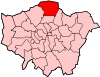
Attractions Parks and open spaces Arnos Park · Broomfield Park · Durants Park · Oakwood Park · Pymmes Park · Trent Country Park · Whitewebbs ParkConstituencies Tube and rail stations Arnos Grove · Brimsdown · Bush Hill Park · Cockfosters · Crews Hill · Edmonton Green · Enfield Chase · Enfield Lock · Enfield Town · Gordon Hill · Grange Park · Hadley Wood · Oakwood · Palmers Green · Ponders End · Silver Street · Southbury · Southgate · Turkey Street · Winchmore HillOther topics Parks and open spaces in Enfield Coordinates: 51°40′19″N 0°05′23″W / 51.672°N 0.0897°W
Categories:- Districts of London
- Districts of Enfield
- London geography stubs

Wikimedia Foundation. 2010.