- Church End, Barnet
-
Coordinates: 51°36′08″N 0°11′34″W / 51.6021°N 0.1927°W
Church End 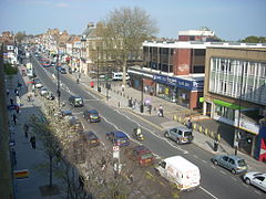
Ballards Lane
 Church End
Church End shown within Greater LondonOS grid reference TQ255905 - Charing Cross 7 mi (11.3 km) SSE London borough Barnet Ceremonial county Greater London Region London Country England Sovereign state United Kingdom Post town LONDON Postcode district N3 Dialling code 020 Police Metropolitan Fire London Ambulance London EU Parliament London UK Parliament Finchley and Golders Green London Assembly Barnet and Camden List of places: UK • England • London Church End is a locality within Finchley in the London Borough of Barnet in London, England. It is the location of Finchley Central tube station. It is a suburban development situated 7 miles (11 km) north-northwest of Charing Cross.
Contents
Toponymy
Church End was named in 1683. The name is formed from Middle English 'churche' and 'ende' and means 'district by the church'.[1] The name refers to the parish church of Finchley, St Mary. Finchley Church End is the name of a ward in Barnet.[2]
Geography
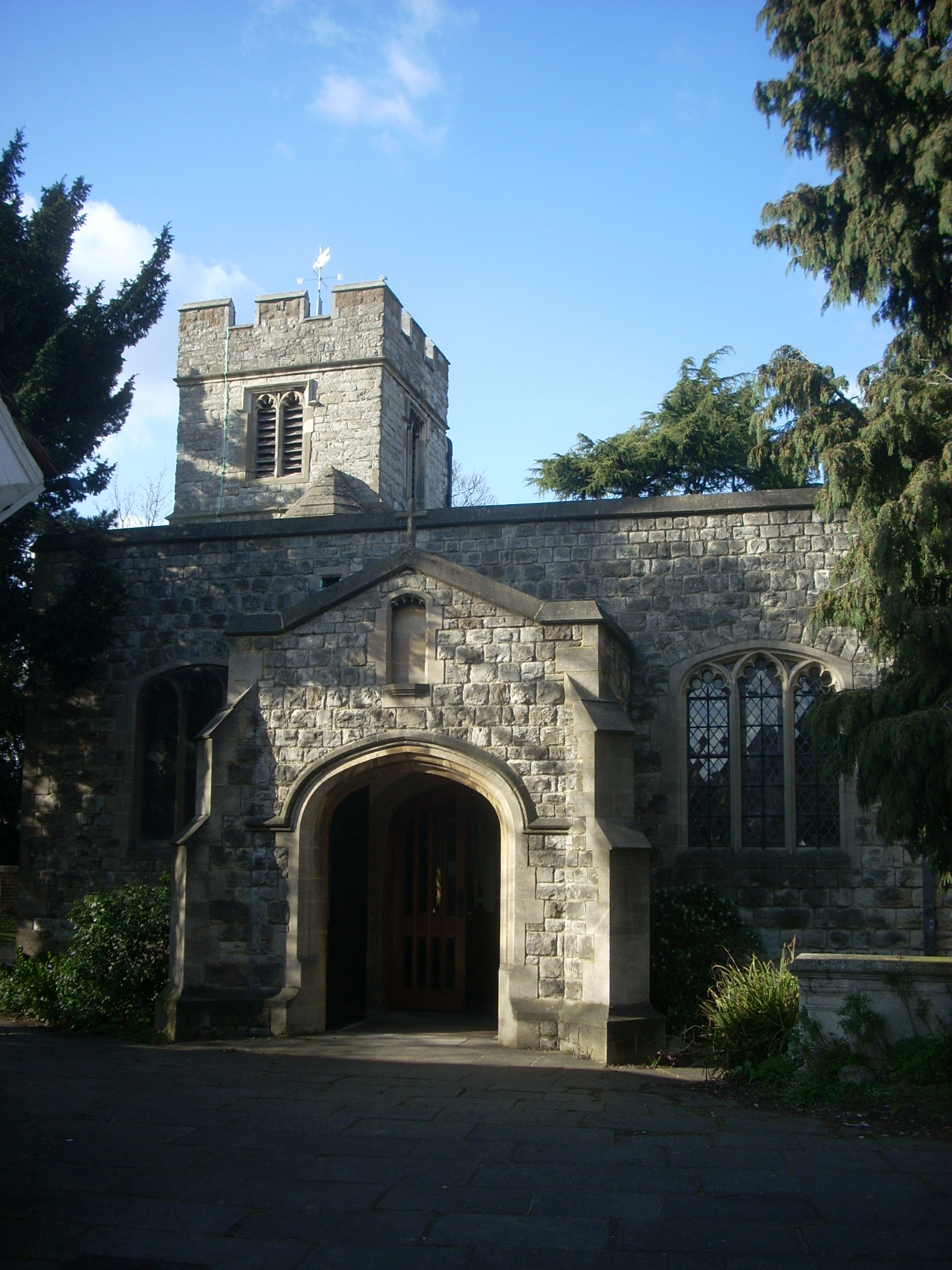
 The entrance to St Mary's church
The main road runs on a north-south axis, and is called Regents Park Road from the North Circular Road until it reaches the station, where the name changes to Ballards Lane. Its heart is the ancient district around St Mary’s Church,[3] where the imposing tower of Pardes House School (formerly Christ’s College Finchley), is a landmark. There is a public library in Hendon Lane. Along Ballards Lane, close to the station, is a retail district with some Victorian and Edwardian shopping parade as well as modern shops including Tesco.
To the southeast, along East End Road are two institutions of note: Avenue House home to the Finchley Society, and a Jewish cultural centre the Sternberg Centre. Avenue House was the home of Henry 'Inky' Stephens, son of Henry Stephens (1796-1864) who founded the Stephens' Ink Company, the first producers of "Blue-Black Writing Fluid" in 1832. A small museum open three afternoons a week commemorates this invention and the Stephens family, along with the history of writing materials including many photographs and artefacts.
'Inky' Stephens, a former local MP, left Avenue House to "the people of Finchley" on his death in 1918. South, along Regents Park Road, is College Farm, the last farm in Finchley, and a statue, referred to locally as “The Naked Lady”, but more properly named La Delivrance. Victoria Park is the home of the Finchley Carnival, a large fun fair held every year in July, dating back to 1905.[4]
Neighbouring areas 
West Finchley North Finchley Friern Barnet Mill Hill 
East Finchley  Church End

Hendon Temple Fortune Hampstead Garden Suburb History
References
- ^ Mills, D. (2000). Oxford Dictionary of London Place Names. Oxford.
- ^ http://committeepapers.barnet.gov.uk/democracy/council/ward.asp?intsectionid=9&wardid=9
- ^ http://www.stmaryatfinchley.org.uk
- ^ http://www.finchleycarnival.co.uk/
Coordinates: 51°36′08″N 0°11′34″W / 51.6021°N 0.1927°W
Categories:- Districts of Barnet
- Districts of London


Wikimedia Foundation. 2010.