- Curbar
-
Coordinates: 53°16′05″N 1°37′26″W / 53.268°N 1.624°W
Curbar 
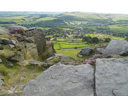
Curbar village viewed from Curbar Edge
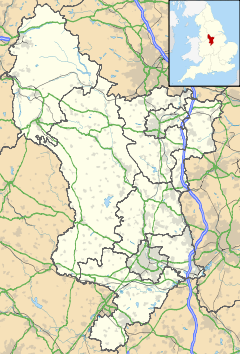
 Curbar shown within Derbyshire
OS grid reference SK251746 District Derbyshire Dales Shire county Derbyshire Region East Midlands Country England Sovereign state United Kingdom Post town HOPE VALLEY Postcode district S32 Police Derbyshire Fire Derbyshire Ambulance East Midlands EU Parliament East Midlands List of places: UK • England • Derbyshire Curbar is a village in the Derbyshire Dales district of Derbyshire, a mile north of Baslow, close to Calver on the A623.
The village has a street (Bar Road) with the highest average house value in Derbyshire. Close to the east are the popular rock-climbing escarpments of Curbar Edge and Baslow Edge. To the west of the village is the River Derwent near The Bridge pub. The parish church is dedicated to All Saints.
External links
Ceremonial county of Derbyshire Unitary authorities Boroughs or districts Major settlements - Alfreton
- Ashbourne
- Bakewell
- Belper
- Bolsover
- Buxton
- Chapel-en-le-Frith
- Chesterfield
- Clay Cross
- Darley Dale
- Derby
- Dronfield
- Eckington
- Glossop
- Hadfield
- Heanor
- Ilkeston
- Killamarsh
- Langley Mill
- Long Eaton
- Matlock
- Melbourne
- New Mills
- Ripley
- Sandiacre
- Shirebrook
- Staveley
- Swadlincote
- Whaley Bridge
- Wirksworth
See also: List of civil parishes in Derbyshire
Rivers Topics Categories:- Villages in Derbyshire
- Towns and villages of the Peak District
Wikimedia Foundation. 2010.

