- River Mease
-
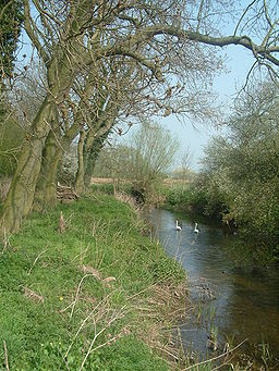
Mease River Country England Regions Leicestershire, Derbyshire, Staffordshire Tributaries - right West Brook Source - elevation 130 m (427 ft) Mouth - location Croxall, Staffordshire, England - coordinates 52°43′0″N 1°43′0″W / 52.716667°N 1.716667°W Length 25 km (16 mi) The River Mease is a lowland clay river in the Midlands area of England. It flows through the counties of Leicestershire, Derbyshire and Staffordshire and forms the administrative border between these counties for parts of its length.
The Mease stems from the coal measures of North West Leicestershire and flows westwards for approximately 16 miles (25 km) across a largely rural and agricultural landscape to its confluence with the rivers Trent and Tame at Croxall in Staffordshire, with its waters eventually reaching the North Sea via the Trent and the Humber Estuary.
The river flows throughout its course across alluvial soils overlying bands of Sherwood Sandstone and Mercia Mudstone. The river is a designated site of special scientific interest due to the fish that it supports.[1]
Of particular interest are the resident populations of spined loach (Cobitis taenia) and bullhead (Cottus gobio), two internationally notable species of native freshwater fish with a restricted distribution in England.
Places along the River Mease
- Clifton Campville
- Croxall
- Edingale
- Harlaston
- Haunton
- Measham
- Netherseal
- Snarestone
- Stretton en le Field
See also
- List of rivers in England
References
Categories:- Rivers of Derbyshire
- Rivers of Staffordshire
- Rivers of Leicestershire
- Sites of Special Scientific Interest in Derbyshire
Wikimedia Foundation. 2010.

