River Drone

River Drone

Infobox River
river_name = River Drone


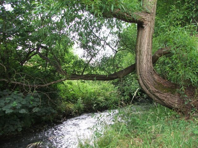
caption =River Drone by Ramshaw Woods, Unstone
origin = Sheffield Border
mouth = River Rother
basin_countries = England
length =
elevation =140 m (Dronfield)
mouth_elevation =
discharge =
watershed =

The River Drone is a river which flows south from its source on the Sheffield, South Yorkshire border. It flows through Dronfield, Unstone and Unstone Green in Derbyshire before merging at Sheepbridge to the north of Chesterfield with the Barlow Brook. It then flows south east till it merges with the River Rother at Brimmington Road North (B6050) at Chesterfield. It is one of the three main tributaries of the Rother.

In the late 1990s the river burst its banks and flooded Dronfield 'bottom' shopping area, and as a result a flood storage reservoir was built at Bowshaw to hold back (attenuate) the storm water runoff from the Batemoor and Jordanthorpe housing estates in the south of Sheffield, which form part of the catchment area. Some work was also done to build up the bank level with bunds or retaining walls in some sections of the valley.

The river used to feed several water wheels at early factories in the Dronfield valley in the 18th and 19th centuries. Part of the mill race is visible off Mill Lane in Dronfield, the remains of the mill being demolished in the 1970s.

This river was highly polluted at times in the past and devoid of any fish life along its full length from Sheffield to its confluence with the Barlow Brook due to mine workings discharging into the river. Also, as with other local rivers, it suffered from sewage discharges from storm overflows. It has been cleaned up in recent years, as the water boards have to meet tighter environmental regulations.Fact|date=September 2008

References

External links

* [http://news.bbc.co.uk/1/hi/in_pictures/6240184.stm BBC news photos of flooding including river Drone]


Wikimedia Foundation. 2010.

Игры ⚽ Поможем написать курсовую

Look at other dictionaries:

  • River Rother, South Yorkshire — Infobox River river name = River Rother caption = the river at Staveley origin = Pilsley mouth = River Don basin countries = England length = elevation = mouth elevation = discharge = watershed = The River Rother is a river in the northern… …   Wikipedia

  • River Noe — Watermill on the River Noe, Brough on Noe. The waterwheel survives (just visible in the dark entrance in this picture), though it is no longer in use. Origin Kinder Scout …   Wikipedia

  • drone — 1. noun /drəʊn/ a) A male bee or wasp, which does not work but can fertilise the queen. he that gathereth not every day as much as I doe, the next day shall be set beyond the river, and be banished from the Fort as a drone, till he amend his… …   Wiktionary

  • Drone Anti-Submarine Helicopter — QH 50 im Museum von Fort Polk Der Drone Anti Submarine Helicopter, (häufig abgekürzt DASH, offizielle Designation QH 50) war eine Drohne zur U Jagd, die im Kalten Krieg für die United States Navy hergestellt wurde. Produzent war die Gyrodyne… …   Deutsch Wikipedia

  • Mississippi River Festival — The Mississippi River Festival (aka MRF) was a summer outdoor concert series held during the years 1969 1980 on the campus of Southern Illinois University in Edwardsville, Illinois. The Festival was notable due to its central midwest location,… …   Wikipedia

  • Dronfield — Coordinates: 53°18′09″N 1°27′59″W / 53.3024°N 1.4664°W / 53.3024; 1.4664 …   Wikipedia

  • List of rivers of England — This is a list of rivers of England, organised geographically and taken anti clockwise, from Land s End. It includes the whole length of those rivers whose estuary lies wholly or partly in England and thus includes a number of tributaries which… …   Wikipedia

  • Geography of Sheffield — Sheffield is the most geographically diverse city in Englandref|GEO. The city nestles in a natural amphitheatre created by a number of hills and the confluence of five rivers: Don, Sheaf, Rivelin, Loxley and Porter. As such, much of the city is… …   Wikipedia

  • Unstone — infobox UK place country = England latitude= 53.28 longitude= 1.44 map type= Derbyshire official name= Unstone population = shire district= North East Derbyshire shire county = Derbyshire region= East Midlands constituency westminster= North East …   Wikipedia

  • Apperknowle — infobox UK place country = England static static image caption=New Road, Apperknowle. latitude= 53.301 longitude= 1.431 official name =Apperknowle population = shire district= shire county= Derbyshire region= East Midlands constituency… …   Wikipedia

Share the article and excerpts

Direct link
Do a right-click on the link above
and select “Copy Link”