- Stanage Edge
-
Stanage Edge 
Elevation 458 m (1,503 ft) Prominence c. 103 m Location Location Derbyshire / South Yorkshire,  England
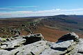
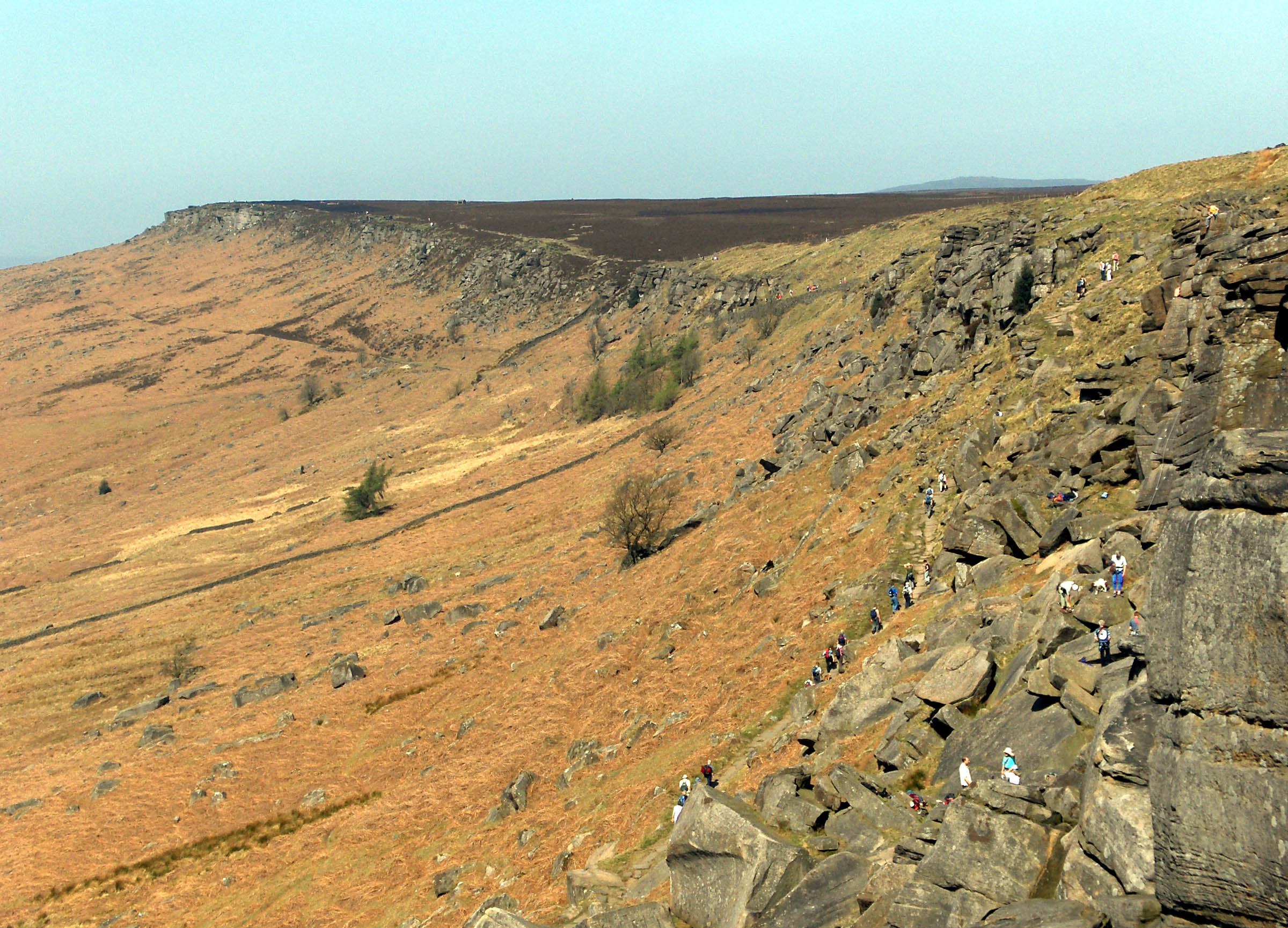
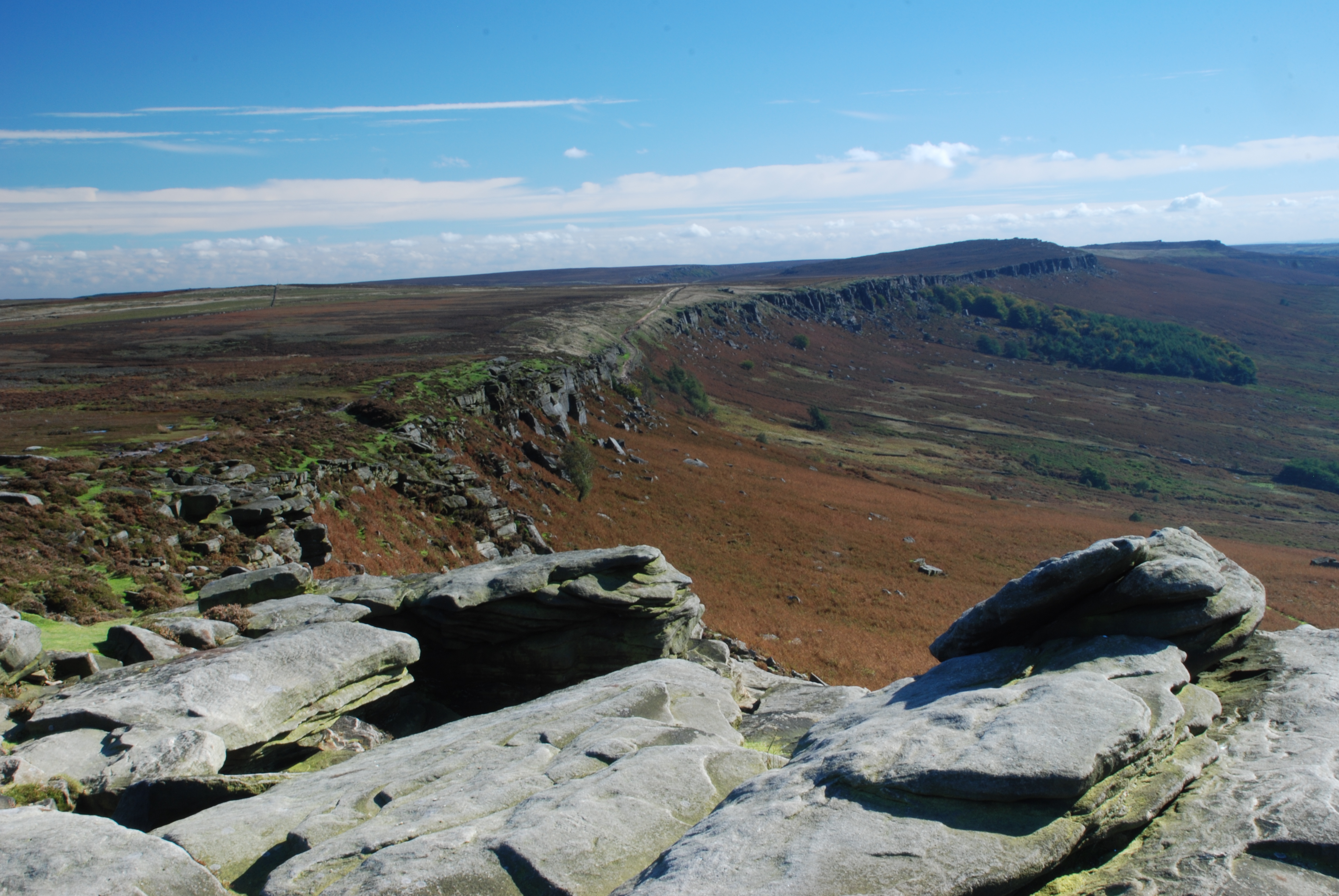
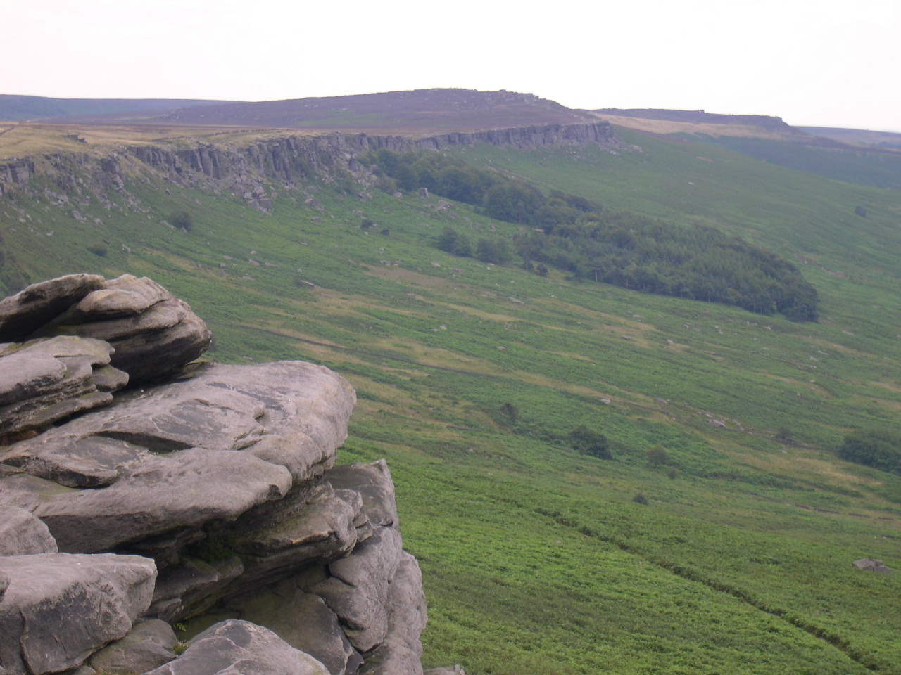
Range Peak District Topo map OS Landranger 110 OS grid SK228853 Stanage Edge, or simply Stanage (from "stone edge") is a gritstone escarpment in the English Peak District, famous as a location for climbing. The northern part of the edge forms the border between the High Peak of Derbyshire and Sheffield in South Yorkshire. Its highest point is High Neb at 458 metres (1,503 ft) above sea level. Areas of Stanage were quarried in the past to produce grindstones, and some can still be seen on the hillside—carved, but never removed.
A paved packhorse road ran along the top of the edge, and remains of it can be seen, as can remains of the Long Causeway Roman road which works its way over the edge on its route from Templeborough to Brough-on-Noe, crossing Hallam Moor and passing Stanedge Pole (note the slightly different spelling), an ancient waymarker on the route to Sheffield. Some cairns along the top are even older, and there is a well-known cave in the cliff known as Robin Hood's Cave. More recent features include early 20th-century drinking basins, designed to collect pure rainwater for grouse to drink.
Stanage is a magnet for climbers and ramblers in addition to runners. The Stanage Struggle is a popular local fell race that starts in nearby Hathersage and rises to High Neb before returning to the village 500 feet below.
Contents
Rock climbing
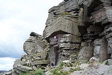
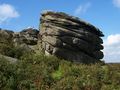
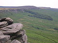
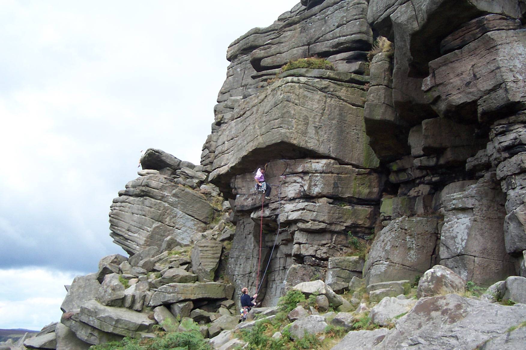
Stanage's naturally weathered Millstone Grit face is now known as a highly popular location for rock climbing in the Peak District. The edge runs four miles north from the Cowper Stone to Stanage End. It is the northernmost of an almost continuous line of cliffs, including Burbage Rocks, Froggatt Edge, Curbar Edge, Baslow Edge and Birchen Edge. The Cowper Stone is a block of gritstone at the most southerly point of Stanage. Set alone a few hundred metres from the last buttress of the main crag, it is a large boulder with distinctive rounded breaks running across it.[1] It is the scene of some classic hard-grit routes of the 1980s first climbed by protagonists such as Johnny Dawes and John Allen.
Although the edge reaches only 30 metres in height it is one of the most famous UK climbing venues: aside from having a plethora of routes close to a major population centre, it is home to the route Right Unconquerable (HVS 5a), which, when first climbed by Joe Brown in 1949, was considered a milestone achievement in British climbing. In spite of its height, the edge is home to the longest recorded rock route in the United Kingdom; the 5000 m Girdle Traverse, completed by Ron Fawcett in 1992 and graded "E5 6b(ish)".[2]
Gallery
-
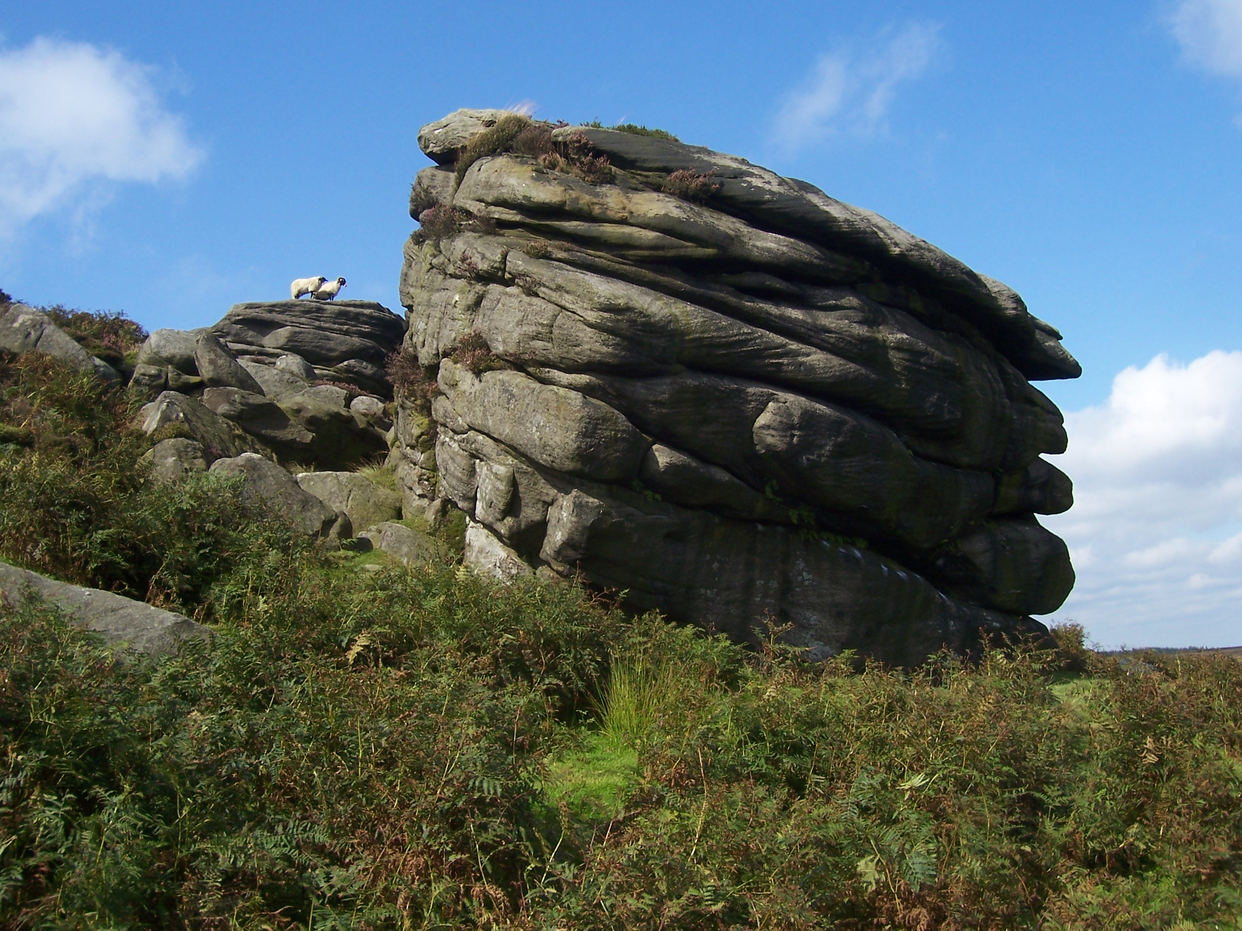
The Cowper Stone
-
-
See also
- Standedge, a moorland escarpment and Pennine crossing point
References
- ^ Rockfax page on the Cowperstone
- ^ Stanage (BMC Guide), David Simmonite et al, (2002) ISBN 0-903908-42-5
External links
 Media related to Stanage Edge at Wikimedia Commons
Coordinates: 53°20′50.25″N 1°37′59.74″W / 53.3472917°N 1.6332611°W
Marilyns 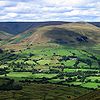
Other peaks Abney Low · Aleck Low · Allman Well Hill · Alport Height · Axe Edge Moor · Back Tor · Beeley Moor · Big Moor · Blake Low · Blakelow Hill · Bleaklow · Bole Hill (Peak District) · Bolehill (Peak District) · Britland Edge Hill · Brittain's Plantation · Brown Knoll · Bunster Hill · Burton Bole End · Calver Peak · Chrome Hill · Crook Hill · Dead Edge End · Derwent Edge · Durham Edge · Eccles Pike · Eldon Hill · Emlin · Eyam Moor - Sir William Hill · Fin Cop · Gautries Hill · Gibraltar Rocks · Grindslow Knoll · Harborough Rocks · Hare Edge Hill · Hartcliff Hill · Haven Hill · Hawks Low · The Height · Heights of Abraham · Higger Tor · High Field · High Low · High Neb · High Wheeldon · Higher Shelf Stones · Houndkirk Hill · Lees Moor · Longstone Moor · Lord's Seat · Lose Hill · Lost Lad · Low Moor · Mam Tor · Margery Hill · Merryton Low · Middleton Moor · Minninglow Hill · Nelson's Monument · Parkhouse Hill · Pike Low · Pikenaze Hill · The Roaches · Rock Hall (Peak District) · Shutlingsloe · Slipper Low · Snailsden Pike End · Snels Low · Stanage Edge · Stanton Moor · Tegg's Nose · Thorpe Cloud · Totley Moor · Ughill Height · Wardlow Hay Cop · West Nab · Wetton Hill · Whaley Moor · Wibben Hill · Win Hill · Wire Stone · Wolfscote HillEastern Grit (north to south) Wharncliffe Crags · Rivelin Rocks · Derwent Edge · Stanage · Bamford Edge · Froggatt Edge · Curbar Edge · Baslow Edge · Gardoms Edge · Birchen Edge · Chatsworth Edge · Black RocksWestern Grit Categories:- Hills and edges of South Yorkshire
- Mountains and hills of Derbyshire
- Mountains and hills of the Peak District
- Mountains and hills of Yorkshire
- Climbing areas of England
- Geography of Sheffield
-
Wikimedia Foundation. 2010.