- Mam Tor
-
This article is about a peak. For the English independent comic book publisher, see Mam Tor Publishing.
Mam Tor 
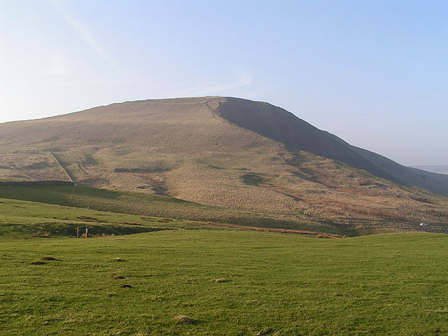
Mam Tor from the south, March 2005Elevation 517 m (1,696 ft) Prominence 62 m (203 ft) Location Location Peak District, England Topo map OS Explorer OL1
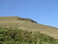
OS Landranger 110OS grid SK127836 Mam Tor is a 517 m (1,696 ft) hill near Castleton in the High Peak of Derbyshire, England. Its name literally translates[vague] as Heights of the Mother[citation needed] and it is also known as the Shivering Mountain on account of the instability of its lower shale layers.[1] Indeed, in 1979 the continual battle to maintain the A625 road (Sheffield to Chapel en le Frith) on the crumbling southern side of the hill was lost when the road officially closed as a through-route.
At the base of the Tor and nearby are four show caves: Blue John Cavern, Speedwell Cavern, Peak Cavern and Treak Cliff Cavern where lead, Blue John, fluor spar and other minerals were once mined.
Contents
Geography
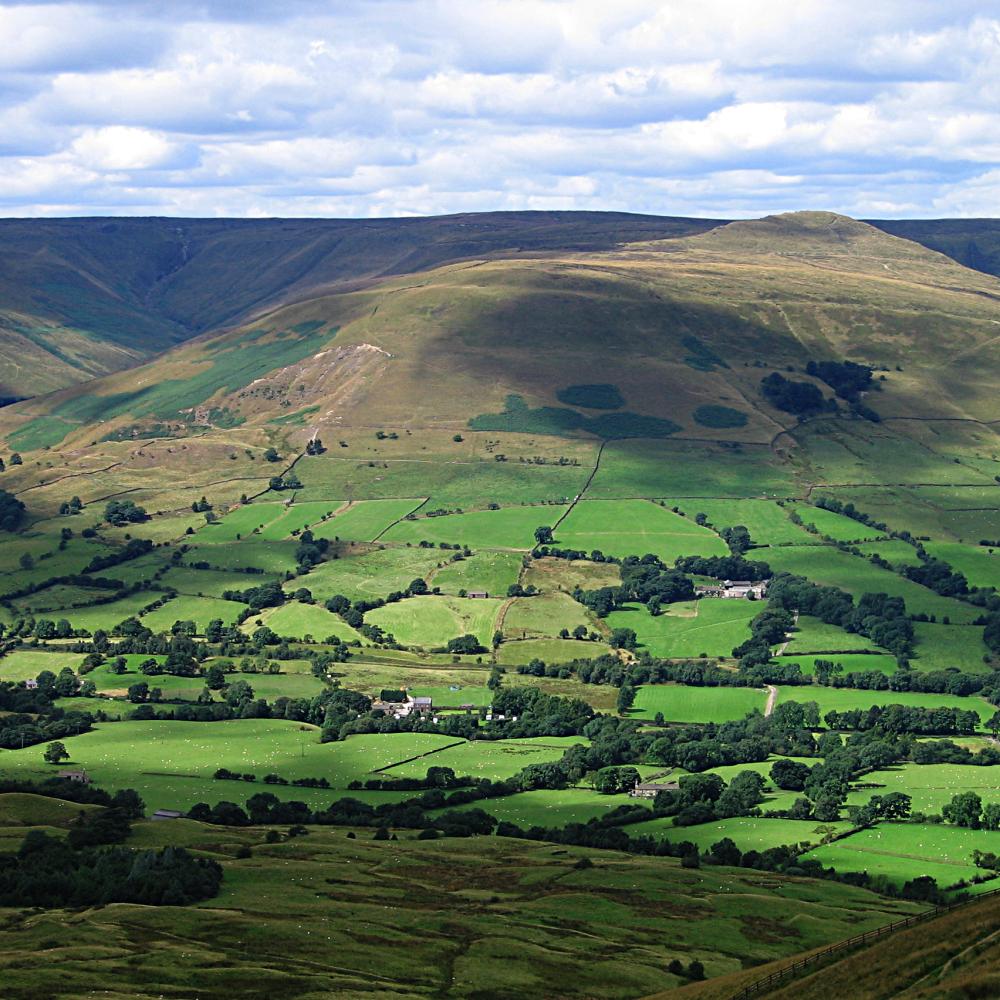
Mam Tor is near the top of Winnats Pass (a steep and narrow limestone gorge), forms the eastern end of Rushup Edge, and dominates the western end of the "Great Ridge", one of the most famous, beautiful, and easy-to-reach ridgewalks in the Peak District and which separates the two arms of the Hope Valley: the valley of the River Noe (Edale) to the north, and the Peakshole Water (Castleton) to the south.
Mam Tor is made of rocks of Carboniferous age, approximately 320 million years old. The base of Mam Tor is composed of black shales of the Bowland Shale Formation of Serpukhovian age overlain by tubiditic sandstone of the Mam Tor Sandstone Formation of Bashkirian age.[2]
In perfect weather conditions, Manchester City Centre, Stockport, and Winter Hill can be seen from here.
Mam Tor landslide
 The landslide scarred scenery of Mam Tor showing the collapsed road
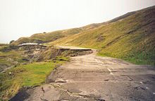 A section of the abandoned road
One of the distinguishing features of Mam Tor Peak is the active debris flow resulting from a rotational landslide that occurred roughly 4,000 years ago. The initial failure exposed bedrock displaying a sequence of shales and sandstones near to the summit. Evidence for the continued movement of the slide mass is demonstrated graphically by the continued severe damage to the old A625 road that traversed this flow. The road was originally built at the beginning of the 1800s and was subsequently relaid until local authorities closed the road in 1979. Layers of tarmac and gravel are up to 2 metres thick in places, demonstrating the numerous efforts to keep the road open.
Current mean annual movement according to a study made in 2000 [3] is:
up to 0.25 m; this increases greatly when winter rainfalls exceed thresholds of both 210 mm/month and 750 mm in the preceding six months
The debris flow poses no threat to any inhabited buildings near the peak; however, small farm buildings lying in the flow's path may become inundated over the next century assuming a flow rate similar to that of the present. The 2000 study suggests that deep drainage may be the most effective means of stabilising the flow, though this may not completely stop movement.
Prehistory
The summit of Mam Tor is encircled by a late Bronze Age and early Iron Age hill fort. Radiocarbon analysis suggests occupation from around 1200 BC. The earliest remaining features are two Bronze Age burial mounds, one just below the summit and the other on the summit itself. At a later stage over a hundred small platforms were levelled into the hill near the summit, allowing inhabited timber huts to be constructed.
See also
- Breast shaped hill
- Edale
- List of hill forts in England
- Pennine Way
References
- ^ Natural Curiosities of Derbyshire, in: The Every-day Book and Table Book; or, Everlasting Calendar of Popular Amusements, Sports, Pastimes, Ceremonies, Manners, Customs, and Events, Each of the Three Hundred and Sixty-Five Days, in Past and Present Times; Forming a Complete History of the Year, Months, and Seasons, and a Perpetual Key to the Almanac, Including Accounts of the Weather, Rules for Health and Conduct, Remarkable and Important Anecdotes, Facts, and Notices, in Chronology, Antiquities, Topography, Biography, Natural History, Art, Science, and General Literature; Derived from the Most Authentic Sources, and Valuable Original Communication, with Poetical Elucidations, for Daily Use and Diversion. Vol III., ed. William Hone, (London: 1838) p 11–16. Retrieved on 24 June 2008.
- ^ Waters, C. N. and Davies S. J. (2006) Carboniferous: extensional basins, advancing deltas and coal swamps - Chapter 9 of Brenchley, P. J. and Rawson P. F. (editors) (2006) The Geology of England and Wales, 2nd edition, London, The Geological Society
- ^ Waltham & Dixon (2000), Movement of the Mam Tor landslide, Derbyshire, UK, The Quarterly Journal of Engineering Geology and Hydrogeology, Volume 33, Number 2, May 2000, pp. 105–123(19)
Gallery
-
View of the village of Castleton from Mam Tor
-
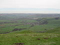
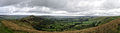
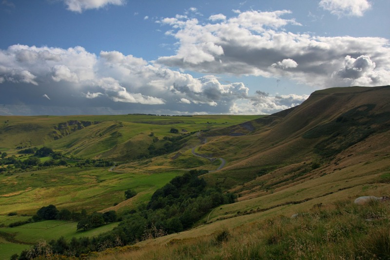
Panoramic view overlooking Hope Valley from a trail heading towards Hollins Cross
-
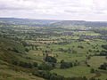
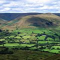
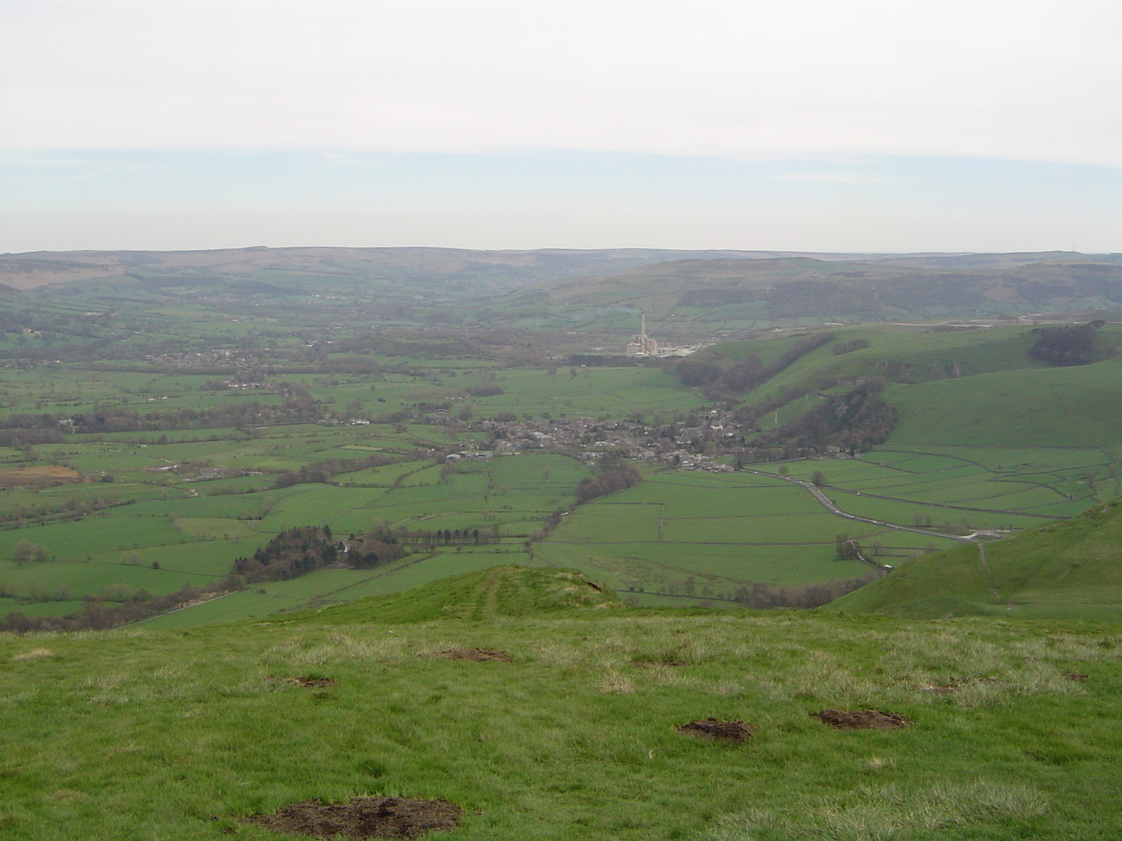
View of the Hope Valley
-
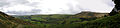
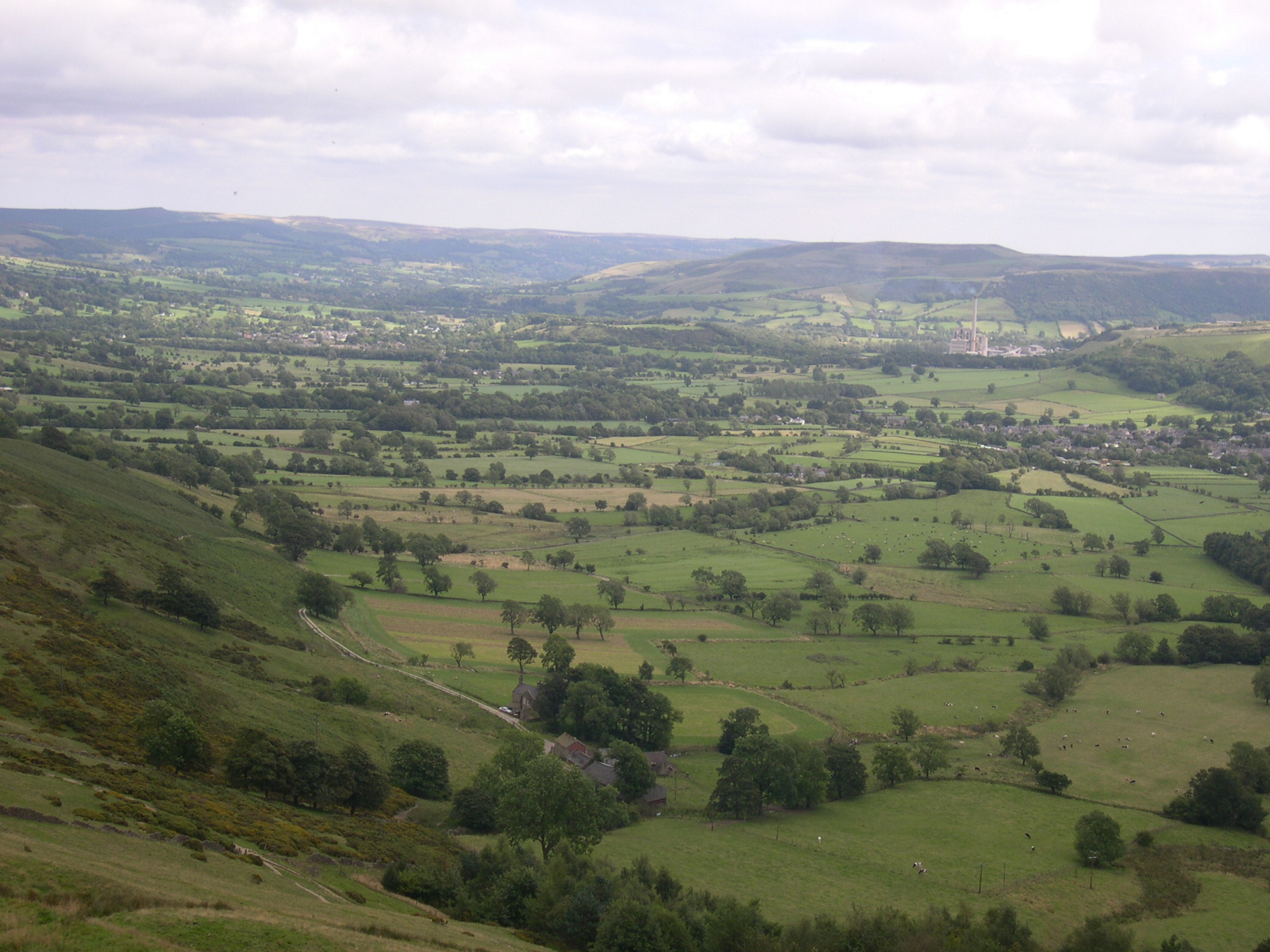
Panoramic view of the Hope Valley and Castleton
-
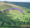
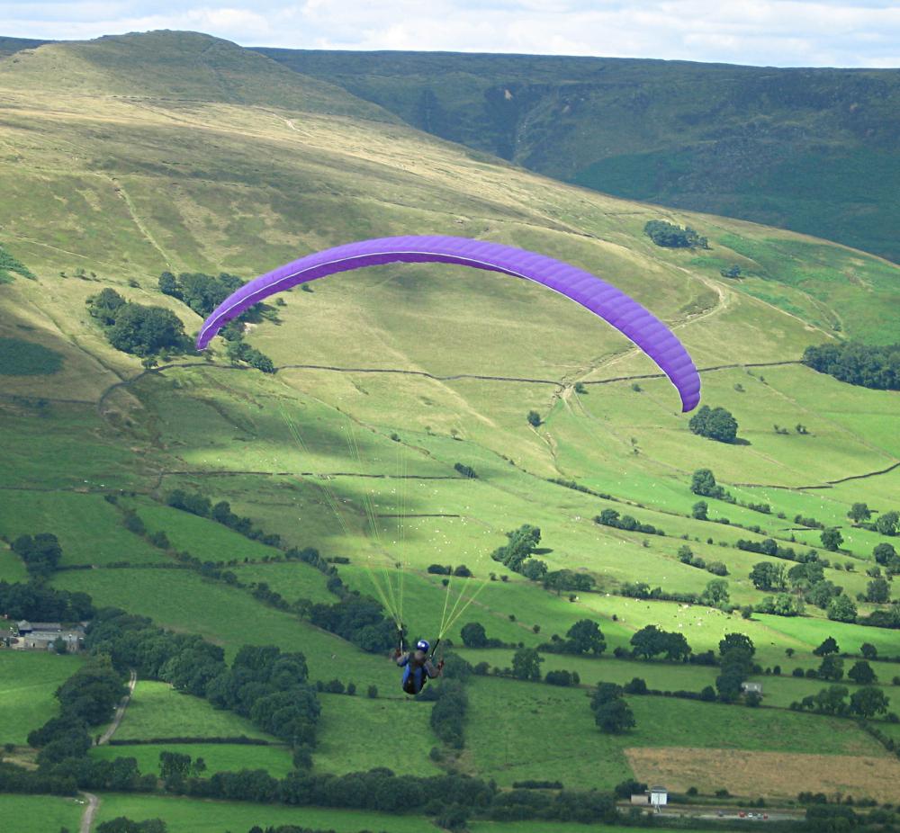
Paragliding from Mam Tor
-
View from Mam Tor looking north towards the Vale of Edale
-
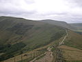
Path leading to Mam Tor from Lose Hill
-
View of the summit from halfway
-
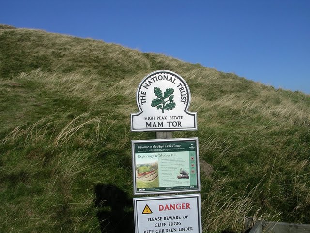
National Trust Sign
Further reading
- Coombs, D. G.; Thompson, F.H. (1979), "Excavation of the hillfort of Mam Tor, Derbyshire", Derbyshire Archaeological Journal 99: 7–51
External links
- Mam Tor Landslide British Geological Survey
Marilyns 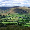
Other peaks Abney Low · Aleck Low · Allman Well Hill · Alport Height · Axe Edge Moor · Back Tor · Beeley Moor · Big Moor · Blake Low · Blakelow Hill · Bleaklow · Bole Hill (Peak District) · Bolehill (Peak District) · Britland Edge Hill · Brittain's Plantation · Brown Knoll · Bunster Hill · Burton Bole End · Calver Peak · Chrome Hill · Crook Hill · Dead Edge End · Derwent Edge · Durham Edge · Eccles Pike · Eldon Hill · Emlin · Eyam Moor - Sir William Hill · Fin Cop · Gautries Hill · Gibraltar Rocks · Grindslow Knoll · Harborough Rocks · Hare Edge Hill · Hartcliff Hill · Haven Hill · Hawks Low · The Height · Heights of Abraham · Higger Tor · High Field · High Low · High Neb · High Wheeldon · Higher Shelf Stones · Houndkirk Hill · Lees Moor · Longstone Moor · Lord's Seat · Lose Hill · Lost Lad · Low Moor · Mam Tor · Margery Hill · Merryton Low · Middleton Moor · Minninglow Hill · Nelson's Monument · Parkhouse Hill · Pike Low · Pikenaze Hill · The Roaches · Rock Hall (Peak District) · Shutlingsloe · Slipper Low · Snailsden Pike End · Snels Low · Stanage Edge · Stanton Moor · Tegg's Nose · Thorpe Cloud · Totley Moor · Ughill Height · Wardlow Hay Cop · West Nab · Wetton Hill · Whaley Moor · Wibben Hill · Win Hill · Wire Stone · Wolfscote HillList of peaks of the Peak District Categories:- Bronze Age sites in England
- Hill forts in Derbyshire
- Mountains and hills of Derbyshire
- Mountains and hills of the Peak District
- Archaeological sites in Derbyshire
- Anthropomorphic geographic features


Wikimedia Foundation. 2010.