- Crook Hill
-
Crook Hill 
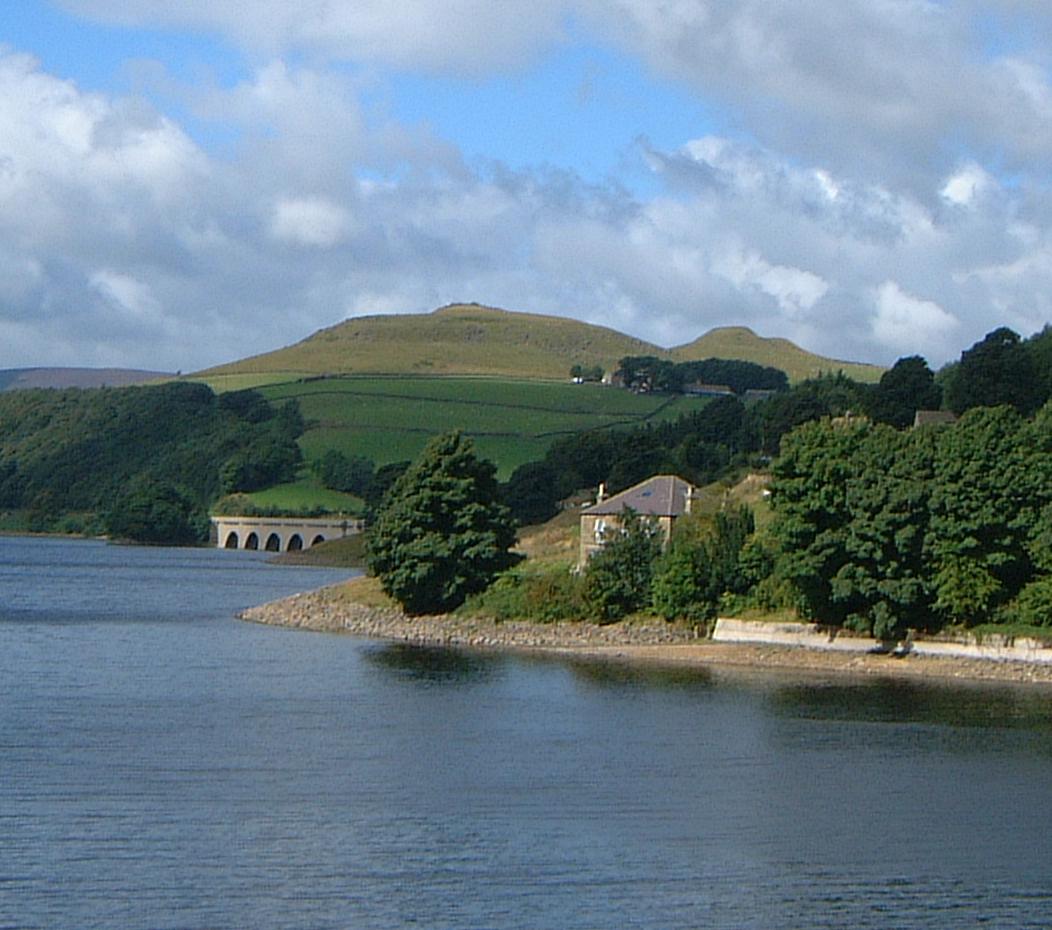
The twin summits of Crook Hill above Ladybower ReservoirElevation 382 m (1,253 ft) Prominence c. 84 m Location Location Peak District, England Range Pennines Coordinates 53°22′42″N 1°43′33″W / 53.3782°N 1.7258°WCoordinates: 53°22′42″N 1°43′33″W / 53.3782°N 1.7258°W Topo map OS Landranger 110 OS grid SK182871 
Crook Hill is a small hill in the Peak District National Park in the English county of Derbyshire. It is located five kilometres north east of Castleton.
Overview
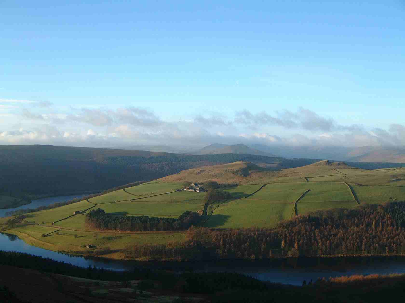
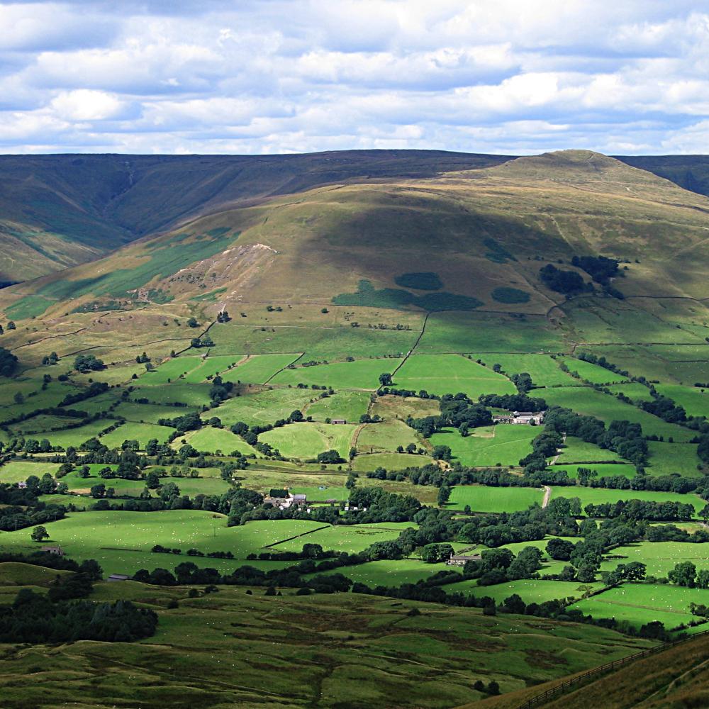
The hill is situated above the A57 Snake Pass road between Sheffield and Manchester as it passes Ladybower Reservoir. Crook Hill is regarded as an outlier of Kinder Scout although the two are separated by the long western arm of Ladybower Reservoir. The hill has twin summits, the highest of which reaches a modest height of 382 metres while the secondary top (sometimes referred to as Ladycrook Hill, although this name does not appear on Ordnance Survey maps)[citation needed] attains an altitude of 374 metres. Geologically, the hill consists of Kinder Scout Grit which is a kind of Sandstone.[1] Both the hill’s summits give excellent views of the surrounding countryside with Ladybower Reservoir, Derwent Edge and Win Hill being the main attractions. Between the two summits there is some evidence of an ancient megalithic standing stone circle. The circle originally consisted of five stones around a surviving mound of which only two still remain upright.[2]
Ascents
Crook Hill is normally climbed from the Derwent valley road just as it leaves the A57: a bridleway leaves the small car park at grid reference SK190871 and climbs steeply and muddily up to Crookhill Farm, a working sheep farm owned by the National Trust which also offers accommodation to tourists. Once the farm is passed, a stile is climbed onto the open sheep pasture and it is then a straight-forward walk to the two twin summits which are actually on private land although there are no access problems.
References
- "Geology Explained in the Peak District", F. Wolverson Cope, Scarthin Books, ISBN 0-907758-98-3
Footnotes
- ^ "Geology Explained in the Peak District" Pages 167 (Gives info on Geology).
- ^ www.themodernantiquarian.com. Gives details of stone circle.
Marilyns 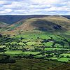
Other peaks Abney Low · Aleck Low · Allman Well Hill · Alport Height · Axe Edge Moor · Back Tor · Beeley Moor · Big Moor · Blake Low · Blakelow Hill · Bleaklow · Bole Hill (Peak District) · Bolehill (Peak District) · Britland Edge Hill · Brittain's Plantation · Brown Knoll · Bunster Hill · Burton Bole End · Calver Peak · Chrome Hill · Crook Hill · Dead Edge End · Derwent Edge · Durham Edge · Eccles Pike · Eldon Hill · Emlin · Eyam Moor - Sir William Hill · Fin Cop · Gautries Hill · Gibraltar Rocks · Grindslow Knoll · Harborough Rocks · Hare Edge Hill · Hartcliff Hill · Haven Hill · Hawks Low · The Height · Heights of Abraham · Higger Tor · High Field · High Low · High Neb · High Wheeldon · Higher Shelf Stones · Houndkirk Hill · Lees Moor · Longstone Moor · Lord's Seat · Lose Hill · Lost Lad · Low Moor · Mam Tor · Margery Hill · Merryton Low · Middleton Moor · Minninglow Hill · Nelson's Monument · Parkhouse Hill · Pike Low · Pikenaze Hill · The Roaches · Rock Hall (Peak District) · Shutlingsloe · Slipper Low · Snailsden Pike End · Snels Low · Stanage Edge · Stanton Moor · Tegg's Nose · Thorpe Cloud · Totley Moor · Ughill Height · Wardlow Hay Cop · West Nab · Wetton Hill · Whaley Moor · Wibben Hill · Win Hill · Wire Stone · Wolfscote HillList of peaks of the Peak District Categories:- Mountains and hills of the Peak District
- Mountains and hills of Derbyshire
Wikimedia Foundation. 2010.