- Manas National Park
-
Manas Wildlife Sanctuary IUCN Category II (National Park)
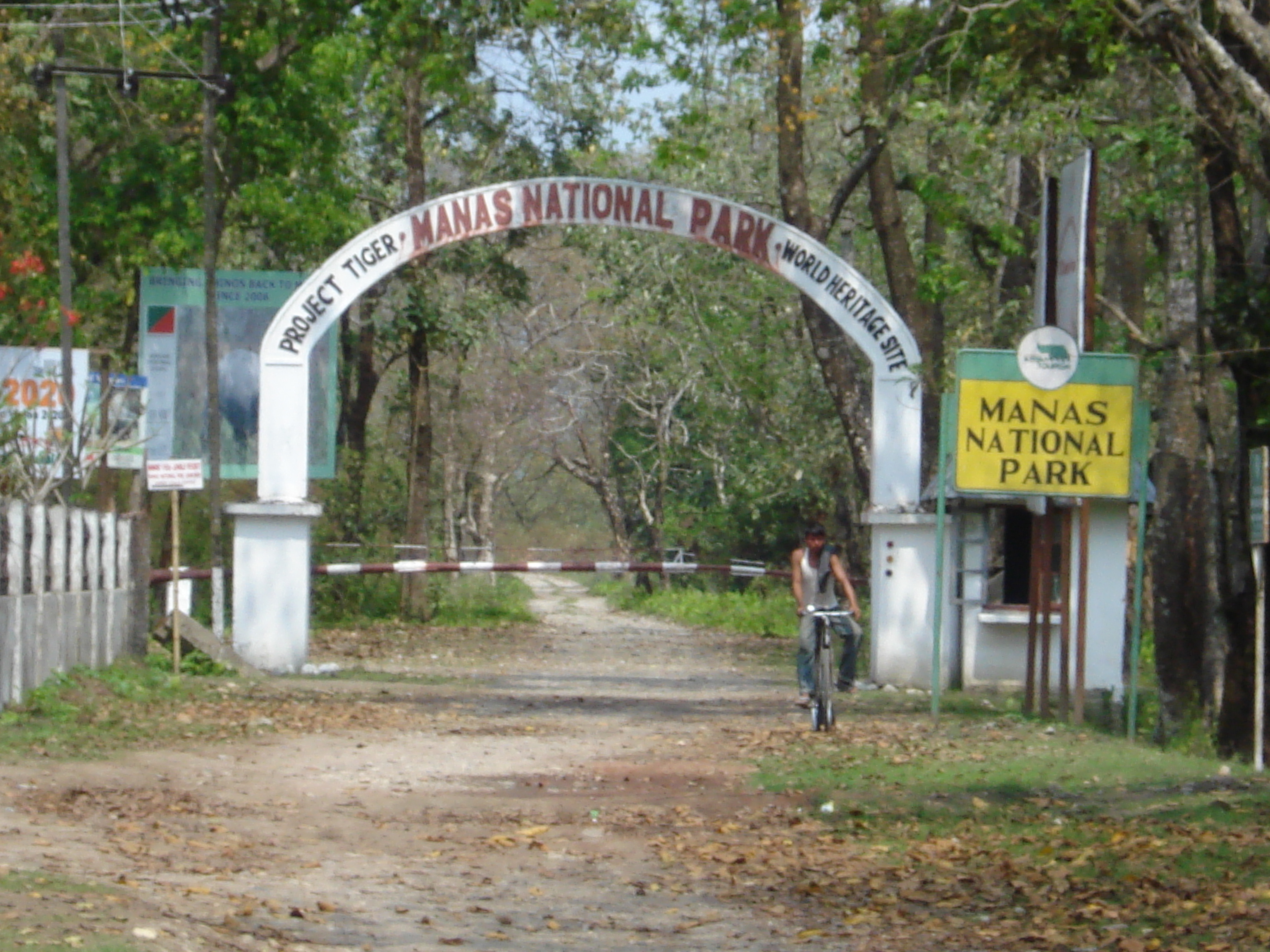
Main entrance of Manas National Park
 Manas WS
Location Assam, India Nearest city Barpeta Road Coordinates 26°30′0″N 91°51′0″E / 26.5°N 91.85°ECoordinates: 26°30′0″N 91°51′0″E / 26.5°N 91.85°E Area 950 km². Established 1990 Visitors NA (in NA) Governing body Ministry of Environment and Forests, Government of India Website http://www.manasassam.org Type: Natural Criteria: vii, ix, x Designated: 1985 (9th session) Reference #: 338 State Party:  India
IndiaRegion: Asia-Pacific Manas National Park or Manas Wildlife Sanctuary is a Wildlife Sanctuary, UNESCO Natural World Heritage site, a Project Tiger Reserve, an Elephant Reserve and a Biosphere Reserve in Assam, India. Located in the Himalayan foothills, it is contiguous with the Royal Manas National park[1] in Bhutan. The park is known for its rare and endangered endemic wildlife such as the Assam Roofed Turtle, Hispid Hare, Golden Langur and Pygmy Hog.Manas is famous for its population of the Wild water buffalo.[2]
Contents
Origin of the name
The name of the park is originated from the Manas River, which is named after the serpent goddess Manasa. The Manas river is a major tributary of Brahmaputra River, which passes through the heart of the national park.
History of the Park
The Manas National Park was declared a sanctuary on October 1, 1928 with an area of 360 km². Manas Tiger reserve was created in 1973. Prior to the declaration of the sanctuary it was a Reserved Forest called Manas R.F. and North Kamrup R.F. It was used by the Cooch Behar royal family and Raja of Gauripur as a hunting reserve. In 1951 and 1955 the area was increased to 391 km². It was declared a World Heritage site in December 1985 by UNESCO. Kahitama R.F. the Kokilabari R.F. and the Panbari R.F. were added in the year 1990 to form the Manas National Park. In 1992, UNESCO declared it as a world heritage site in danger due to heavy poaching and terrorist activities. In 25 February 2008 the area was increased to 950 km². On 21st June 2011, it was removed from the List of World Heritage in Danger and was commended for its efforts in preservation.[3]
Human History
There is only one forest village, Agrang, in the core of the National Park. Apart from this village 56 more villages surround the park. Many more fringe villages are directly or indirectly dependent on the park.
Geography of the Park
Political Geography: The park area falls in five districts: Kokrajhar, Chirang, Baksa, Udalguri, and Darrang in the state of Assam in India.
The park is divided into three ranges. The western range is based at Panbari, the central at Bansbari near Barpeta Road, and the eastern at Bhuiyapara near Pathsala. The ranges are not well connected; while two major rivers need to be forded in going from the centre to the Panbari, there is a rough trail (the daimAri road) connecting the central to the eastern range. Most visitors come to Bansbari and then spend some time inside the forest at Mathanguri on the Manas river at the Bhutan border.
Physical Geography: Manas is located in the Eastern Himalaya foothills. The park is densely forested. The Manas river is the main river, a major tributary of Brahmaputra river. The Manas River flows through the west of the park, further it splits into two separate rivers, the Beki and Bholkaduba. Manas and five other small rivers flow through the National Park which lies on a wide low-lying alluvial terrace below the foothills of the outer Himalaya. The river also acts an international border dividing India and Bhutan. The bedrock of the savanna area in the north of the park is made up of Limestone and sandstone, whereas the grasslands in the south of the park is made up of deep deposits of fine alluvium. The combination of Sub-Himalayan Bhabar Terai formation along with riverine succession continuing up to Sub-Himalayan mountain forest making it one of the richest biodiversity areas in the world. The park is 950 km². in area and situated at a height of 61m to 110m above mean sea level.
Climate: The minimum temperature is around 15 degree C and maximum temperature is around 37 degree C.
Heavy rainfall occurs between May and September and the annual average rainfall is around 333 cm.
Natural History of the Park
Biomes
There are two major biomes present in Manas:
- The grassland biomes : pygmy hog, Indian rhinoceros (re-introduced in 2007 after extinction due to heavy poaching during the Bodo uprising), bengal florican, wild Asian buffalo, etc.
- The forest biomes : slow loris, capped langur, wild pig, sambar, great hornbill, Malayan giant squirrel or black giant squirrel, etc.
Flora
Vegetation: The Burma Monsoon Forests of Manas lie on the borders between the Indo-Gangetic and Indo-Malayan biogeographical realms and is part of the Brahmaputra Valley Biogeographic Province. The combination of Sub-Himalayan Bhabar Terai formation with riverine succession leading up to Sub-Himalayan mountain forest makes it one of the richest biodiversity areas in the world.
The main vegetation types are:
- Sub-Himalayan Light Alluvial Semi-Evergreen forests in the northern parts.
- East Himalayan mixed Moist and Dry Deciduous forests (the most common type).
- Low Alluvial Savanna Woodland, and
- Assam Valley Semi-Evergreen Alluvial Grasslands which cover almost 50% of the Park.
Much of the riverine dry deciduous forest is at an early successional stage. It is replaced by moist deciduous forest away from water courses, which is succeeded by semi-evergreen climax forest in the northern part of the park. A total of 543 plants species have been recorded from the core zone. Of these, 374 species are dicotyledons (including 89 trees), 139 species monocotyledons and 30 are Pteridophytes and Gymnosperms.
The Park's common trees include Aphanamixis polystachya, Anthocephalus chinensis, Syzygium cumini, S. formosum, S. oblatum, Bauhinia purpurea, Mallotus philippensis, Cinnamomum tamala, Actinodaphne obvata, Bombax ceiba, Sterculia villosa, Dillenia indica, D. pentagyna, Careya arborea, Lagerstroemia parviflora, L.speciosa, Terminalia bellirica, T. chebula, Trewia polycarpa, Gmelina arborea, Oroxylum indicum and Bridelia spp. The Grasslands are dominated by Imperata cylindrica, Saccharum naranga, Phragmites karka, Arundo donax, Dillenia pentagyna, Phyllanthus emblica, Bombax ceiba, and species of Clerodendrum, Leea, Grewia, Premna and Mussaenda
Fauna
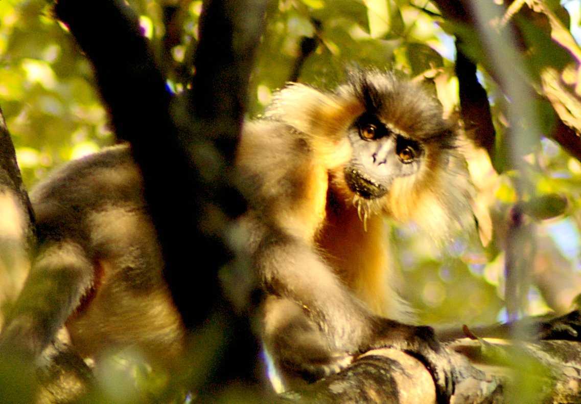
 A Capped langur in Manas
The sanctuary has recorded 55 species of mammals, 380 species of birds, 50 of reptiles, and 3 species of amphibians. Out of these wildlife, 21 mammals are India’s Schedule I mammals and 31 of them are threatened.
The fauna of the sanctuary include Asian Elephants, Indian Rhinoceros, Gaurs, Asian Water Buffaloes, Barasingha, Tigers, Leopards, Clouded Leopards, Asian golden cat, Capped Langurs, Golden Langurs, Assamese Macaques, Slow Loris, Hoolock Gibbons, Smooth-coated Otters, Sloth Bears, Barking Deer, Hog Deer, Sambar Deer and Chital.
The park is well known for its rare and endangered wildlife which is not found anywhere else in the world like the Assam Roofed Turtle, Hispid Hare, Golden Langur and Pygmy Hog.
Manas houses more than 450 species of birds.[4]Manas have the largest population of endangered Bengal Florican. The major other birds includes Giant Hornbills, Jungle Fowls, Bulbuls, Brahminy Ducks, Kalij Pheasants, Egrets, Pelicans, Fishing Eagles, Serpent Eagles, Falcons, Scarlet Minivets, Bee-Eaters, Magpie Robins, Pied Hornbills, Grey Hornbills, Mergansers, Harriers, Ospreys and Herons.
Park-specific information
Activities
The best way to watch wildlife at the park is to use powerful binoculars, with night vision facilities at night. A popular way to explore a majority of the Manas National Park in Assam is in a 4-wheel (Jeep) drive petrol vehicle. Much more terrain becomes available if on an elephant ride, but these are usually restricted to a few kilometers near the gate. A raft ride on Manas river from Mathanguri ending 25 km downstream at Bansbari is also a popular option. These take you deep in to the densest areas of the forest and often right in between some of the wildlife there, including elephants, rhinos and wild buffaloes. The park is open from November to April, and is closed in the remaining period owing to the monsoon.
Lodging
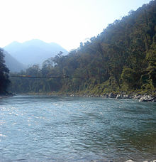 A suspension bridge across the Manas River in reserved area of the Park
Inside the park, one may stay at Mothanguri the forest department bungalow, or at a small facility run by the NGO Manas Ever Welfare Society (MEWS).[5] Or one may stay at the park entrance in Bansbari, where there are two tourist lodges and also some cottages run by MEWS.
Alternately, one may stay at Kokilabari in the Eastern range (traveling in from Pathsala), where a facility is run by the NGO MMES (Manas Maozigendri Ecotourism Society).[6] Both the MMES and MEWS are constituted with volunteers from the fringe villages. MMES is the older group, and many of its workers were erstwhile members of the Bodo liberation struggle. The MMES camp has 4 ethnic cottages in a som plantation meant for rearing of famous muga silk of assam at the park boundary.
Approach
- Nearest airport: Gopinath Bordoloi International Airport, Borjhar, Guwahati
- Nearest railhead: Barpeta Road
- Nearest Highway: NH 31 (22 km away)
- Nearest town: The town of Barpeta Road is next to the park boundary and entrance. The district head-quarter Barpeta is about 44 km away from the entrance.
- Nearest city: The city of Guwahati is 176 km away from the park.
References
- ^ http://www.panda.org/who_we_are/wwf_offices/bhutan/projects/index.cfm?uProjectID=BT0010
- ^ Choudhury, A.U.(2010)The vanishing herds : the wild water buffalo. Gibbon Books, Rhino Foundation, CEPF & COA, Taiwan, Guwahati, India
- ^ Amelan, Roni. "Successful preservation of India's Manas Wildlife Sanctuary enables withdrawal from the List of World Heritage in Danger". http://whc.unesco.org/en/news/762. Retrieved 21 June 2011.
- ^ Choudhury, A.U. (2006) Birds of Manas National Park. Gibbon Books & The Rhino Foundation for Nature in North East India, Guwahati, India. 84pp
- ^ http://sites.google.com/site/manasmews/
- ^ Website:www.manas100.com, www.helptourism.com
External links
- Manas Tiger Reserve of Assam
- Wildlife Times: A trip to Kaziranga and Manas National Park
- Manas Maozigendri Ecotourism Society - Protectors of Manas
- Manas National Park travel guide from Wikitravel
- Official Website of Manas National Park
 • Part of the series on National Parks of India •
Andaman &
Nicobar IslandsAndhra Pradesh Arunachal Pradesh Assam Bihar Valmiki• Kanwar Taal Bird Sanctuary • Vikramshila Dolphin SanctuaryChhattisgarh Goa Gujarat Haryana Himachal Pradesh Jammu & Kashmir Jharkhand Karnataka Kerala Madhya Pradesh Maharashtra Manipur Meghalaya Mizoram Nagaland Orissa Rajasthan Sikkim Tamil Nadu Uttar Pradesh Uttarakhand West Bengal National Parks • Protected areas of India • Ministry of Environment and Forests (India) Tiger Reserves of India Assam Kaziranga Tiger Reserve · Manas Tiger Reserve · Nameri Tiger ReserveArunachal Pradesh Namdapha Tiger Reserve · Pakhui Tiger ReserveAndhra Pradesh Bihar Valmiki Tiger ReserveChhattisgarh Jharkhand Palamau Tiger ReserveKarnataka Bandipur Tiger Reserve · Nagarhole (extension) Tiger Reserve · Bhadra Tiger Reserve · Dandeli-AnashiTiger Reserve ·
Bannerghatta tiger and lion reserve · Biligiri Rangaswamy Temple Wildlife Sanctuary · Kudremukh Tiger ReserveKerala Periyar Tiger Reserve · Parambikulam Tiger ReserveMadhya Pradesh Bandhavgarh Tiger Reserve · Bori-Satpura Tiger Reserve · Kanha Tiger Reserve · Panna Tiger Reserve · Pench Tiger Reserve · Ratapani Tiger Reserve · Sanjay Dubri Tiger ReserveMaharashtra Melghat Tiger Reserve · Pench Tiger Reserve · Tadoba-Andhari Tiger Reserve · Shahayadri Tiger reserve · Nagzira-Navegaon Tiger Reserve · Bhor Tiger ReserveMizoram Orissa Rajasthan Tamil Nadu Kalakkad Mundanthurai Tiger Reserve · Anamalai Tiger Reserve · Mudumalai Tiger Reserve · Sathyamangalam Tiger ReserveUttar Pradesh Uttarakhand Corbett Tiger ReserveWest Bengal Buxa Tiger Reserve · Sunderbans Tiger ReserveCategories:- IUCN Category II
- Tiger reserves of India
- National parks of Assam
- Tourism in Assam
- World Heritage Sites in India
- World Heritage in Danger
- Protected areas established in 1928


Wikimedia Foundation. 2010.