- Majuro
-
Majuro 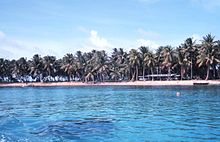
Lagoon shoreline on Majuro, February 1973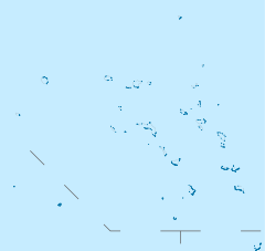
 Majuro (Marshall islands)
Geography Location Pacific Ocean Coordinates 7°4′N 171°16′E / 7.067°N 171.267°E Archipelago Marshall Islands Area 3.75 sq mi (9.71 km2) Highest elevation 10 ft (3 m) Highest point Laura Country  Marshall Islands
Demographics Population 25,400 (as of 2004) Density 2,618.56 /km2 (6,782.04 /sq mi) Ethnic groups Marshallese Majuro (
 /ˈmædʒəroʊ/) (Marshallese: Mājro, /mʲatʲrˠɘɦˠʷ/ or [mæʑɛ͡ʌr̴ɤ͡oo̯]),[1] is a large coral atoll of 64 islands in the Pacific Ocean, and forms a legislative district of the Ratak Chain of the Marshall Islands. The atoll itself has a land area of 9.7 square kilometres (3.7 sq mi) and encloses a lagoon of 295 square kilometres (114 sq mi). As with other atolls in the Marshall Islands, Majuro consists of narrow land masses.
The main population center, also named Majuro, population 25,400 (as of 2004[update]), is the capital and largest city of the Republic of the Marshall Islands. Majuro has a port, shopping district, hotels, and an international airport.
Contents
Demographics
The major population centers are the D–U–D communities: the islets of Delap–Uliga–Djarrit (listed from south to north, on the eastern edge of the atoll).
Geography
At the western end of the atoll, about 30 miles (48 km) from D–U–D by road, is the island community of Laura, a growing residential area with a popular beach. Laura has the highest elevation point on the atoll, estimated at less than 10 feet above sea level.
Laura has the best soil for planting and has several farms.
History
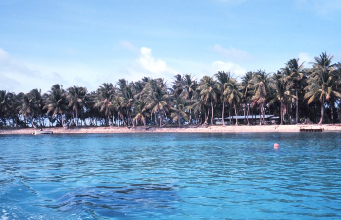
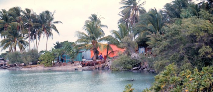
 Lagoon side with native dwellings
Humans have inhabited the atoll for at least 2,000 years.[2]
Majuro Atoll was claimed by the Empire of Germany along with the rest of the Marshall Islands in 1884, and the Germans established a trading outpost. As with the rest of the Marshalls, Maruro was captured by the Imperial Japanese Navy in 1914 during World War I and mandated to the Empire of Japan by the League of Nations in 1920. The Japanese administration of the island came under the South Pacific Mandate, but mostly left local affairs in hands of traditional local leaders until the start of World War II.
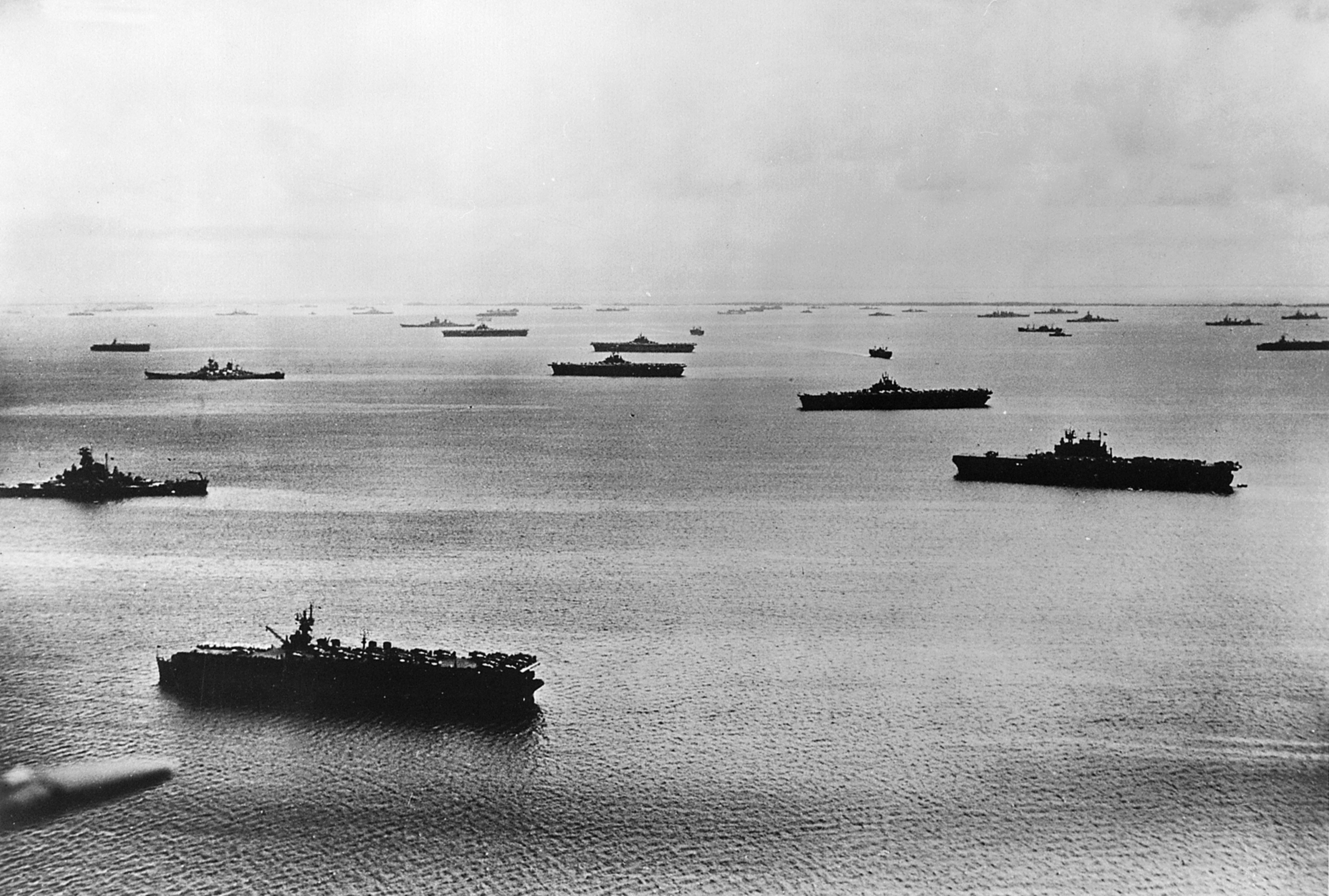
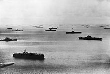 U.S. Fifth Fleet at Majuro Atoll 1944.
On January 30, 1944, United States troops invaded, but found that Japanese forces had previously evacuated their fortifications to Kwajalein and Enewetak about a year earlier. A single Japanese warrant officer had been left on the island as a care taker. With his capture, the islands were secured. This gave the U.S. Navy use of one of the largest anchorages in the Central Pacific. The lagoon became a large forward naval base of operations, and was the largest and most active port in the world until the war moved westward and it was supplanted by Ulithi.[3]
Following the end of World War II, Majuro came under the control of the United States as part of the Trust Territory of the Pacific Islands. It supplanted Jaluit Atoll as the administrative center of the Marshall Islands, a status that it retains after the independence of the Marshall Islands in 1986.
Economy
Uliga is the main business district, and banking and tourism are increasingly important.[citation needed]
The government offices are located in Delap. Located at the eastern point of Majuro Atoll is the capitol building for the Marshall Islands. Delap also has several large stores.
Copra (coconut oil) is one of the main exports of the Marshall Islands, and Majuro receives copra shipments from most of the smaller populated atolls surrounding the area. Sport fishing is popular, and scuba divers are attracted to the area. Majuro serves as a transportation hub for the Marshall Islands, both for air service and shipping.
On September 15, 2007, Witon Barry, of the Tobolar Copra processing plant in the Marshall Islands' capital of Majuro, said power authorities, private companies and entrepreneurs had been experimenting with coconut oil as an alternative to diesel fuel for vehicles, power generators and ships. Coconut trees abound in the Pacific's tropical islands. Copra from 6 to 10 coconuts makes 1 litre oil.[4]
Air Marshall Islands has its headquarters in Majuro.[5]
Education
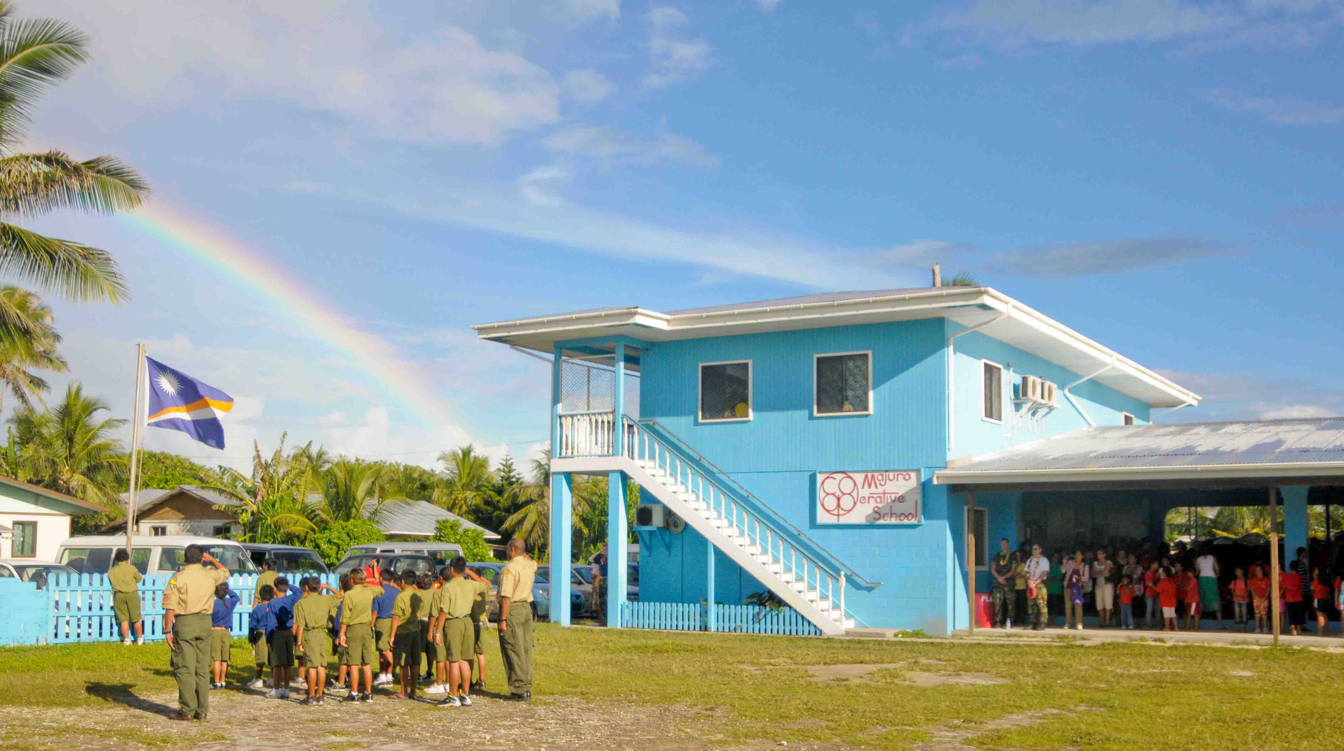
 Students at the Majuro Cooperative School raise the Republic of Marshall Islands flag at a flag raising ceremony during a Pacific Partnership 2009 community service project
Uliga is home to the College of the Marshall Islands, Assumption High School, and Uliga Elementary School where English is taught to all students.[citation needed]
Djarrit is mostly residential. It has the largest public primary and a secondary schools in the country,[citation needed] including Marshall Islands High School located near the north end of Majuro.
Transportation
Air
Marshall Islands International Airport, offering domestic and international service, is located on Majuro Atoll. It is served by two passenger airlines: Continental Airlines and Air Marshall Islands.
Boat
Majuro Lagoon is an active port that is visited by ships and boats used for various activities. The Marshall Islands Shipping Corporation operates three ships (Aeaman, Langdrik, Ribuukae) and a landing craft (Jelejeletae). These boats are the main link for transporting people and supplies to and from the outer islands.
Additionally, the lagoon acts as a harbor for commercial fishing vessels, cruisers, sport fishing boats, outrigger sailing canoes and the occasional luxury yacht.
Roads
Most of the roadway from Delap to Laura is a single two-lane paved road.[citation needed]
Sport
Majuro was initially scheduled to host the seventh edition of the Micronesian Games, in 2010. It subsequently renounced its hosting rights, citing a lack of adequate infrastructure.[6][7]
Sister cities
City Region Country Year Guam  Guam
Guam United States
1973 Kawai  Nara
Nara Japan
JapanTapei  Taipei–Keelung metropolitan area Taiwan
1999 References
- ^ Marshallese-English Dictionary - Place Name Index
- ^ p. 333 archive.org
- ^ Battle of Kwajalein and Enewetak
- ^ "Pacific Islands look to coconut power to fuel future growth". afp.google.com. http://afp.google.com/article/ALeqM5iwlwgv6YIwatWfk9HEp0bSjAiV-Q.
- ^ "Contact Information." Air Marshall Islands. Retrieved on October 6, 2010. "Headquarters P.O. Box 1319 Majuro, MH 96960."
- ^ "Scaled down Micro Games in 2010", Jon Perez, Saipan Tribune, April 9, 2008
- ^ "Two Northern Pacific countries vying for the right to host Micronesia Games". Radio New Zealand International. May 8, 2008. http://www.rnzi.com/pages/news.php?op=read&id=39650. Retrieved October 19, 2011.
External links
- Marshall Islands site
- Entry at Oceandots.com
- Recent photos of the rural portions of Majuro
- World War II photos of Majuro
- Battle of Kwajalein and Enewetak
Marshall Islands Bold indicates populated islands · Italics indicate single islandRatak Chain (Sunrise, Eastern)
Ralik Chain (Sunset, Western)Coordinates: 7°04′N 171°16′E / 7.067°N 171.267°E
Australasia Melanesia Micronesia Polynesia Hagåtña, Guam6
Majuro, Marshall Islands
Ngerulmud, Palau
Palikir, FS Micronesia
Saipan, Northern Mariana Islands6
South Tarawa, Kiribati
Yaren, Nauru (de facto)Adamstown, Pitcairn Islands7
Alofi, Niue8
Apia, Samoa
Avarua, Cook Islands8
Funafuti, Tuvalu
Hanga Roa, Easter Island9
Honolulu, Hawaii10
Mata-Utu, Wallis and Futuna4
Nukuʻalofa, Tonga
Nukunonu, Tokelau11
Pago Pago, American Samoa6
Papeete, French Polynesia41 Territory of Australia. 2 Often included in Polynesia. 3 Often included in Southeast Asia. 4 Overseas collectivity of France. 5 Often included in Australasia. 6 Insular area of the United States. 7 Overseas Territory of the United Kingdom.8 In free association with New Zealand. 9 Territory of Chile. 10 U.S. state.11 New Zealand dependent territory.Categories:- Capitals in Oceania
- Populated places in the Marshall Islands
- Majuro Atoll

Wikimedia Foundation. 2010.