- Mili Atoll
-
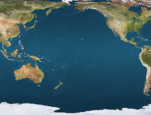
 MiliLocation of Mili Atoll in the Pacific Ocean
Mili Atoll 
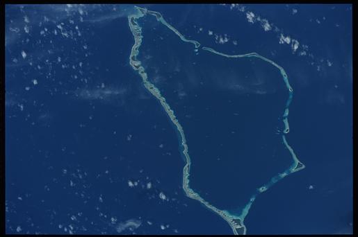
NASA picture of Mili Atoll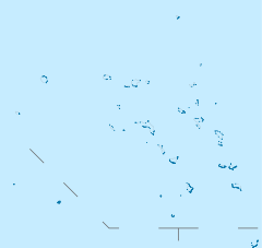
 Mili Atoll (Marshall islands)
Geography Location North Pacific Coordinates 06°08′00″N 171°55′00″E / 6.1333333°N 171.9166667°E Archipelago Ratak Total islands 92 Area 14.9 km2 (5.75 sq mi) Highest elevation 3 m (10 ft) Country Demographics Population 1032 (as of 1998) Ethnic groups Marshallese Mili Atoll (Marshallese: Mile, /mʲɨlʲɘɦʲ/ or [milee̯][1]) is a coral atoll of 92 islands in the Pacific Ocean, and forms a legislative district of the Ratak Chain of the Marshall Islands. It is located approximately 78 kilometres (48 mi) southeast of Arno Its total land area is 14.9 square kilometres (5.8 sq mi) making it the second largest of the Marshall Islands after Kwajalein. It encloses a much smaller lagoon than Kwajalein, with an area of 760 square kilometres (290 sq mi). The atoll is separated by a water channel called the Klee Passage from the Knox Atoll which is considerably smaller. The population of Mili Atoll was 1032 as of 1999. The main village is also called Mili. Other villages include Nallu, Enejet, Lukonor, Tokewa, and Wau, Mili. Nallu, Enejet and Lukonwor are only accessible from Mili by land during lowtide. Only Mili, Mili and Enejet, Mili have runways for small planes. Mili Airport and Enejet Airport are served by Air Marshall Islands when its aircraft are operational.
Contents
History
In 1823 the whaleship Globe, out of Nantucket, Massachusetts, was brought to Mili Atoll by her mutinous crew.[2] After killing the ship's captain and its three officers, Samuel B. Comstock “Bloody Sam” sailed the ship here. A few days after anchoring, Comstock was murdered by his co-mutineer Silas Payne. Six of the crew fled in the ship and stranded nine men on the island. By the time the U.S. Schooner Dolphin, commanded by Lieut. Com. John Percival, arrived to rescue them two years later, all but two of the crew members had been murdered by the islanders.
The infamous blackbirder Bully Hayes owned Tokowa Islet on Mile during the late 19th century and used it as a base for his operations. Mili Atoll was claimed by the Empire of Germany along with the rest of the Marshall Islands in 1884. The Germans established a trading station and in 1870 a Christian church. After World War I, the island came under the South Pacific Mandate of the Empire of Japan. Mili housed a radio direction finding and weather station. In World War II the atoll was occupied by the Japanese. The garrison was composed of 2,045 men of the IJN and 2,237 men of the IJA.[3] In 1942 a seaplane base was developed. Between late 1942 and late 1943, the Japanese also constructed a land airfield with three runways (4750', 4550' + 4400'), and numerous support buildings, including a radar station. The perimeter of the island was fortified with coastal defense and anti-aircraft guns. Between mid-1943 and Aug. 1945, Mili was bombed by United States Navy carrier-based aircraft and shelled by warships. The attacks increased in frequency and severity after Majuro and Kwajalein had fallen to the United States. Of the 5100 man Japanese garrison (2600 Imperial Japanese Navy and 2500 Imperial Japanese Army) only half survived to the end of the war.[4]
Following the end of World War II, Mili Atoll came under the control of the United States as part of the Trust Territory of the Pacific Islands. The island has been part of the independent Republic of the Marshall Islands since 1986.
Mili remains littered with thousands of World War II relics. The law forbids these items from being removed from the island. Mostly what remains are large bunker systems, rail systems, old artillery pieces and remnants of aircraft. Examples includes Japanese Zeroes and a B-25 Mitchell bomber sitting in just several feet of water. The ground is still covered with craters created by the artillery campaigns that lasted 30 days to "prep" the island for the Allied invasion.
Notes
- ^ Marshallese-English Dictionary - Place Name Index
- ^ Hussey, Cyrus M; Lay, William (1828). "A Narrative of the Mutiny, on Board the Ship Globe, of Nantucket, in the Pacific Ocean, Jan. 1824, And the journal of a residence of two years on the Mulgrave Islands; with observations on the manners and customs of the inhabitants". New-London: Wm.-Lay and C.M. Hussey. http://www.gutenberg.org/etext/28955. Retrieved 2010-02-19.
- ^ Takizawa, Akira; Alsleben, Allan (1999-2000). "Japanese garrisons on the by-passed Pacific Islands 1944-1945". Forgotten Campaign: The Dutch East Indies Campaign 1941-1942. http://www.dutcheastindies.webs.com/japan_garrison.html.
- ^ WWII Sites on Mili Atoll
References
- L, Klemen (1999-2000). "Forgotten Campaign: The Dutch East Indies Campaign 1941-1942". http://www.dutcheastindies.webs.com/index.html.
- WWII Sites on Mili Atoll
External links
Marshall Islands - Bold indicates populated islands
- Italics indicate single island
Ratak Chain (Sunrise, Eastern) 
Ralik Chain (Sunset, Western) Categories:


Wikimedia Foundation. 2010.