- Drayton Park railway station
-
Drayton Park 

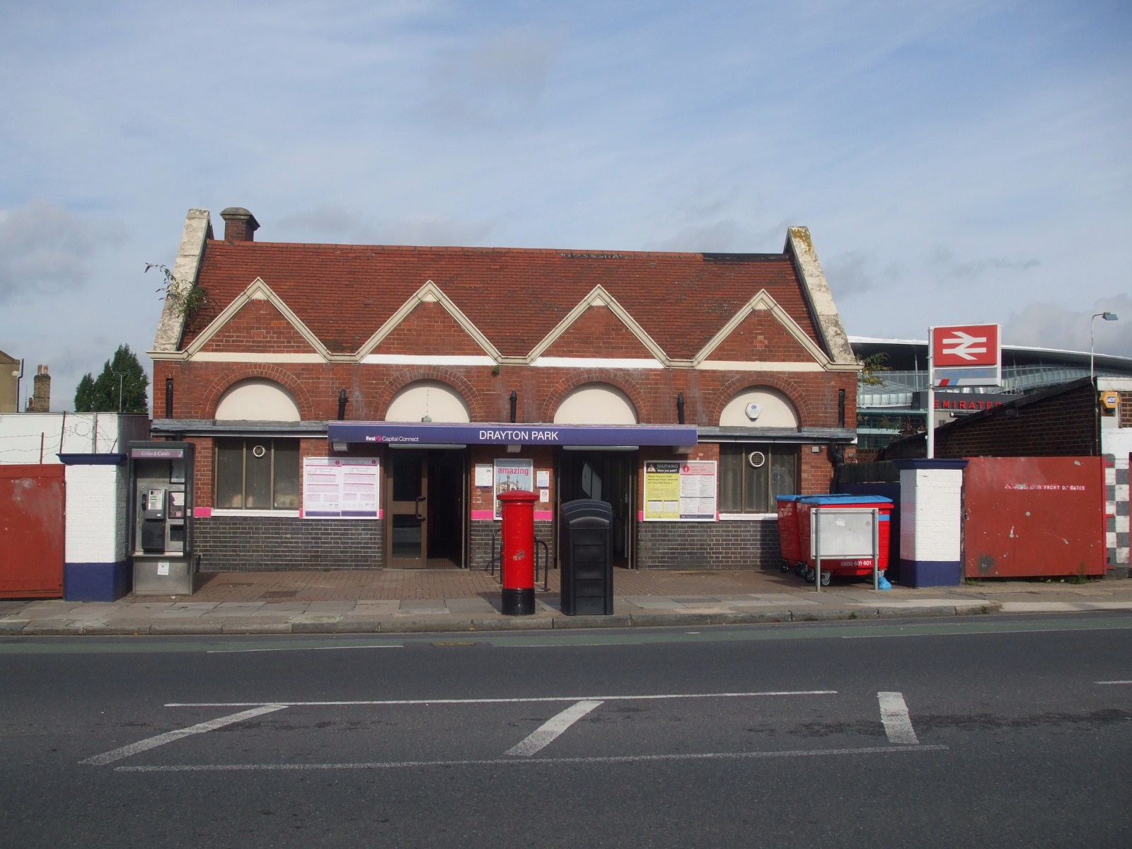
Station building
 Drayton Park
Location of Drayton Park in Greater LondonLocation Lower Holloway Local authority London Borough of Islington Managed by First Capital Connect Owner Network Rail Station code DYP Number of platforms 2 Fare zone 2 National Rail annual entry and exit 2004-05 0.130 million[1] 2005-06  0.118 million[1]
2006-07  0.288 million[1]
2007-08 0.279 million[1]2008-09 0.261 million[1]1904 Opened (GN&CR) 1964 Became terminus 1975 Closed (Northern Line) 1976 Reopened as through station (British Rail) List of stations Underground · National Rail External links Departures • Layout Facilities • Buses Coordinates: 51°33′10″N 0°06′20″W / 51.5528°N 0.1055°W
Drayton Park railway station is on the Network Rail Northern City Line which carries First Capital Connect services between Moorgate and Welwyn Garden City or Hertford via Finsbury Park. Drayton Park lies between Finsbury Park and Highbury & Islington, and is Travelcard Zone 2
The station is in Islington, just off the Holloway Road near its southern end, close to the Liverpool Road junction. It stands in the shadow of Arsenal football club's new Emirates Stadium, but is effectively shut on matchdays as the services at the station do not operate at weekends nor after 9pm, instead being diverted to London Kings Cross.
Contents
History
Drayton Park was opened by the Great Northern & City Railway (GN&CR) on 14 February 1904. The GN&CR was constructed to provide a route for Great Northern Railway (GNR) trains between the GNR station at Finsbury Park and the Metropolitan Railway (MR) and City & South London Railway (C&SLR) station at Moorgate in the City of London. With the exception of Drayton Park station and the former depot which are in a deep cutting, the railway was constructed in deep tube tunnel. The tunnels were constructed with a larger diameter than the other deep tube railways being built at that time to accommodate the GNR mainline trains but a dispute between the two companies prevented the GN&CR connecting its tunnels to the GNR platforms at Finsbury Park. The GN&CR tunnels, instead, terminated beneath the mainline station without a connection to the surface. Rolling stock accessed the GN&CR tracks via a link tunnel under Highbury Fields to the North London Railway west of Canonbury.
In 1913 the GN&CR was taken over by the MR. The MR ran the line under its own name until it became part of the London Passenger Transport Board (LPTB) in 1933. In preparation for the LPTB's "Northern Heights" plan the line was transferred to the control of the Morden-Edgware Line (now the Northern Line).
 How Drayton Park might have appeared on the London Underground Map today if the Northern City Line had been connected to the LNER Northern Heights branch to Alexandra Palace
The Northern Heights plan involved the construction of the GN&CR's unbuilt connection from Drayton Park to the surface platforms at Finsbury Park and the transfer of a London and North Eastern Railway (LNER) branch from there to Edgware, High Barnet and Alexandra Palace. By 1939 much of the work for the connection of the lines had been done including the ramps needed to take the tracks from Drayton Park up to Finsbury Park and the opening of the connection was scheduled for autumn 1940 but the start of World War II put a halt to further construction.
After the war the plan to incorporate the Alexandra Palace branch into the Underground was cancelled and it closed to passengers in the 1950s. No further effort was made to connect the City Line to the main line platforms (controlled after the 1948 nationalisation by British Railways) and Northern Line tube trains continued to run in tunnel to Finsbury Park. For some colour pictures of Drayton Park station in 1964, see : http://ronfisher.fotopic.net/c917966.html
Although the Victoria Line does not visit Drayton Park its construction during the 1960s did have a significant impact on the station. The City Line tunnels north of Drayton Park were closed on 3 October 1964 and were reused by the Victoria Line which was connected to them south of Finsbury Park. Drayton Park became the northern terminus of the City line which later became known as the Northern Line Highbury Branch.
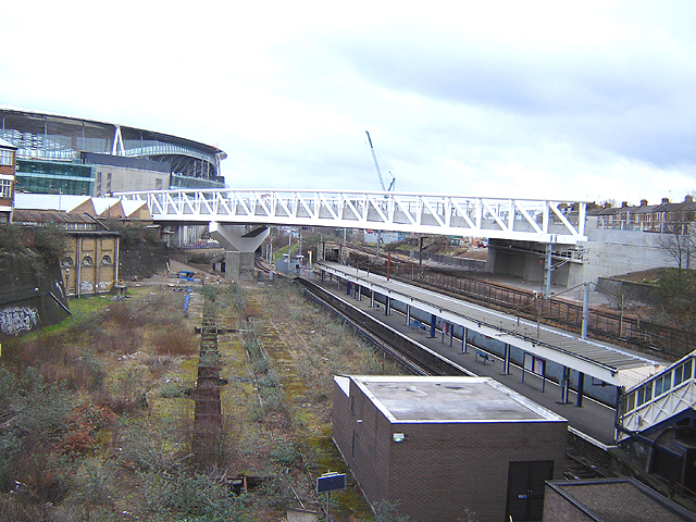
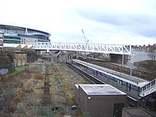 The remnants of the station's stabling yard are visible to the left of the platform, though the area has already been encroached upon by the bridge support for the then unfinished Emirates Stadium. (February 2006)
On 4 October 1975 the line was closed and ceased to be part of the London Underground. The line was transferred to British Rail (BR) and the unused ramps from the cancelled Northern Heights plan finally received the tracks to connect the line to the surface platforms at Finsbury Park. On 8 August 1976 Drayton Park reopened as part of the BR network with main-line-sized trains running to Old Street. On 8 November 1976, seventy-two years after the GN&CR first opened, the line was opened fully for mainline trains from Moorgate to Finsbury Park and beyond as had been originally intended.
Following the transfer of the line from London Transport to British Rail, the tube train car sheds at Drayton Park became redundant. The track in the sheds and outside in the yard had only been used by slow moving empty tube trains, so was in very good condition. It was purchased by the Ffestiniog Railway in North Wales and the job of lifting and loading it onto a bogie flat wagon fell to volunteers of the London Area Group of the Ffestiniog Railway Society. This was accomplished over about three weekends in June, 1977.
Trains running on the line have dual power pick-up equipment. In the tunnel section of the line train use third rail supplies but above ground they take overhead supplies via pantograph equipment. Trains change between the two methods at Drayton Park and the transition may be noticeable as sparks or momentary power blackouts.
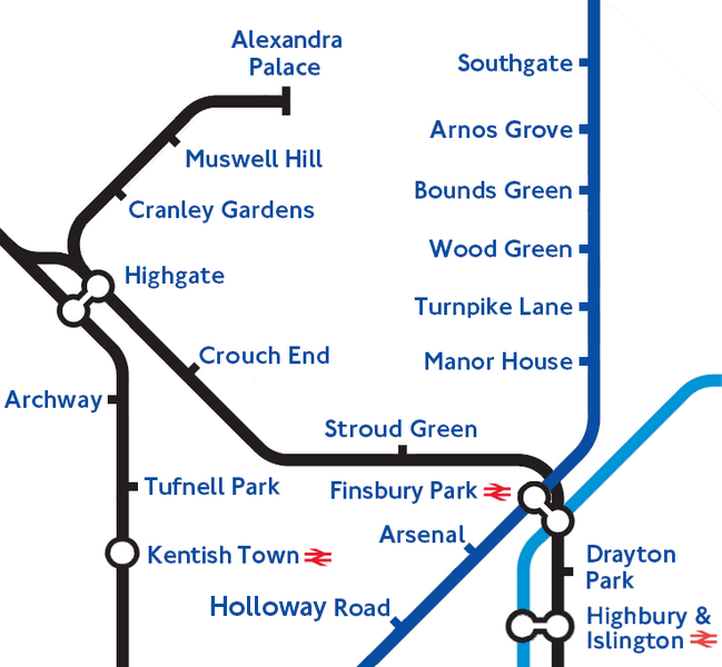
Finsbury Park to Highbury & Islington to Dalston Legend

East Coast Main Line 


Finsbury Park 


Junctions with Canonbury 
Curve and Northern City Line 


towards King's Cross 


Bridge to Emirates Stadium Drayton Park 

Victoria line 
North London Line 


Highbury & Islington _ 

Canonbury Curve Victoria line 
Northern City Line 

Canonbury 

Dalston Junction 


Dalston Kingsland East London Line 


North London Line Gallery
-
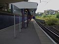
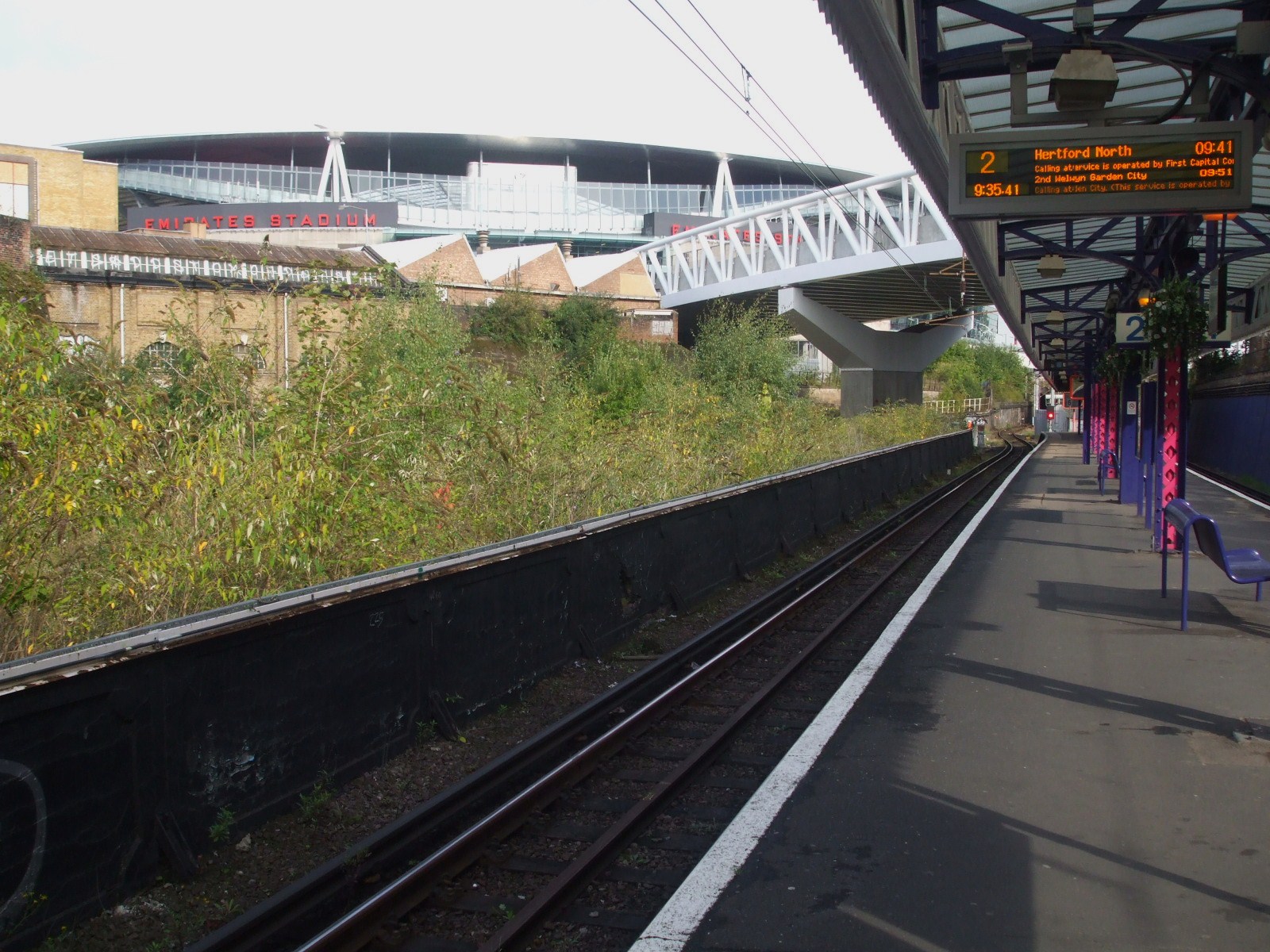
Looking south
-
Looking north
-

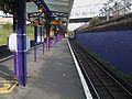
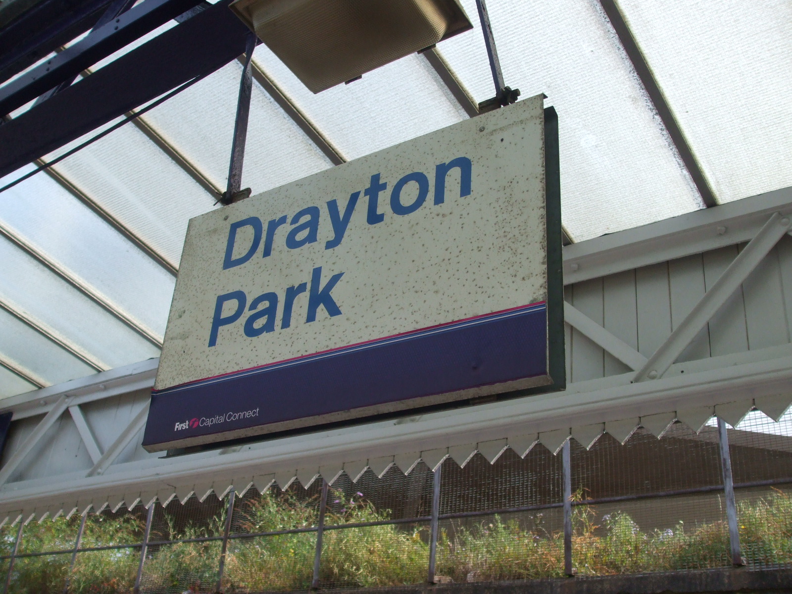
Platform signage
-

The station is just east of the Emirates Stadium
References
- ^ a b c d e "Station usage". Rail statistics. Office of Rail Regulation. 30 April 2010. http://www.rail-reg.gov.uk/server/show/nav.1529. Retrieved 17 January 2011. Please note: Some methodology may vary year on year.
Transport links
London bus routes 43, 153, 271 and 393 11mins walk to the station.
External links
- London Transport Museum Photographic Archive
- Drayton Park station building with Metropolitan Railway signage, 1933
- Former GN&CR carriage in Metropolitan Railway Livery but with London Underground roundels visible in windows, Drayton Park depot, 1935
- Drayton Park station building with Underground signage, 1935
- View of platforms looking south towards tunnel mouth, Metropolitan diamond shaped signage still in place, 1956
- View of train sheds at Drayton Park depot, 1966
- Train times for Drayton Park railway station from National Rail
- Maps and aerial photos of Drayton Park railway station
Preceding station  National Rail
Following station Highbury & Islington First Capital Connect
Northern City Line
Monday-Friday onlyFinsbury Park Abandoned Northern Heights extension Preceding station  London Underground
Following station towards Bushey HeathNorthern line towards Moorgatetowards Alexandra PalaceNorthern line Railway stations in the United Kingdom • Railway station categories A B C D E F G H I J K L M N O P Q R S T U V W X Y Z
FCC Great Northern Route GN Core Route Stations King's Cross • Finsbury Park • Harringay • Hornsey • Alexandra Palace • New Southgate • Oakleigh Park • New Barnet • Hadley Wood • Potters Bar • Brookmans Park • Welham Green • Hatfield • Welwyn Garden City • Welwyn North • Knebworth • Stevenage • HitchinNorthern City Line Hertford Loop Line Peterborough Line Hitchin-Cambridge Line Letchworth Garden city • Baldock • Ashwell & Morden • Royston • Meldreth • Shepreth • Foxton • CambridgeRoute TOC Previous TOC(s) West Anglia Great Northern (WAGN)Closed Line(s) Categories:- Rail transport stations in London fare zone 2
- Railway stations in Islington
- Former Great Northern and City Railway stations
- Railway stations opened in 1904
- Railway stations closed in 1975
- Railway stations opened in 1976
- Railway stations served by First Capital Connect
- DfT Category E stations
-


Wikimedia Foundation. 2010.