- London Inner Ring Road
-
 The congestion charge used to apply to drivers within the London Inner Ring Road.
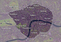
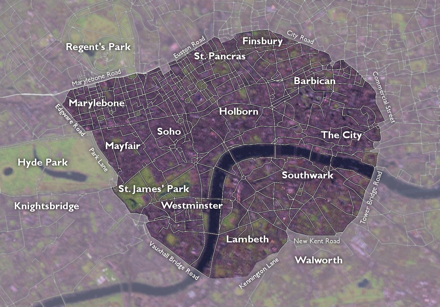
The London Inner Ring Road is the name commonly given to a route formed from a number of major roads that encircle the centremost part of London.[1] The ring road previously formed the boundary of the London congestion charge zone before the western expansion.
Starting at the northernmost point and moving clockwise, the roads defining the boundary are Pentonville Road, City Road, Old Street, Great Eastern Street, Commercial Street, Mansell Street, Tower Bridge, Tower Bridge Road, New Kent Road, the Elephant & Castle, Kennington Lane, the roads that constitute the Vauxhall one-way system and Vauxhall Bridge, Vauxhall Bridge Road, the roads that constitute the Victoria one-way system, Grosvenor Place, Park Lane, Edgware Road, Marylebone Road and Euston Road.[2]
The route is described as the "Inner" Ring Road because there are two further sets of roads that have been described as London ring roads. The North and South Circular Roads together form the second ring road around London, averaging 10–15 miles (16–24 km) in diameter. The M25 motorway is the outermost road encircling the metropolis, at an average diameter of 40–50 miles (64–80 km).
Contents
History
Plans for an Inner Ring Road were put forward by Patrick Abercrombie [3] in the 1940s,[4] in the County of London Plan.
Constituent Roads
- A100 (Tower Bridge Road, Tower Bridge Approach)
- A1202 (Commercial Street)
- A1210/A1211 (Mansell Street)
- A201 (New Kent Road)
- A202 (Vauxhall Bridge Road)
- A302 (Grosvenor Place, Lower Grosvenor Place, Bressenden Place)
- A3204 (Kennington Lane)
- A4202 (Park Lane)
- A5 (southern section of the Edgware Road between Sussex Gardens and Marble Arch)
- A501 (from Paddington station to Moorgate via Kings Cross, along City Road, Pentonville Road and Euston Road). It formed part of the historical New Road.[5]
Historical New Road
Main article: New Road (London)Construction on the New Road from Paddington to Islington began in 1756 [6] to relieve congestion in the built-up area of London. At that time the districts of Marylebone, Fitzrovia and Bloomsbury were on the northern edge of the city, and only the southern parts of them had been built up. The New Road ran through the fields to the north of these three neighbourhoods.
The road is now one of the busiest main roads in the city. It runs from Edgware Road in the west to The Angel, Islington, in the east. The western section between Edgware Road and Great Portland Street is known as Marylebone Road; the central section between Great Portland Street and King's Cross is known as Euston Road; and the eastern section from King's Cross to The Angel is called Pentonville Road.
City Road was constructed in 1761 to continue the route eastwards to the northern edge of the City of London[7]
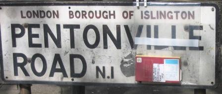
Pentonville Road
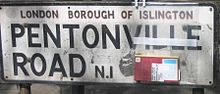 A battered street sign
Pentonville Road runs west to east from Kings Cross to City Road. By far the greater portion of the road is in the London Borough of Islington but a small part near Kings Cross is in the London Borough of Camden, including an entrance to Kings Cross St Pancras tube station at the former Kings Cross Thameslink station. It acquired its present name in 1857.[8]
There are several halls of residence located on Pentonville Road, these being Dinwiddy House (SOAS), Paul Robeson House and Nido Student Living.
This street is distinguished by the "set back" housing lines originally intended to provide an atmosphere of spaciousness along the thoroughfare. It is one of the locations on the London version of the Monopoly board game.
Mansell Street
Mansell Street is a short road, part of the A1210 route (though sometimes shown as being the A1211), which for most of its length marks the boundary between the City of London and the London Borough of Tower Hamlets, though the southernmost part is entirely in Tower Hamlets. It runs from Aldgate southwards to the Tower of London. The northern part, north of the junction with Goodmans Yard and Prescot Street, has one way northbound traffic, while the southern part has one way southbound traffic.
Mansell Street is also named in Google maps in Guernsey Channel Islands with 'upper' and 'lower' Mansell Street connecting lower Vauvert to 'Upper' Mill Street onto Back Street and Mansell Street has its original 'cobble' Blue Granite surface still in place as other attaching streets have part 'tarmac' covered 'cobbles'.
Tower Bridge Road
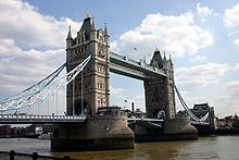 Tower Bridge.
Tower Bridge Road is a road in Bermondsey in the London Borough of Southwark, UK, that runs north to south, and connects the Bricklayers' Arms roundabout and flyover at its southern end (New Kent Road and Old Kent Road) to Tower Bridge and across the River Thames at its northern end. It also links to Long Lane.
The road has an abundance of antique (or junk) shops along part of its length. There is also Bermondsey Square which holds an 'antique' market every Friday morning, usually known as Bermondsey Market, though officially as New Caledonian Market.
Towards its southern end are a collection of shops, pubs and takeaways.
Kennington Lane
Kennington Lane is an A-road (classified A3204) running between the Elephant & Castle to the east and Vauxhall to the west.
Starting at the Elephant, Kennington Lane splits off from the A3 by means of a Y-junction, where Newington Butts becomes Kennington Park Road. Heading in a southwesterly direction, the road then crosses the A23 Kennington Road, before reaching the Vauxhall one-way system, where the A3036 Albert Embankment and Wandsworth Road, A202 Vauxhall Bridge, Durham Street and Harleyford Road, A203 South Lambeth Road, and A3205 Nine Elms Lane all converge.
Vauxhall Bridge Road
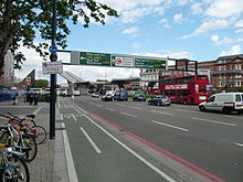 Approaching the ring road at Vauxhall cross
Vauxhall Bridge Road runs south-east to north-west from Vauxhall Cross, over the River Thames to Victoria station. At the southernmost point the road runs past the headquarters of MI6.
See also
References
- ^ UK Roads: London Inner Ring Road
- ^ "Congestion Charging in London". BBC. 2006-10-30. http://www.bbc.co.uk/london/content/articles/2006/10/30/congestioncharge_feature.shtml. Retrieved 2008-05-29.
- ^ http://www.haroldhill.org/section_two/now_we_must_rebuild.htm
- ^ "Even before the war was over a regional planner, Patrick Abercrombie, had prepared two proposals, the County of London Plan and the Greater London Plan, which would lend London 'order and efficiency and beauty and spaciousness' with an end to 'violent competitive passion'. It is the eternal aspiration, or delusion, that somehow the city can be forced to change its nature by getting rid of all the elements by which it had previously thrived." London: The Biography, Peter Ackroyd, Vintage, 2001, page 755
- ^ SABRE - Road Lists - Roads by 10 - A501
- ^ CBRD - Histories - Ringways - Early plans
- ^ "City Road" in Ben Weinreb and Christopher Hibbert (1983) The London Encyclopedia: 176-77
- ^ "Pentonville Road" in Ben Weinreb and Christopher Hibbert (1983) The London Encyclopedia: 592
Roads in London Roads MotorwaysRing roadsLondon Ringways · South Circular Road · North Circular Road · London Inner Ring Road · M25 London OrbitalMajor roadsOther Categories:- London ring roads
- Transport in Camden
- Transport in Islington
- Transport in Southwark
- Transport in Tower Hamlets
- Transport in Westminster
- Transport in the City of London


Wikimedia Foundation. 2010.