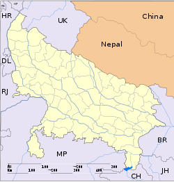
- Dhanaura
-
Dhanaura — city — Coordinates 28°58′N 78°15′E / 28.97°N 78.25°ECoordinates: 28°58′N 78°15′E / 28.97°N 78.25°E Country India State Uttar Pradesh District(s) Jyotiba Phule Nagar Population 24,465 (2001[update]) Time zone IST (UTC+05:30) Area
• 212 metres (696 ft)
Dhanaura is a city and a municipal board in Jyotiba Phule Nagar district in the state of Uttar Pradesh, India.
Geography
Dhanaura is located at 28°58′N 78°15′E / 28.97°N 78.25°E[1] 10km from gajraula.It has an average elevation of 212 metres (695 feet).
Demographics
As of 2001[update] India census[2], Dhanaura had a population of 24,465. Males constitute 53% of the population and females 47%. Dhanaura has an average literacy rate of 58%, lower than the national average of 59.5%: male literacy is 66% and, female literacy is 49%. In Dhanaura, 17% of the population is under 6 years of age. It is the main city of sugar belt area in West U.P. The land is very fertile. Sugarcane, wheat rice, pulses and green vegetables are the main crops. It is a very big market of 'GUR' (a variety of sugar). The main source of income here is the trading of commodities. That is why this place is known as Mandi Dhanaura. Apart from commodities the trade of jewellery and cloths are the other major sources of income. Mandi Dahnaura is also known for temples.There are so many temples in the city such as- Mahadev mandir,Patharkuti,Krishna mandir,Teen devi Mandir,Balji Dham,Raam mandir,Jain Mandir,Garhi Mandir,Aanand dham aashram,Ganesh Aashram etc. Recently(2010 Sept.) the nearby area of the city is badly affected by the flood.in which thousands of peoples & pets were affected & thwy escaped their home to the safe areas. The flood also destroyed thosand of acres farming land which resulted in bankruption to the farmers.
References
- ^ Falling Rain Genomics, Inc - Dhanaura
- ^ "Census of India 2001: Data from the 2001 Census, including cities, villages and towns (Provisional)". Census Commission of India. Archived from the original on 2004-06-16. http://web.archive.org/web/20040616075334/http://www.censusindia.net/results/town.php?stad=A&state5=999. Retrieved 2008-11-01.
Cities and towns in Jyotiba Phule Nagar district Jyotiba Phule Nagar Cities and towns
in other districtsAgra · Aligarh · Allahabad · Ambedkar Nagar · Auraiya · Azamgarh · Badaun · Bagpat · Bahraich · Ballia · Balrampur · Banda · Barabanki · Bareilly · Basti · Bhimnagar · Bijnor · Bulandshahr · Chandauli · Chitrakoot · Deoria · Etah · Etawah · Faizabad · Farrukhabad · Fatehpur · Firozabad · Gautam Buddha Nagar · Ghaziabad · Ghazipur · Gonda · Gorakhpur · Hamirpur · Hardoi · Jalaun · Jaunpur · Jhansi · Kannauj · Kanpur Nagar · Kanshi Ram Nagar · Kaushambi · Kushinagar · Lakhimpur Kheri · Lalitpur · Lucknow · Mahamaya Nagar · Maharajganj · Mahoba · Mainpuri · Mathura · Mau · Meerut · Mirzapur · Moradabad · Muzaffarnagar · Panchsheel Nagar · Pilibhit · Prabuddhanagar · Pratapgarh · Raebareli · Ramabai Nagar · Rampur · Saharanpur · Sant Kabir Nagar · Sant Ravidas Nagar · Shahjahanpur · Shravasti · Siddharthnagar · Sitapur · Sonbhadra · Sultanpur · Unnao · Varanasi
Categories:- Cities and towns in Jyotiba Phule Nagar district
- Uttar Pradesh geography stubs
Wikimedia Foundation. 2010.


