- Tigray Region
-
For other uses, see Tigre (disambiguation).
Tigray Region
ትግራይ ክልል— kililoch — 
FlagMap of Ethiopia showing Tigray Region
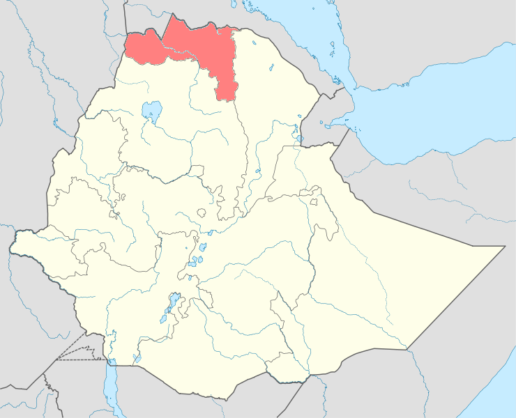
Country Ethiopia Capital Mek'ele Area - Total 50,078.64 km2 (19,335.5 sq mi) Population (2005) - Total 4,334,996 - Density 86.6/km2 (224.2/sq mi) ISO 3166 code ET-TI Tigray Region (ትግራይ ክልል Tigrāy Kilil) is the northernmost of the nine ethnic regions (kililoch) of Ethiopia containing the homeland of the Tigray people. It was formerly known as Region 1. Its capital is Mek'ele.
Tigray is bordered by Eritrea to the north (independent from Ethiopia since 1993), Gondar to the west, the Afar Region to the east, and the Amhara Region to the south and southwest.[1] Besides Mek'ele, other major cities in Tigray include Abiy Addi, Adigrat, Adwa, Aksum, Inda Selassie, Korem, Maychew, Wukro, Qwiha and Zalambessa, as well as the historically significant town of Yeha.
Contents
History
- For the history of the Tigray area prior to 1991, see Tigray Province.
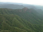
 Canyon west of Adigrat in northern Tigray.
Following the conclusion of the Ethiopian Civil War, although the area which became the Tigray Region was thought by inhabitants in the rest of Ethiopia to be the beneficiaries of enormous funds from an Ethiopian People's Revolutionary Democratic Front (EPRDF) government dominated by fellow Tigrayans, in reality even emergency assistance was slow to materialize. John Young, who visited the area several times in the early 1990s, attributes this delay in part to "Budgetary restraints, structural readjustments, and lack of awareness in Addis Ababa of conditions in the province", but notes "an equally significant obstacle was posed by an entrenched, and largely Amhara-dominated central bureaucracy which used its power to block even authorised funds from reaching Tigray." At the same time, a growing urban middle class of traders, businessmen and government officials emerged which was both suspicious and distant from the victorious EPRDF. The ruling party attempted to address these challenges in forums with its middle class critics, as well as the establishment of a number of charitable non-governmental organizations controlled by the EPRDF, which include Endowment Fund for the Rehabilitation of Tigray, Relief Society of Tigray, and Tigray Development Association.[2]
In 1998, war erupted between Eritrea and Ethiopia over a portion of territory that had been administered at part of Tigray, which included the town of Badme. Following a 2002 United Nations decision, much of this land was awarded to Eritrea, so far however, Ethiopia has refused to implement the final and binding ruling and as a result, relation with Eritrea is very tense.
Demographics
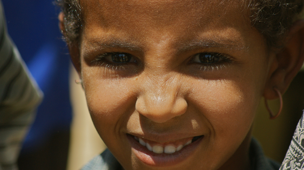
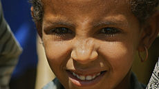 An Ethiopian child in the northern Tigray Region.
Based on the 2007 Census conducted by the Central Statistical Agency of Ethiopia (CSA), the Tigray Region has an estimated total population of 4,314,456, of whom 2,124,853 are men and 2,189,603 women; urban inhabitants number 842,723 or 19.53% of the population. With an estimated area of 50,078.64 square kilometers, this region has an estimated density of 86.15 people per square kilometer. For the entire region 985,654 households were counted, which results in an average for the Region of 4.4 persons to a household, with urban households having on average 3.4 and rural households 4.6 people. At 96.55% of the local population, the region is predominantly inhabited by people from the Semitic-speaking Tigray people. Most other residents hail from other Afro-Asiatic communities, including the Amhara (1.63%), Saho (0.71%), Afar (0.29%), Agaw (0.19%) and Oromo (0.17%). There are also a minority of Nilo-Saharan-speaking Kunama Nilotes (0.07%). 95.6% of the Tigray region's population is Orthodox Christians, 4.0% Muslim, 0.4% Catholics and 0.1% Protestant.[3]
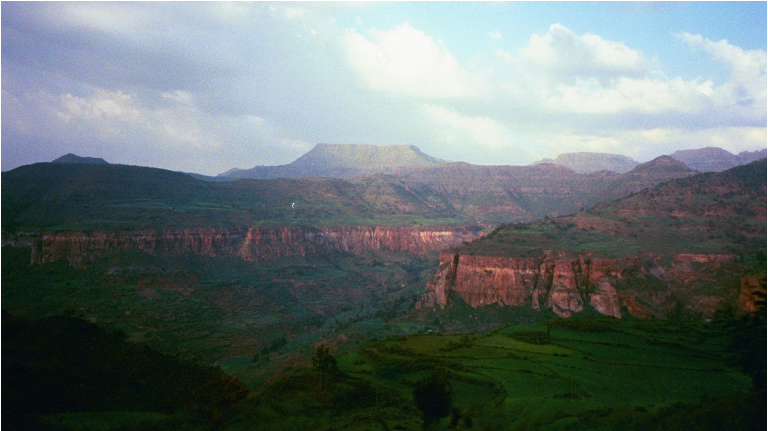
 Mountains of Lemalimo near Inda Selassie in western Tigray
In the previous census, conducted in 1994, the Region's population was 3,136,267, of whom 1,542,165 were men and 1,594,102 women; urban inhabitants numbered 621,210 or 14% of the population. Ethnic groups present at the time of the earlier census included Tigrayan (94.98%), 2.6% Amhara (2.6%), Irob (0.7%), and Kunama (0.05%). 95.5% of the population were Orthodox Christians, while 4.1% and 0.4% were Muslim and Catholics, respectively. Its working language is Tigrinya.[4]
According to the CSA, as of 2004[update], 53.99% of the total population had access to safe drinking water, of whom 42.68% were rural inhabitants and 97.28% were urban.[5] Values for other reported common indicators of the standard of living for Tigray as of 2005[update] include the following: 31.6% of the inhabitants fall into the lowest wealth quintile; adult literacy for men is 67.5% and for women 33.7%; and the Regional infant mortality rate is 67 infant deaths per 1,000 live births, which less than the nationwide average of 77; at least half of these deaths occurred in the infants’ first month of life.[6]
Agriculture
The CSA estimated in 2005 that farmers in Tigray had a total of 2,713,750 cattle (representing 7.0% of Ethiopia's total cattle), 72,640 sheep (0.42%), 208,970 goats (1.61%), 1,200 horses (less than 0.1%), 9,190 mules (6.24%), 386,600 asses (15.43%), 32,650 camels (7.15%), 3,180,240 poultry of all species (10.3%), and 20,480 beehives (0.47%).[7]
Landmarks of Tigray
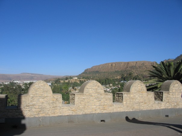
 View of Tigray from Emperor Yohannes' Palace
A distinctive feature of Tigray are its rock-hewn churches. Similar in design to those of Lalibela, these churches are found in four or five clusters—Gheralta, Teka-Tesfay, Atsbi and Tembien -- with Wukro sometimes included. Some of the churches are considered earlier than those of Lalibela, perhaps dating from the eighth century. Mostly monolithic, with designs partly inspired by classical architecture, they are often located at the top of cliffs or steep hills, for security. For example, Tigray's ancient Debre Damo monastery is accessible only by climbing a rope 25 meters up a sheer cliff.
Looting has become a major issue in the Tigray Region, as archaeological sites have become sources for construction materials and ancient artifacts used for everyday purposes by local populations.[8]
The area is famous for a single rock sculptured 23 meter long obelisk in Axum as well as for other fallen obelisks. The Axum treasure site of ancient Tigrayan history is a major landmark. Yeha is another important local landmark that is little-known outside the region.
Presidents of the Executive Committee
- Gebru Asrat (TPLF) 1991–2001
- Tsegay Berhe (TPLF) 2001–2010
- Abay Woldu (TPLF) 2010–present
(This list is based on information from Worldstatesmen.org.)
See also
References
- ^ Central Intelligence Agency (2009). Eritrea and Ethiopia (Map). 1:5,000,000. Map #803395. http://www.lib.utexas.edu/maps/africa/eritrea_ethiopia_2009.jpg.
- ^ Young, "Development and Change in Post-Revolutionary Tigray", Journal of Modern African Studies, 35 (1997), pp. 81-99
- ^ "Census 2007", first draft, Tables 1, 4, 5, 6.
- ^ FDRE States: Basic Information - Tigray, Population (accessed 22 March 2006)
- ^ "Households by sources of drinking water, safe water sources" CSA Selected Basic Welfare Indicators (accessed 21 January 2009)
- ^ Macro International Inc. "2008. Ethiopia Atlas of Key Demographic and Health Indicators, 2005." (Calverton: Macro International, 2008), pp. 2, 3, 10 (accessed 28 January 2009)
- ^ "CSA 2005 National Statistics", Tables D.4 - D.7.
- ^ Jacke Phillips, Tekle Hagos et alia, "Combating the destruction of Ethiopia's archaeological heritage", Antiquity, 78 (December 2004)
External links
- Tigrai Region Web Portal
- Tigrai State Information
- FDRE States: Basic Information - Tigray
- Map of Tigray Region at UN-OCHA
- Map of Tigray Region at DPPA of Ethiopia
- Endowment Fund for the Rehabilitation of Tigray website
- Debre Damo Monastery
- Ethiopian Treasures - Queen of Sheba, Aksumite Kingdom - Aksum
- Ethiopian Treasures - Emperor Yohannes IV Castle - Mekele
- Future Observatory - Dam Building in Tigray by David Mercer
- "Tigrayans want end to border row" by Elizabeth Blunt, BBC News, 20 December 2007
 First-level administrative divisions of Ethiopia
Regions Afar · Amhara · Benishangul-Gumuz · Gambela · Harari · Oromia · Somali · Southern Nations, Nationalities, and People's Region · TigrayChartered cities Provinces
(prior to 1995)List of woredas in the Tigray Region Mi'irabawi (Western) 
Semien Mi'irab (Northwestern) Misraqawi (Eastern) Mehakelegnaw (Central) Abergele · Adwa · Degua Tembien · Enticho · Kola Tembien · La'ilay Maychew · Mereb Lehe · Naeder Adet · Tahtay Maychew · Werie LeheDebub Misraqawi (Southeastern) Debubawi (Southern) Mek'ele Debub (South) Mek'ele · Semien (North) Mek'eleCoordinates: 14°08′12″N 38°18′34″E / 14.1365757°N 38.3093262°E
Categories:


Wikimedia Foundation. 2010.