- Somali Region
Infobox Regions of Ethiopia
native_name = ሶማሌ ክልል
Gobolka Soomaalida
Somalia
conventional_long_name = the Somali Region
common_name = the Somali Region
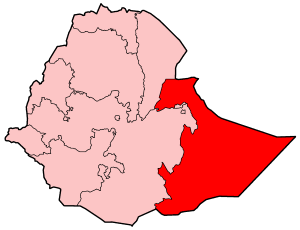
map_caption = Map of Ethiopia highlighting Somali Region
capital =Jijiga
official_languages = Somali
regional_languages/dialects = SomaliSomali ( _so. "Gobolka Soomaalida"); is the eastern-most of the nine ethnic divisions ("kililoch") of
Ethiopia . It is often called Somali, though it is not to be confused with the independent country of the same name. Also known as Western Somali, the capital of Somali State isJijiga . The capital had been atGode /Godey until April 1994, but due to political considerations it was moved. [ [http://www.africa.upenn.edu/eue_web/strp0494.htm "April 1994 Monthly Situation Report"] United Nations Emergencies Unit for Ethiopia (accessed 29 May 2008)] ) Other major towns and cities include (the Somali spelling in brackets):Degehabur (Dhagaxbuur),Kebri Dahar (Qabridahare),Shilavo (Shilaabo),Geladin ,Kelafo (Qalaafe)Werder (Wardheer)andShinile (shiniile). The region bordersKenya to the south-west, the Ethopian regions ofOromia , Afar andDire Dawa (Diridhawa) to the west,Djibouti to the north andSomalia to the north, east and south.The region covers much of the traditional territory of
Ogaden and it formed a large part of the pre-1995 province ofHararghe . The region has a very high Somali population, and there is internal pressure to remove Ethiopian rule. in the past has been tried to free as part of aGreater Somalia . In the 1970s, Somalia invaded Ethiopia in support of local Somali rebels, particularly during theOgaden War ,was defeated.In late April
2005 , heavy rains generated widespread flooding throughout Somali Region as well as Somalia, and caused theShebelle River to burst its banks. As of May2005 , theflood ing in Somali Region alone had caused over 100 confirmed deaths and widespread property damage affecting over 100,000 persons. The floods also destroyed shelters housing 25,000 Somali refugees inKenya .Demographics
Based on figures from the Central Statistical Agency of Ethiopia (CSA) published in 2005, the Somali Region has an estimated total population of 4,329,001, consisting of 2,325,001 men and 2,004,000 women. 3,594,000 or 83% of the population are estimated to be rural inhabitants, while 735,000 or 17% are urban. With an estimated area of 279,252 square kilometers, this region has an estimated density of 15.5 people per square kilometer. [ [http://www.csa.gov.et/text_files/2005_national_statistics.htm CSA 2005 National Statistics] , Table B.3.]
These estimates are based on the September 1997 census, in which the region's population was reported to be 3,439,860, of which 1,875,996 were males and 1,563,864 were females. The urban residents of the Somali Region numbered 492,710 households, with an average of 6.6 persons per household; a high sex ratio of 120 males to 100 females was reported.
The ethnic groups include Somalis (96.23%), Oromo (2.25%), Amhara (0.69%), and Gurages (0.14%). Somali is the working language and is predominantly spoken within the State, constituting 95.9% of languages spoken in the State. Other major languages include Oromifa (2.24%), Amharic (0.92%), and Gurage (0.033%). 98.7% of the population is Muslim, 0.9% Orthodox Christian, and 0.3% are followers of other religions. [The 1994 national census was delayed in the Somali Region until 1997. [http://www.ethiopar.net/English/basinfo/infosoml.htm FDRE States: Basic Information - Somalia] , Population (accessed 12 March 2006)]
Agriculture
The CSA of Ethiopia estimated in 2005 that farmers in Somalia had a total of 459,720 cattle (representing 1.19%% of Ethiopia's total cattle), 463,000 sheep (2.66%), 650,970 goats (5.02%), 91,550 asses (3.66%), 165,260 camels (36.2%), 154,670 poultry of all species (0.5%), and 5,330 beehives (0.12%). For nomadic inhabitants, the CSA provided two sets of estimates, one based on aerial surveys and the other on more conventional methodology: [CSA 2005 National Statistics, Tables D.3 - D.5 and D.7.]
Presidents of the Executive Committee
*
Abdulahi Muhammed Sa'adi (January 1993 - November 1993)
*Hassan Jire Kalinle (1993 - April 1994)
*Ugaz Abdulrahman Abd Ghani (April 1994 - 1995?)
*Id Tahir Farah (1995 - October 1997)
*Mohammed Ma'alin Ali (ONLF) (October 1997 - October 2000)
*Abdul Reshid Dulane (SPDP) (October 2000 - 2003)
*Abdul Jibril (acting) (SPDP) (2003 - October 2005)
*Abdulahi Hassan Mohammed (SPDP) (October 2005 - present)(This list is based on information from [http://www.worldstatesmen.org/Ethiopia_Regions.html Worldstatesmen.org] .)
Zones
*
Gode Zone
*Jijiga Zone
*Degehabur Zone
*Korahe Zone
*Fiq Zone
*Shinile Zone
*Werder Zone
*Afder Zone
*Liben Zone See also
*
List of woredas in the Somali Region Notes
External links
* [http://www.ocha-eth.org/Maps/downloadables/SOMALI.pdf Map of Somali Region at UN-OCHA] (PDF file)
* [http://www.dppc.gov.et/downloadable/map/administrative/Atlas_Somali.pdf Map of Somali Region at DPPA of Ethiopia] (PDF file)
* [http://www.irinnews.org/report.asp?ReportID=46953&SelectRegion=Horn_of_Africa&SelectCountry=ETHIOPIA "Ethiopia: Rains pound Somali region as death toll rises" - UN IRIN]
* [http://www.un.org/apps/news/story.asp?NewsID=14150 "Floods plague Horn of Africa, wash away refugee shelters" - UN News]

Wikimedia Foundation. 2010.