- Çatalca
-
- "Tchataldja" and "Chataldja" redirect here. For the town in Greece with those names see Khoristi.
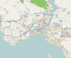
Çatalca Coordinates: 41°09′00″N 28°27′01″E / 41.15°N 28.45028°ECoordinates: 41°09′00″N 28°27′01″E / 41.15°N 28.45028°E Country Turkey Province İstanbul Government – Mayor Cem Kara (CHP) – Kaymakam Yüksel Ayhan Area – District 1,344 km2 (518.9 sq mi) Elevation 29 m (95 ft) Population (2008)[1][2] – Urban 35,995 – District 62,339 – District Density 46.4/km2 (120.1/sq mi) Website www.catalca.bel.tr Çatalca is a city and a rural district in Istanbul, Turkey. It is in Thrace, on the ridge between the Marmara and the Black Sea. Most people living in Çatalca are either farmers or those visiting vacation homes. Many families from Istanbul come to Çatalca during weekends to hike in the forests or have picnics.
Contents
History
Ancient period
Çatalca's ancient Greek name was Ergískē (Ἐργίσκη). According to Suida, the name is after Ergiscus, a son of Poseidon through the naiad Aba.
Modern period
Çatalca was settled throughout the Ottoman period, with a typical Ottoman mixed population of Greeks and Turks. The Crimean War caused a mass exodus of Crimean Tatars towards Ottoman lands. A few Crimean Tatars settled in Çatalca.
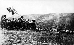
In the First Balkan War the Bulgarian army had driven the Turkish forces back from the border, but the Turkish forces retreated to the prepared positions at Chatalja where on 16-17 November 1912 they defeated the Bulgarians at the "Battle of Chatalja".[3][4] The Chatalja fortifications formed a line across the peninsula, the "Chatalja line", which became the armistice line of 3 December 1912,[3] after Bulgaria decided not to attack Adrianople at that time.[3][4]
Population
As of a November 22, 2000 census, the population of Çatalca district was 81,589, while the city of Çatalca had a population of 36,544 in 2009. The population growth rate was 0.66%. The literacy rate was 99%.
Geography
Çatalca has an area of 1,175 km² and 135 kilometers of coastline. Its neighbors include Büyükçekmece to the south, and Silivri and Tekirdağ Province to the west. Avcılar, Küçükçekmece, and Gaziosmanpaşa lie to the east. Fresh water for Istanbul is provided from by lakes Durusu and Büyükçekmece.
Media
At Çatalca, there is a mediumwave broadcasting station with a 226 metres tall mast. It works on 702 kHz with 600 kW.
International relations
Twin towns — Sister cities
Çatalca is twinned with:
 Fancy, Saint Vincent and Grenadines
 Oran, Algeria
 Diego Garcia, British Indian Ocean Territory
 Hitadhoo, Maldives
 Ganja, Azerbaijan
 Lille, France
 Kule, Botswana
References
- ^ Türkisches Institut für Statistik, abgerufen 17. November 2009
- ^ Türkisches Institut für Statistik, abgerufen 17. November 2009
- ^ a b c Hall, Richard C. (2000) The Balkan Wars 1912-1913: Prelude to the First World War Routledge, London, page 69, ISBN 0-415-22946-4
- ^ a b Black, Jeremy (2002) Warfare in the Western World, 1882-1975 Indiana University Press, Bloomington, Indiana, page 40 ISBN 0-253-34050-0
External links
- District governor's official website (Turkish)
- District municipality's official website (Turkish)
- Çatalca local news website (Turkish)
 Çatalca in Istanbul Province (in the Marmara region) of Turkey
Urban districts Istanbul - (Adalar - Arnavutköy - Ataşehir - Avcılar - Bağcılar - Bahçelievler - Bakırköy - Başakşehir - Bayrampaşa - Beşiktaş - Beylikdüzü - Beyoğlu - Beykoz - Büyükçekmece - Çatalca - Çekmeköy - Eyüp - Esenler - Esenyurt - Fatih - Gaziosmanpaşa - Güngören - Kadıköy - Kağıthane - Kartal - Küçükçekmece - Maltepe - Pendik - Sancaktepe - Sarıyer - Silivri - Sultanbeyli - Sultangazi - Şile - Şişli - Tuzla - Ümraniye - Üsküdar - Zeytinburnu)
RegionsAegean Black Sea Central Anatolia Eastern Anatolia Marmara Mediterranean Southeastern Anatolia Categories:- Districts of Istanbul
- Marmara Region
- Cities in Turkey
- Populated places in Istanbul Province
- Marmara Region geography stubs
Wikimedia Foundation. 2010.


