- Ngawa Tibetan and Qiang Autonomous Prefecture
-
Ngawa — Autonomous Prefecture — Ngawa Tibetan and Qiang Autonomous Prefecture
རྔ་བ་བོད་རིགས་ཆ་བ༹ང་རིགས་རང་སྐྱོང་ཁུལ་
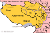
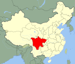
阿坝藏族羌族自治州Buddhist stupa and houses outside the town of Aba, Sichuan Province, China. Ngawa Prefecture (yellow), Sichuan (light gray), China (dark gray) Location in China Coordinates: 31°55′N 101°43′E / 31.917°N 101.717°ECoordinates: 31°55′N 101°43′E / 31.917°N 101.717°E Country China Province Sichuan Prefecture Seat Barkam Government – CPC Party Chief Shi Jun (侍俊) – Governor Zhang Dongsheng (张东升) Area – Total 83,201 km2 (32,124.1 sq mi) Population (2007) – Total 874,000 – Density 10.5/km2 (27.2/sq mi) – Major Ethnic Groups Tibetan-53.72%
Han-24.69%
Qiang- 18.28%Time zone China Standard (UTC+8) Postal code ?????? Area code(s) 0837 GDP Total ¥ 8.7 billion GDP Per Capita ¥ 9,758 License Plate Prefix 川U Website http://www.abazhou.gov.cn/ Ngawa Tibetan and Qiang Autonomous Prefecture Chinese name Simplified Chinese 阿坝藏族羌族自治州 Traditional Chinese 阿壩藏族羌族自治州 Transcriptions Mandarin - Hanyu Pinyin Ābà Zàngzú Qiāngzú Zìzhìzhōu Abbreviated as "Ngawa Prefecture" Simplified Chinese 阿坝州 Traditional Chinese 阿壩州 Transcriptions Mandarin - Hanyu Pinyin Ābà Zhōu Tibetan name Tibetan རྔ་བ་བོད་རིགས་དང་ཆང་རིགས་རང་སྐྱོང་ཁུལ་ Transcriptions - Wylie nga ba bod rigs dang ch'ang rigs rang skyong khul - Zangwen Pinyin Ngawa Poirig Qangrig Ranggyong Kü The Ngawa Tibetan and Qiang Autonomous Prefecture (Tibetan: རྔ་བ་བོད་རིགས་དང་ཆང་རིགས་རང་སྐྱོང་ཁུལ་; Chinese: 阿坝藏族羌族自治州) is an autonomous prefecture in Sichuan, whose capital is Barkam town (Ch. Ma'erkang). It has an area of 83,201 km².
Ngawa, also known as Ngaba, is the site of the epicenter of the 2008 Sichuan earthquake, in which over 20,000 of its residents died.
Contents
Demographics
As of 2000[update], the prefecture's population was 847,468 inhabitants at a density of 10.19 per km²:
Ethnic group Population Proportion
of totalTibetan 455,238 53.72% Han 209,270 24.69% Qiang 154,905 18.28% Hui 26,353 3.11% Manchu 373 0.04% Miao 266 0.03% Yi 205 0.02% Mongols 202 0.02% Tujia 182 0.02% Bai 101 0.01% Zhuang 95 0.01% others 278 0.03% Languages
The three principal languages are Tibetan, Mandarin and Qiang.
History
The region is historically part of the Tibetan region of Amdo.
In contemporary history, most part of Ngawa was under the 16th Administrative Prefecture of Szechwan (Chinese:四川省第十六行政督察區), which was established by the Republic of China (ROC).[1] The People's Republic of China (PRC) defeated ROC troops in this area and established the Tibetan Autonomous Prefecture of Sichuan by the end of 1952. It was renamed Ngawa Tibetan Autonomous Prefecture in 1956, and Ngawa Tibetan and Qiang Autonomous Prefecture in 1987.[2]
On May 12, 2008, a major earthquake occurred in Wenchuan County (Tibetan: lung dgu), a county in the southeastern part of this autonomous prefecture. 20,258 people were killed, 45,079 injured, 7,696 missing in the prefecture as of June 6, 2008. [3] [4]
Administrative divisions
The region is composed of thirteen counties:
Map 
# Nme Hanzi Hanyu Pinyin Tibetan Wylie Population
(2004 est.)Area (km²) Density
(/km²)1 Barkam County 马尔康县 Mǎ'ěrkāng Xiàn འབར་ཁམས་རྫོང་ 'bar khams rdzong 50,000 6,639 8 2 Wenchuan County 汶川县 Wènchuān Xiàn ཝུན་ཁྲོན་རྫོང་ wun khron rdzong 110,000 4,083 27 3 Li County 理县 Lǐ Xiàn བཀྲ་ཤིང་གླིང་༼ལི་རྫོང་༽ li rdzong 40,000 4,318 9 4 Mao County 茂县 Mào Xiàn 110,000 4,075 27 5 Songpan County 松潘县 Sōngpān Xiàn ཟུང་ཆུ་རྫོང་ zung chu rdzong 70,000 8,486 8 6 Jiuzhaigou County 九寨沟县 Jiǔzhàigōu Xiàn གཟི་ཚ་སྡེ་དགུ་ 60,000 5,286 11 7 Jinchuan County 金川县 Jīnchuān Xiàn ཆུ་ཆེན་རྫོང་ chu chen rdzong 70,000 5,524 13 8 Xiaojin County 小金县 Xiǎojīn Xiàn བཙན་ལྷ་རྫོང་ btsan lha rdzong 80,000 5,571 14 9 Heishui County 黑水县 Hēishuǐ Xiàn ཁྲོ་ཆུ་རྫོང་ khro chu rdzong 60,000 4,154 14 10 Zamtang County 壤塘县 Rǎngtáng Xiàn འཛམ་ཐང་རྫོང་ 'dzam thang rdzong 30,000 6,836 4 11 Aba County 阿坝县 Ābà Xiàn རྔ་བ་རྫོང་ rnga ba rdzong 60,000 10,435 6 12 Zoigê County 若尔盖县 Ruò'ěrgài Xiàn མཛོད་དགེ་རྫོང་ mdzod dge rdzong 70,000 10,437 7 13 Hongyuan County 红原县 Hóngyuán Xiàn རྐ་ཁོག་རྫོང་ rka khog rdzong 40,000 8,398 5 Tourism
Tourism produced 71.0% of the GDP of the prefecture in 2006.[5] There are many places of interest in the prefecture. For example
- Wolong National Nature Reserve in Wenchuan County is a reserve for giant pandas. It is the best-known place to watch pandas. China Conservation and Research Center for the Giant Panda was established there in 1980.
- Gerdeng Monastery
- Narshi Gonpa monastery
- Huanglong is a scenic and historic interest area in Songpan County.
- Jiuzhaigou Valley is a nature reserve in Jiuzhaigou County. It is known for its many multi-level waterfalls and colorful lakes, and was declared a UNESCO World Heritage Site in 1992.
- Mount Siguniang (Chinese: 四姑娘山; Tibetan: སྐུ་བླ; former Chinese name: 四姑山, transcription of སྐུ), the highest point of the Qionglai Mountains, is on the border of Xiaojin County (Chinese: 小金县; Tibetan: བཙན་ལྷ) and Wenchuan County.
Further reading
- A. Gruschke: The Cultural Monuments of Tibet’s Outer Provinces: Amdo - Volume 2. The Gansu and Sichuan Parts of Amdo, White Lotus Press, Bangkok 2001. ISBN 974-480-049-6
- Tsering Shakya: The Dragon in the Land of Snows. A History of Modern Tibet Since 1947, London 1999, ISBN 0-14-019615-3
References
- ^ Öйú°¢°ÓÖÝ
- ^ 中国阿坝州
- ^ "Casualties in Wenchuan Earthquake" (in Chinese). Sina.com. 2008-06-02. http://news.sina.com.cn/pc/2008-05-13/326/651.html. Retrieved 2008-06-02.
- ^ "Death Toll in Ngawa Prefecture Rose to 20,258 as of June 6, 18:00 CST" (in Chinese). Official website of Ngawa Prefecture Government. 2008-06-07. Archived from the original on 2008-06-09. http://web.archive.org/web/20080609043145/http://www.abazhou.gov.cn/html/2008-6/7/content_200867214914578.html. Retrieved 2008-06-07.
- ^ 中国阿坝州
External links
Sichuan Province county-level divisions Chengdu: Qingyang District · Jinjiang District · Jinniu District · Wuhou District · Chenghua District · Longquanyi District · Qingbaijiang District · Xindu District · Wenjiang District · Dujiangyan City · Pengzhou City · Qionglai City · Chongzhou City · Jintang County · Shuangliu County · Pi County · Dayi County · Pujiang County · Xinjin County
Zigong: Ziliujing District · Da'an District · Gongjing District · Yantan District · Rong County · Fushun County
Panzhihua: Dongqu District · Xiqu District · Renhe District · Miyi County · Yanbian County
Luzhou: Jiangyang District · Naxi District · Longmatan District · Lu County · Hejiang County · Xuyong County · Gulin County
Deyang: Jingyang District · Shifang City · Guanghan City · Mianzhu City · Luojiang County · Zhongjiang County
Mianyang: Fucheng District · Youxian District · Jiangyou City · Santai County · Yanting County · An County · Zitong County · Pingwu County · Beichuan Autonomous County
Guangyuan: Lizhou District · Yuanba District · Chaotian District · Wangcang County · Qingchuan County · Jiange County · Cangxi County
Suining: Chuanshan District · Anju District · Pengxi County · Shehong County · Daying County
Neijiang: Shizhong District · Dongxing District · Weiyuan County · Zizhong County · Longchang County
Leshan: Shizhong District · Shawan District · Wutongqiao District · Jinkouhe District · Emeishan City · Qianwei County · Jingyan County · Jiajiang County · Muchuan County · Ebian Autonomous County · Mabian Autonomous County
Nanchong: Shunqing District · Gaoping District · Jialing District · Langzhong City · Nanbu County · Xichong County · Yingshan County · Yilong County · Peng'an County
Meishan: Dongpo District · Renshou County · Pengshan County · Hongya County · Danleng County · Qingshen County
Yibin: Cuiping District · Yibin County · Nanxi County · Jiang'an County · Changning County · Gao County · Junlian County · Gong County · Xingwen County · Pingshan County
Guang'an: Guang'an District · Huaying City · Yuechi County · Wusheng County · Linshui County
Dazhou: Tongchuan District · Wanyuan City · Da County · Xuanhan County · Kaijiang County · Dazhu County · Qu County
Ya'an: Yucheng District · Mingshan County · Yingjing County · Hanyuan County · Shimian County · Tianquan County · Lushan County · Baoxing County
Bazhong: Bazhou District · Tongjiang County · Nanjiang County · Pingchang County
Ziyang: Yanjiang District · Jianyang City · Lezhi County · Anyue County
Ngawa: Barkam County · Wenchuan County · Li County · Mao County · Songpan County · Jiuzhaigou County · Jinchuan County · Xiaojin County · Heishui County · Zamtang County · Ngawa County · Zoigê County · Hongyuan County
Garzê: Luding County · Danba County · Jiulong County · Yajiang County · Dawu County · Luhuo County · Garzê County · Xinlong County · Dêgê County · Baiyü County · Sêrxü County · Sêrtar County · Litang County · Batang County · Xiangcheng County · Daocheng County · Dêrong County
Liangshan: Xichang City · Yanyuan County · Dechang County · Huili County · Huidong County · Ningnan County · Puge County · Butuo County · Jinyang County · Zhaojue County · Xide County · Mianning County · Yuexi County · Ganluo County · Meigu County · Leibo County · Muli Autonomous CountyTibetan autonomous areas in the People's Republic of China Regions 
Prefectures
and countiesGannan · TenzhuCategories:- Autonomous prefectures of the People's Republic of China
- Prefecture-level divisions of Sichuan
- Amdo
Wikimedia Foundation. 2010.


