- Chetumal, Quintana Roo
-
"Chetumal" redirects here. For the ancient Maya site commonly associated with this name, see Santa Rita (Maya site).
Chetumal 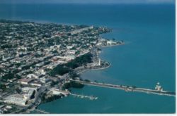

Emblem of Othon P. Blanco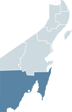
Coordinates: 18°30′13″N 88°18′19″W / 18.50361°N 88.30528°W Country Mexico State Quintana Roo Municipality Othon P. Blanco Founded May 5, 1898 (Othon P. Blanco) Current site 1898 Government - Mayor Andrés Ruiz Morcillo Elevation 10 m (33 ft) Population (2010) - City 151,243 - Urban 151,243 - Demonym Chetumaleño(a) Time zone CST (UTC−6) - Summer (DST) CDT (UTC−5) Postal code 77000 Area code(s) 983, 912 Website www.chetumal.gob.mx Chetumal (Chactemàal which means: "Place of the red wood" Modern Maya) (coordinates: 18°30′13″N 88°18′19″W / 18.50361°N 88.30528°W) is a city on the east coast of the Yucatán Peninsula in Mexico. It is the capital of the state of Quintana Roo and the municipal seat of the Municipality of Othón P. Blanco. In 2010 it had a population of 151,243 people.[1]
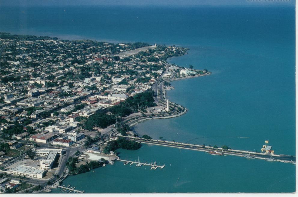
The city is situated on the western side of Chetumal Bay, near the mouth of the Río Hondo. Chetumal is an important port for the region and operates as Mexico's main trading gateway with the neighboring country of Belize. Goods are transported via a road connecting Chetumal with Belize City to the south, and also via coastal merchant ships. Because of its location on the Caribbean coastline, it is vulnerable to tropical cyclones; Hurricane Janet and Hurricane Dean, both Category 5 storms, made landfall near Chetumal in 1955 and 2007 respectively.[2]
Contents
History
In Pre-Columbian times, a city called Chactemal (sometimes rendered as "Chetumal" in early European sources), probably today's Santa Rita in Belize,[3][4] was the capital of a Maya state of the same name that roughly controlled the southern quarter of modern Quintana Roo and the northeast portion of Belize. This original Chetumal is now believed to have been on the other side of the Río Hondo, in modern Belize, not at the site of modern Chetumal.
During the Spanish conquest of Yucatán, the Maya state of Chetumal fought off several Spanish expeditions before finally being subjugated in the late 16th century.
The 1840s revolt of the indigenous Maya peoples against Mexican rule, known as the Caste War of Yucatán, drove all the Hispanic people from this region; many settled in British Honduras (modern Belize).
The current site of Chetumal was established as a Mexican port town in 1898, originally under the name Payo Obispo. The name was officially changed to Chetumal in 1936.
Two hurricanes in the 1940s leveled the entire town; Chetumal was devastated a third time in 1955 by Hurricane Janet. After this, the town was rebuilt with more solid construction, with concrete blocks replacing wood as the usual material.
The population of Chetumal was small (about 5,000 in 1950) until the construction of highways linking it to the rest of Mexico in the 1960s and 1970s; the city then boomed with substantial migration from other parts of Mexico.
Contemporary Chetumal
Chetumal is a small growing city with an international airport. The city has a Museum of Maya Culture as well as a zoo. Chetumal's economy has been influenced by its proximity to the border with Belize. A goods and services tax-free zone (Corozal Free Zone) established on the Belizean side attracts many visitors to Chetumal and also provides a ready market for Chetumal's retailers and traders. Chetumal itself was also once a free zone and a notable destination for people from other parts of Mexico seeking to purchase high-value and bulk goods, free of government duty charges (a policy that was deliberately implemented to attract this business). The city retains a significant retail trade for the region, which supports many local businesses.
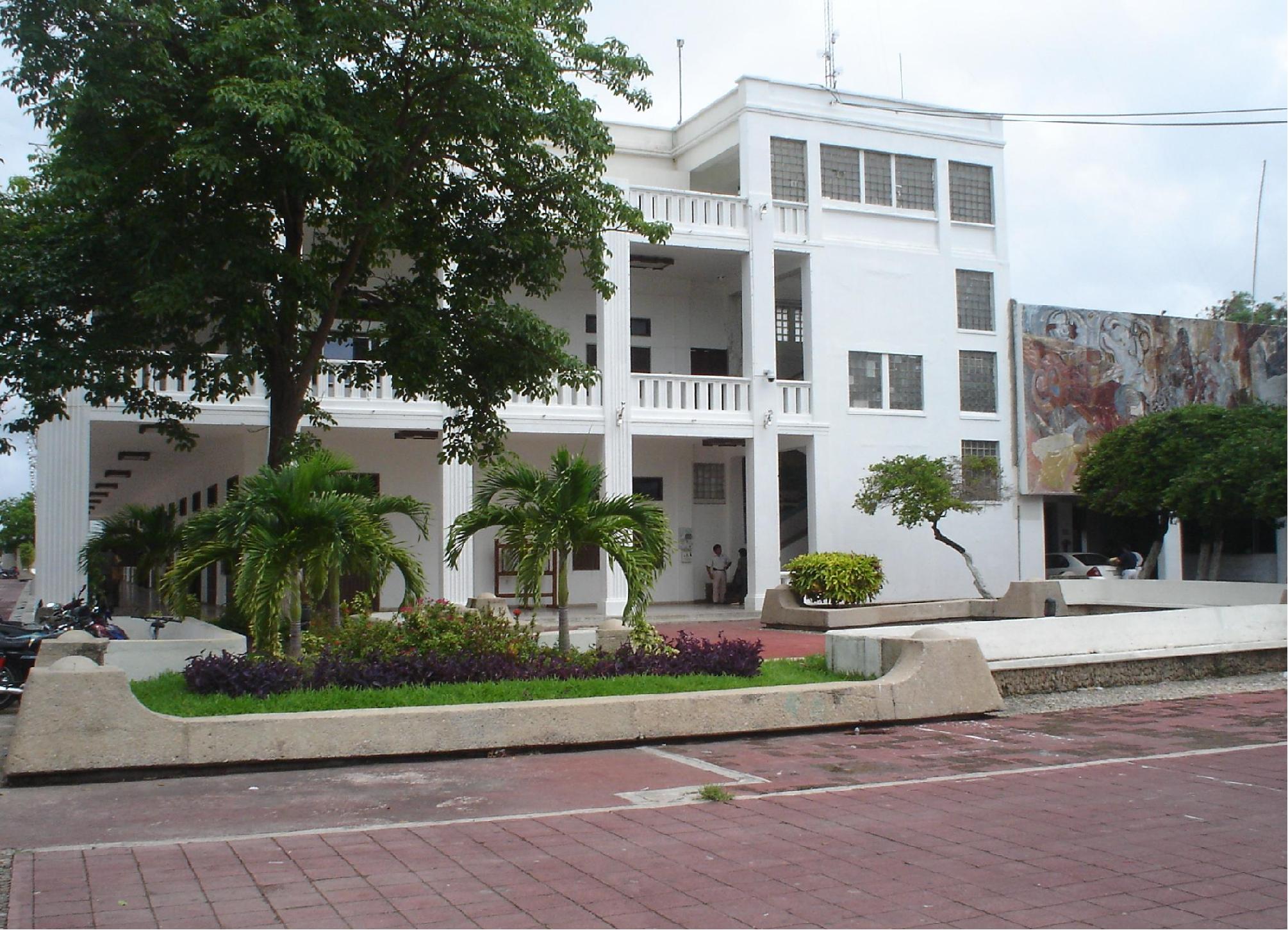
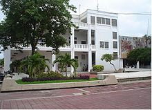 Front of the palace of the Governor of the state of Quintana Roo in Chetumal
Several modern malls have been built, such as the Plaza de Américas mall, which houses a modern movie theater (which belongs to the Mexican chain Cinepolis), various department store chains, fast-food outlets, and supermarkets. In addition to its retail economy, Chetumal is also the capital of the state of Quintana Roo. Since it is the location of all of the state's central offices, there is a large population of government employees whose consumption of local goods and services injects additional revenue into the Chetumal economy.
The city has a music school which offers lessons of various instruments as well as music theory and history. The school is the main music school of the state and is the home of the Junior symphonic orchestra of the state Quintana Roo ("Orquesta sinfonica juvenil del estado de Quintana Roo") which is directed by Silvia Alcantara Chavero.
The city houses two theaters. The "Teatro minerva", which is an open air theater and belongs to the state's music school , and the "Teatro Constitullentes", which is a private-owned theater.
There is a Country club, which features tennis, football and basketball courts, a gym, a swimming pool, a steam-bath and a lounge for parties.
In the early 1990s, the University of Quintana Roo was established at Chetumal, providing training and advanced tertiary degrees over a range of subjects.
Points of interest
 Museum of the Mayan Culture
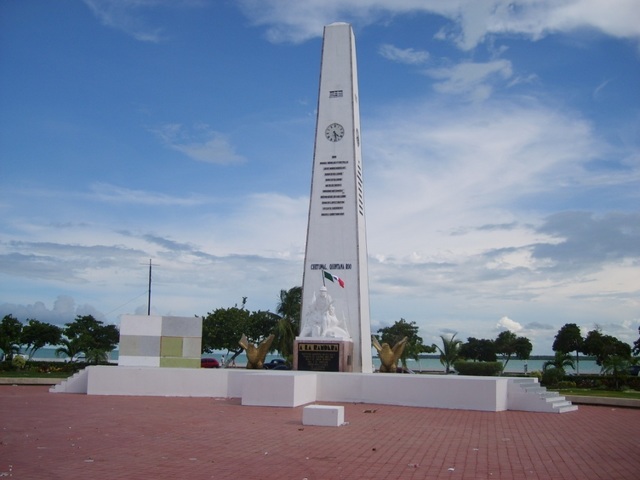
 Monument of the Flag (Monumento a la Bandera)
Museums
- Cultural Center of the Fine Arts (Centro Cultural de las Bellas Artes), located in the center of the city, the building it is housed in was the school Belisario Domínguez, which was the first school of Quintana Roo.
- Museum of the Mayan Culture (Museo de la Cultura Maya), considered the largest and most comprehensive museum in the state dedicated to the Mayan culture, has an important collection of authentic and reproductions of classical works, and tells the development of Mayan culture, its origins, as well as various aspects of their daily life.
- Museum of the City Tied to the Cultural Center of the Fine Arts, dedicated to the exhibition of photographs, tools and documents that tell the story of the founding of the city.
Monuments
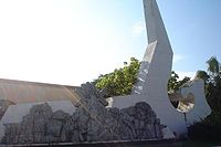
- Monument to the Flag (Monumento a la Bandera), the first monument built in Chetumal, it consists of a white obelisk that has a clock dial on each of its faces.
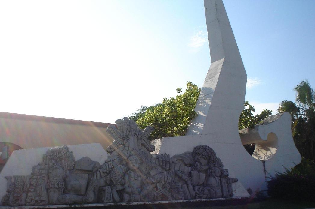
- Cradles of the Meztizaje (Monumento Cuna del Meztizaje), constructed in the entrance of Chetumal, it has the form of a Mayan pyramid on which are the statues of Gonzalo Guerrero, his wife Zazil Há and the children of both.
- Andrés Quintana Roo Memorial, dedicated to Andrés Quintana Roo, whom the state was named after.
- Monument to the Fishermen, one of the most recent, it is located in the Bay of Chetumal.
Parks
- Ecological Park (Parque Ecológico). There are many rabbits, turtles, birds and trees here.
- Cheese Park One of the most popular parks, it now has a skating park.
- Biouniverzoo Zoo of the city.
In literature
A "filthy bar buried deep in the most depraved slum of Chetumal, Mexico" is the starting locale for a 1950s styled men's adventure story published in Modern Drunkard magazine.[5]
References
- ^ 2010 census tables: INEGI
- ^ Carrillo, Manuel. Dean pummels Mexican resorts, Reuters Canada, 2007-08-21. Accessed 2007-08-21.
- ^ Belize Tourist Board. "Santa Rita". The Belize Virtual Guide. Naturalight Productions Ltd. http://www.travelbelize.org/german/html/guide/ma/ma13.html. Retrieved 14 August 2011.
- ^ Association for Belizean Archaeology (1989). Foster, Byron. ed. Warlords and maize men: a guide to the Maya sites of Belize. Cubola Productions. ISBN 9789686233063.
- ^ http://drunkard.com/issues/01_07/01_07_spill_kill_cult.html
External links
Coordinates: 18°30′13″N 88°18′19″W / 18.50361°N 88.30528°W
 State of Quintana RooChetumal (capital)
Municipalities (seats) Bacalar (Bacalar) · Cozumel (San Miguel de Cozumel) · Felipe Carrillo Puerto (Felipe Carrillo Puerto) · Isla Mujeres (Isla Mujeres) · Othón P. Blanco (Chetumal) · Benito Juárez (Cancún) · José María Morelos (José María Morelos) · Lázaro Cárdenas (Kantunilkín) · Solidaridad (Playa del Carmen) · Tulum (Tulum)

Places of interest Akumal · Arrecifes de Cozumel National Park · Banco Chinchorro · Chacchoben · Coba · Isla Contoy · Isla Holbox · Kohunlich · Mahahual · Muyil · Puerto Morelos · Punta Allen · Punta Sur · Riviera Maya · San Gervasio · Sian Ka'an · Tulum · Xcalak · Xcaret · Xelha · Yo'okop
 Mexican state capitalsAguascalientes (Aguascalientes) · Mexicali (Baja California) · La Paz (Baja California Sur) · Campeche (Campeche) · Tuxtla Gutiérrez (Chiapas) · Chihuahua (Chihuahua) · Saltillo (Coahuila) · Colima (Colima) · Mexico City (DF) · Durango (Durango) · Guanajuato (Guanajuato) · Chilpancingo (Guerrero) · Pachuca (Hidalgo) · Guadalajara (Jalisco) · Toluca (Mexico State) · Morelia (Michoacán) · Cuernavaca (Morelos) · Tepic (Nayarit) · Monterrey (Nuevo León) · Oaxaca (Oaxaca) · Puebla (Puebla) · Querétaro (Querétaro) · Chetumal (Quintana Roo) · San Luis Potosí (San Luis Potosí) · Culiacán (Sinaloa) · Hermosillo (Sonora) · Villahermosa (Tabasco) · Cd. Victoria (Tamaulipas) · Tlaxcala (Tlaxcala) · Xalapa (Veracruz) · Mérida (Yucatán) · Zacatecas (Zacatecas)Categories:
- Populated places in Quintana Roo
- Mexican state capitals
- Port settlements in Mexico
- Port cities in the Caribbean
- Populated places established in 1898
- Belize–Mexico border crossings


Wikimedia Foundation. 2010.