- Selje
-
Selje kommune — Municipality — 

Coat of arms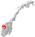
Sogn og Fjordane within
NorwaySelje within Sogn og Fjordane
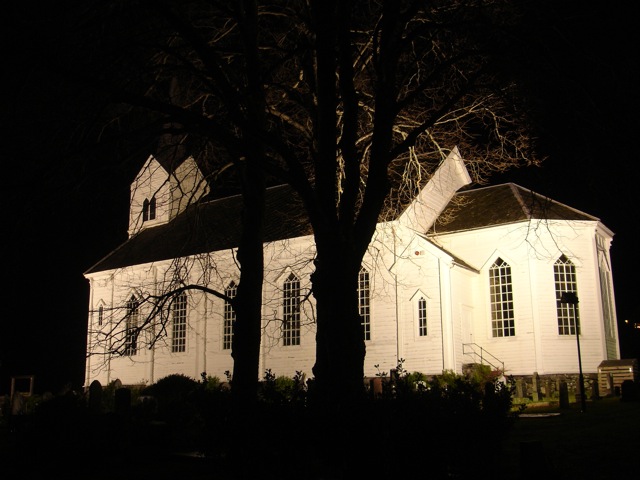
Coordinates: 62°8′14″N 5°13′23″E / 62.13722°N 5.22306°ECoordinates: 62°8′14″N 5°13′23″E / 62.13722°N 5.22306°E Country Norway County Sogn og Fjordane District Nordfjord Administrative centre Selje Government – Mayor (2001) Gunn Helgesen (KrF) Area – Total 226.14 km2 (87.3 sq mi) – Land 219.90 km2 (84.9 sq mi) – Water 6.24 km2 (2.4 sq mi) Area rank 315 in Norway Population (2010) – Total 2,821 – Rank 268 in Norway – Density 12.8/km2 (33.2/sq mi) – Change (10 years) -8 % Demonym Seljeværing[1] Time zone CET (UTC+1) – Summer (DST) CEST (UTC+2) ISO 3166 code NO-1441 Official language form Nynorsk Website selje.kommune.no Data from Statistics Norway 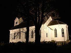 Selje church
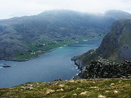
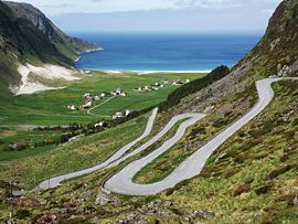 Hoddevik village on the Stad peninsula
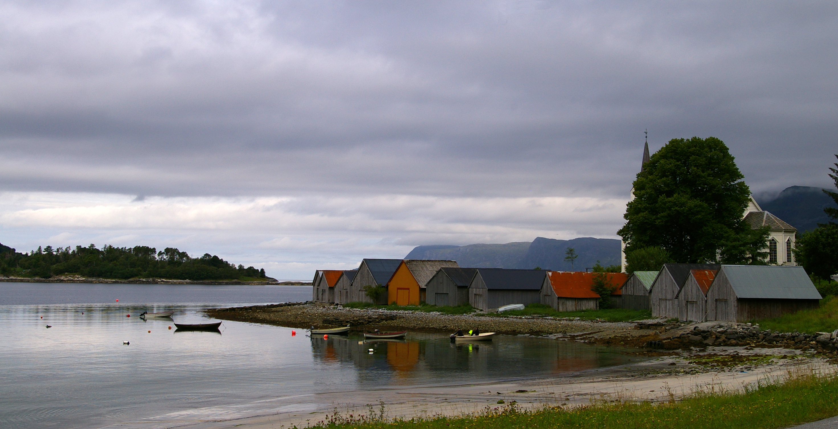
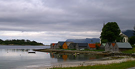 Some boat-houses at Selje
Selje is a municipality in the county of Sogn og Fjordane, Norway. It is located in the traditional district of Nordfjord. The village of Selje (population 685 in 2007)[2] is the administrative center of Selje municipality. Some of the other villages in the municipality include Barmen, Ervik, Flatraket, Hoddevik, Håvik, and Leikanger.
Selje is located at the northwesternmost part of Sogn og Fjordane county. Most of the municipality is located on and around the Stadlandet peninsula.
Selje was one of the first three Episcopal sees in Norway (Oslo, Nidaros, and Selje). After the diocese was moved to Bergen, monks took over the church in Selje, which was later destroyed by pirates in 1536. The municipality of Selje is also home to the Selje Abbey, a former Benedictine monastery located on the island of Selja. There are ruins of the abbey and church can still be seen on the island.[3]
Contents
General information
Selje was established as a municipality on 1 January 1838 (see formannskapsdistrikt). The original municipality was identical to the Selje parish (prestegjeld) with the sub-parishes (sokn) of Hove and Vågsøy.
In 1906 the sub-parish (sokn) of Vågsøy was divided in two: Nord-Vågsøy and Sør-Vågsøy. Then on 1 January 1910 these sub-parishes were separated from Selje to form municipalities of their own. The sub-parish of Hove was re-named Selje at the same time. After the separation, Selje had a population of 3,367 residents.[4]
Later, on 1 January 1964, Nord-Vågsøy, Sør-Vågsøy, and parts of Selje were merged to form the municipality of Vågsøy. The parts of Selje involved were the island of Silda, the Hagevik-Osmundsvåg area, and the farms of Sørpollen and Straumen.[5] There were 344 residents in those areas that were moved out of Selje.[4]
Name
The municipality (originally the parish) is named after the small island of Selja, since the first church was built there. The meaning of the name is unknown. Until 1889 the name was written Selø or Selløe.
Coat-of-arms
The coat-of-arms is from modern times (1991). It shows the Saint Sunniva, who according to the legend died as a martyr on the island of Selja.
Churches
The Church of Norway has three churches within the parish of Selje. It is part of the Diocese of Bjørgvin and the Rural Deanery (Prosti) of Nordfjord.[6][7]
Churches in Selje Parish
(Prestegjeld)Sub-Parish
(Sogn)Church Name Year Built Location
of the ChurchSelje Parish Ervik* Ervik kyrkje 1970 Ervik Leikanger* Leikanger kyrkje 1866 Leikanger Selje Selje kyrkje 1866 Selje *Formerly part of the Selje song, separated into their own "sogns" in 1997. Also, the ruins of the Selje Abbey (built in 1100) are located on the island of Selja
Government
All municipalities in Norway, including Selje, are responsible for primary education (through 10th grade), outpatient health services, senior citizen services, unemployment and other social services, zoning, economic development, and municipal roads. The municipality is governed by a municipal council of elected representatives, which in turn elect a mayor.
Municipal council
The municipal council (Kommunestyre) of Selje is made up of 17 representatives that are elected to every four years. For 2007–2011, the party breakdown is as follows:[8]
Selje Kommunestyre 2007 - 2011 Party Name Name in Norwegian Number of
representativesLabour Party Det Norske Arbeiderpartiet 4 Progress Party Fremskrittspartiet 4 Conservative Party Høyre 3 Christian Democratic Party Kristelig Folkeparti 3 Local Lists Lokale lister 1 Centre Party Senterpartiet 2 Total: 17 Mayor
The mayor (ordførar) of a municipality in Norway is a representative of the majority party of the municipal council who is elected to lead the council. Gunn Vårdal Helgesen of the Christian Democratic Party (Kristeleg folkeparti) was elected mayor for the 2007–2011 term.[9]
In 2007, Selje participated in a trial where the mayor was directly elected. The sitting mayor, Gunn Helgesen, was re-elected with 49.8% of the votes.[citation needed]
Many previous mayors have later entered national or regional politics: Julius Fure, Magne Aarøen, Åge Starheim, and Sverre J. Hoddevik.
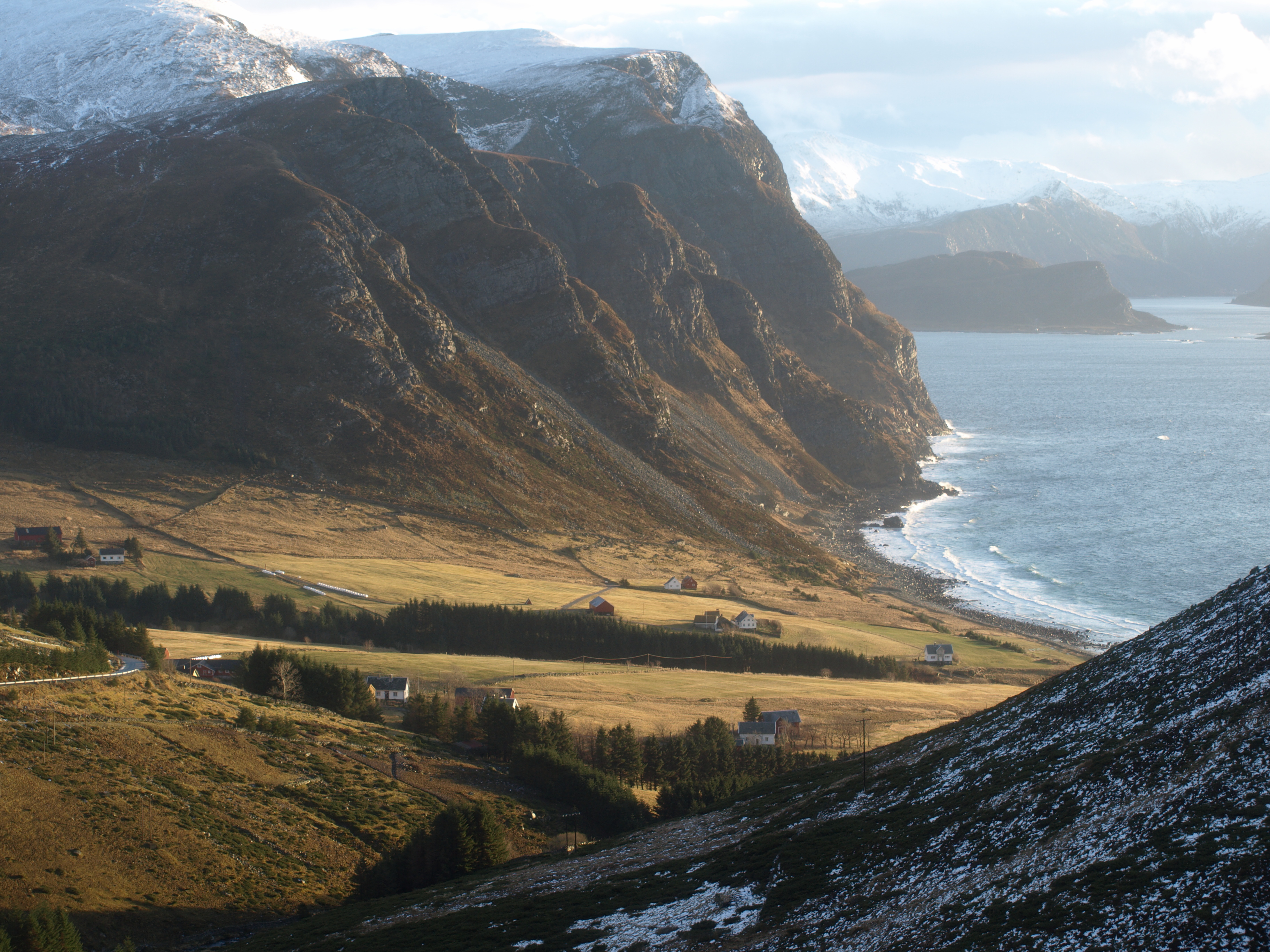
 Honningsvåg lake on the Stad peninsula
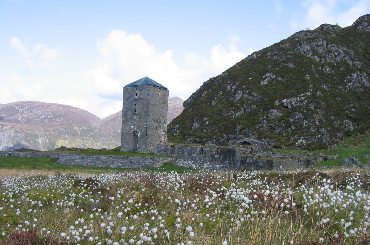
 Ruins of the Selje Abbey on Selja
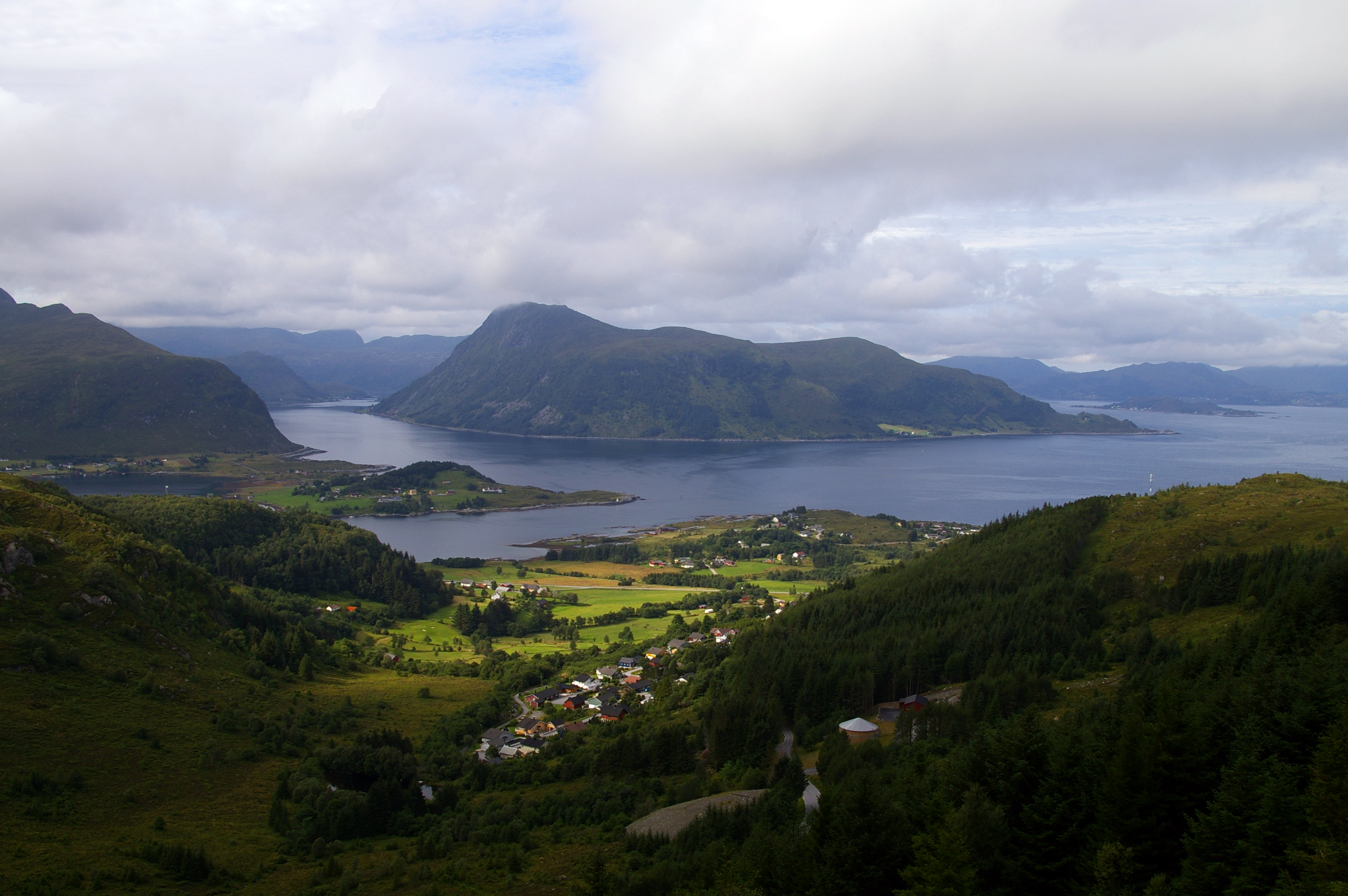
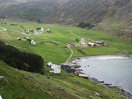 The village of Årvik on the Stad peninsula
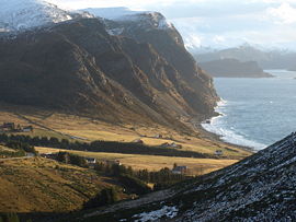 The village of Drage on the Stad peninsula
Geography
Selje is located in the northwesternmost part of Sogn og Fjordane county. It includes the Stad peninsula and the islands of Barmøya, Venøya, and Selja. Selje is surrounded by water on three sides. The Sildagapet bay on the west, the North Sea to the north, and the Vanylvsfjorden to the northeast. Selje is bordered to the south and west by the municipality of Vågsøy, to the east by Vanylven and Sande in Møre og Romsdal county.
Economy
The main industries in the municipality of Selje have been fishing and farming. These industries are still present in Selje, with the addition of new industries such as fish breeding, boat building, ready-made clothing manufacturing, and service industries.[3]
Attractions
Selja
On the island of Selja, a 15-minute boat trip from the village of Selje, lie the ruins of the Selje Abbey, its tower still intact. The abbey was built by Benedictine monks early in the 12th century in honour of St. Sunniva. The legend of St. Sunniva who was martyred here lives on. Norway has two male saints (St. Olav and St. Hallvard) and one female one, St. Sunniva, the guardian saint of Western Norway. According to legend, Sunniva, daughter of an Irish king, fled when her country was conquered by heathens and the new king wanted to marry her. She came ashore on the island of Selja. The St. Sunniva cave where Sunniva is said to have died is a large cavern containing remains of walls and traces of the first church dedicated to the Archangel Michael.
The island of Selja is also home to the following sites:
- The site of the first parish church which was later moved to the mainland. The ruins of St. Sunniva's Church on the site where Olav Trygvasson built one of the first churches in Norway.
- The ruins of St. Alban's Church, the monastery church dedicated to the English Saint Alban. The monastery ruins are still used for church ceremonies such as masses and weddings.
- Several Viking graves and the remains of an Iron Age long house have also been found on the south side of the island.[3]
Vestkapp
The part of Norway's mainland that is farthest west is in Selje. The West Cape (Vestkapp) is 496 metres (1,627 ft) above sea level at the northwestern end of the Stad peninsula. It is a precipitous rocky plateau, almost flat on top, that drops steeply down to the sea. In good weather, there is a panoramic view in all directions.[3]
Ervik
Ervik is located by the ocean near the West Cape at the end of the Stad peninsula. The Ervik Chapel is located here in memory of those who died when the coastal express ship St. Svithun, which was bombed in 1943. Ervik has a fine sandy beach, and a river rich in trout and salmon.[3]
References
- ^ "Personnemningar til stadnamn i Noreg" (in Norwegian). Språkrådet. http://www.sprakrad.no/nb-no/Sprakhjelp/Rettskrivning_Ordboeker/Innbyggjarnamn/.
- ^ "Urban settlements. Population and area, by municipality.". Statistics Norway. 1 January 2007. http://www.ssb.no/english/subjects/02/01/10/beftett_en/arkiv/tab-2007-06-07-01-en.html. Retrieved 20 July 2008.
- ^ a b c d e "Selje Municipality in Norway". GoNorway.com. http://www.gonorway.com/norway/township_seo.php?county=sogn-and-fjordande&township=selje&id=763b49b767511b9. Retrieved 20 July 2008.
- ^ a b Jukvam, Dag (1999). "Historisk oversikt over endringer i kommune- og fylkesinndelingen" (in Norwegian). Statistisk sentralbyrå. http://www.ssb.no/emner/00/90/rapp_9913/rapp_9913.pdf.
- ^ "The municipality of Selje". 19 March 2007. http://www.northseatrail.org/show_single_article.php?article_id=352&lang=uk. Retrieved 20 July 2008.
- ^ "Selje kirkelige fellesråd" (in Norwegian). Den Norske Kirke. http://www.kirken.no/?event=showCouncils&pFellesId=f1441.
- ^ Natvik, Oddvar (9 February 2005). "Some historical data on the 26 Kommunes". http://www.sf-f.kommune.no/sff/emigration3.nsf/enduser?readform.
- ^ "Members of the local councils". Statistics Norway. 2007. http://www.ssb.no/english/subjects/00/01/20/kommvalgform_en/tab-2008-01-29-15-en.html. Retrieved 20 July 2008.
- ^ Selje Kommune. "Ordførar" (in Norwegian). http://www.selje.kommune.no/artikkel.aspx?AId=73&back=1&MId1=14. Retrieved 20 July 2008.
External links
Municipalities of Sogn og Fjordane Nordfjord 
Sunnfjord Sogn Categories:- Municipalities of Sogn og Fjordane
- Villages in Sogn og Fjordane


Wikimedia Foundation. 2010.