- Høyanger
Infobox_Kommune
name = Høyanger
idnumber = 1416
county = Sogn og Fjordane
landscape = Sogn
capital = Høyanger
language =Nynorsk
demonym = Høyangring
munwebpage = www.hoyanger.kommune.no
governor = Kjartan Longva (Ap)
governor_as_of = 2003
arearank = 121
area = 908
arealand = 838
areapercent = 0.28
population_as_of = 2004
populationrank = 213
population = 4,550
populationpercent = 0.10
populationdensity = 5
populationincrease = -5.4
lat_deg = 61 | lat_min = 11 | lat_sec = 17 | lon_deg = 5 | lon_min = 53 | lon_sec = 44
utm_zone = 32V | utm_northing = 6787727 | utm_easting = 0333141 | geo_cat = adm2ndAudio|Hoeyanger.ogg|Høyanger is a municipality in the county of
Sogn og Fjordane ,Norway . It is located in the traditional district ofSogn . The administrative center is the village of Høyanger, which has 2221 inhabitants (2006). Other villages in Høyanger includeLavik ,Kyrkjebø ,Austreim , andVadheim . Høyanger was created on1 January 1964 when the municipalities ofKyrkjebø andLavik were merged.Høyanger is known for being one of the first industrial towns in
Norway leveraging its steep mountains surrounding the town giving excellent conditions for producinghydroelectricity needed forelectrolysis . The main product being produced in Høyanger wasaluminium .General information
Name
The name originally belonged to an arm of
Sognefjord (now called Høyangsfjord). The first element is "høy" which means "hay " and the last element is "angr" which means "fjord ". The word "høy" is probably referring to the green hillsides along the fjord.Coat-of-arms
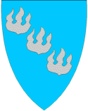
The
coat of arms is from modern times. The arms were granted on15 May 1987 . It shows threeflame s as a symbol for the local aluminium industry.Aluminium is melted and purified in Høyanger, due to the cheap hydroelectric energy that is locally available. The colors represent waterpower (blue) andaluminium (silver). [cite web|url=http://www.ngw.nl/int/nor/h/hoyanger.htm|author=Norske Kommunevåpen|date=1990|title=Nye kommunevåbener i Norden|accessdaymonth=11 June|accessyear=2008]Background
"Ladevig" was established as a municipality on
1 January 1838 (seeformannskapsdistrikt ). The municipality was created to be identical to the Ladevig parish "(prestegjeld)".In 1858 the district of Klævold (population: 1,645) was separated from
Lavik to constitute a municipality of its own. This left Ladevig with a population of 2,042. (The name of Klævold was changed to Kirkebø on1 July 1890 and later changed toKyrkjebø in 1917).In 1861
Lavik (population: 926) was merged withBrekke municipality (population: 898), located across theSognefjord . The municipality was then namedLavik og Brekke .In 1862 the sub-parish "(sokn)" of Bø in the western part of the municipality was removed from
Lavik og Brekke and merged with the Øn and Hyllestad sub-parishes "(sokn)" fromAskvoll to form a new municipality which was namedHyllestad .On
1 January 1875 , a part of Klævold with 90 inhabitants was moved toLavik og Brekke .On
1 January 1905 , the municipality was split into two separate municipalities:Lavik (population: 1,182) andBrekke (population: 982).On
1 January 1964 , a new municipality named Høyanger was created. It consisted of the former municipalities ofLavik (population: 894) andKyrkjebø (population: 4,742) along with the Nybø and Nygjerdet farms inVik .cite web|first=Dag|last=Jukvam|publisher=Statistics Norway|title=Historisk oversikt over endringer i kommune- og fylkesinndelingen|date=1999|url=http://www.ssb.no/emner/00/90/rapp_9913/rapp_9913.pdf no icon ]Today's municipality is identical to the Lavik parish "(prestegjeld)" which is made up of the sub-parishes "(sokns)" of Høyanger, Kyrkjebø, Lavik, and Bjordal og Ortnevik.cite web|url=http://www.emigration.no/sff/emigration3.nsf/0/326D0346278A5909C1256F570048962C?OpenDocument|title=Some historical data on the 26 Kommunes|first=Oddvar|last=Natvik|date=9 Feb 2005|accessdaymonth=11 June|accessyear=2008]
Churches
The
Church of Norway has six churches within the municipality of Høyanger. It is part of theDiocese of Bjørgvin and the RuralDeanery "(Prosti)" of YtreSogn .Government
All municipalities in Norway, including Høyanger, are responsible for
primary education (through 10th grade), outpatient health services, senior citizen services,unemployment and other social services,zoning ,economic development , and municipalroad s. The municipality is governed by a municipal council of elected representatives, which in turn elect amayor .Municipal council
The municipal council "(Kommunestyre)" of Høyanger is made up of 21 representatives that are elected to every four years. For 2007–2011, the party breakdown is as follows:cite web|publisher=Statistics Norway|url=http://www.ssb.no/english/subjects/00/01/20/kommvalgform_en/tab-2008-01-29-15-en.html|title=Members of the local councils|accessdaymonth=19 June|accessyear=2008|date=2007] Infobox_Kommunestyre
name = Høyanger
start = 2007
end = 2011
Total = 21
Arbeiderpartiet = 10
Fremskrittspartiet =
Høyre = 4
Kristelig_Folkeparti = 1
Rød_Valgallianse = 2
Rødt =
Senterpartiet = 3
Sosialistisk_Venstreparti =
Venstre = 1
Local_Lists = |Mayor
The
mayor "(ordførar)" of a municipality in Norway is a representative of the majority party of the municipal council who is elected to lead the council. The mayor for the 2007-2011 term is Kjartan Longva of the Labour Party "(Det Norske Arbeiderpartiet)". [cite web|author=Høyanger Kommune|title=Mandatfordeling i kommunestyret|date=9 Nov 2007|url=http://www.hoyanger.kommune.no/Modules/article.aspx?ObjectType=Article&Article.ID=2273&Category.ID=653|accessdaymonth=11 June|accessyear=2008 no icon]Geography
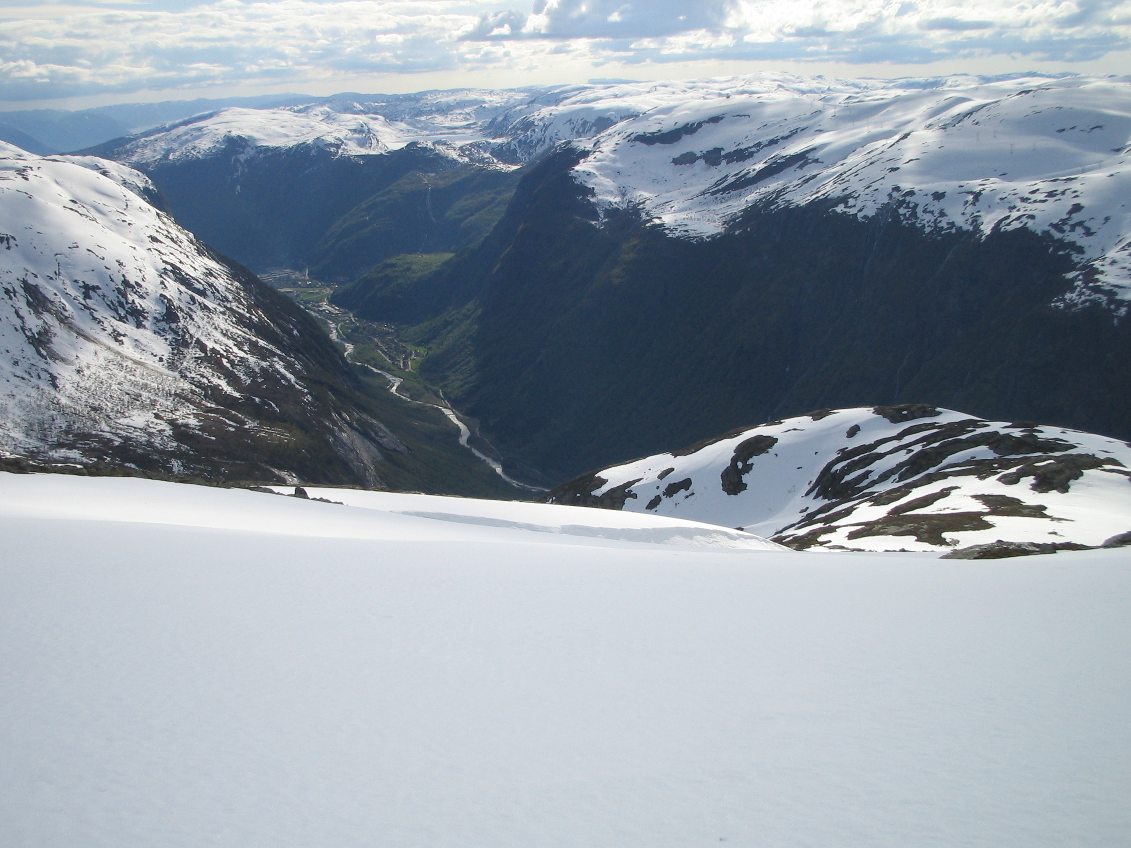
Høyanger forms part of the southern border of
Sogn og Fjordane county. TheSognefjord runs through the center of the municipality. Høyanger is bordered to the north by the municipalities ofFjaler andGaular , to the east byBalestrand andVik , to the south byModalen andMasfjorden (inHordaland county), and to the west byGulen andHyllestad .Høyanger municipality covers an area of about 910 km². Stølsheimen Nature Reserve was created in 1990 in Høyanger. Its 367 km² area stretches from high mountaintops through fertile
valley s and sweeps over steepmeadow s down to thefjord . Høyanger is perhaps best known for itsmountain farms and lakes. From the village of Ortnevik there are marked footpaths up to Stølsheimen Park and from the village of Bjordal you may drive up the Stordal road to the summit (2390 feet above sea level).Economy
Høyanger is a modern industrial community which has grown in pace with the principal employers being Hydro Aluminium and Høyanger Metallverk.
Hydroelectricity has played a major role in the development of the area. In addition to manufacturingaluminium , Høyanger supports a varied range of light industry that is backed by retail and service trades. In the rural areas bordering the fjord, farming is the main source of livelihood.cite web|title=Høyanger is a modern industrial community|date=2008|author=Høyanger Kommune|url=http://www.hoyanger.kommune.no/english/article.aspx?ObjectType=Article&Article.ID=1731&Category.ID=826|accessdaymonth=11 June|accessyear=2008] There are currently 115 traditional farms "gårds" in the municipality. Each traditional farms originally had one owner, but most of them have been divided up and sold off over the years, and so there are more than 115 farms in use today.Transportation
There are good connections with
Oslo andBergen by bus, as well as air and fast boat services. The nearest airport is inFørde , about 50 kilometres away. The village ofLavik is an important junction for traffic to and from Bergen. Høyanger is reached from the neighboring municipality ofBalestrand to the east by the "Bjordalstunnelen" which is 7.5 kilometers in length. It is one of the longesttunnel s inEurope . Good ferry services across theSognefjord link the northern and southern sides of the municipality. cite web|author=Høyanger Kommune|title=Høyanger is a modern industrial community|date=2008|url=http://www.hoyanger.kommune.no/english/article.aspx?ObjectType=Article&Article.ID=1731&Category.ID=826|accessdaymonth=11 June|accessyear=2008]Attractions
In 1986, in Høyanger, Norsk Hydro Aluminium/Høyanger Metallverk opened a museum designed to show what water power has meant both locally and to
Norway as a whole. Visitors will get to learn about how the aluminium industry has grown and prospered in the area thanks to the vastenergy produced bywater .Near Vadheim is an 18th-century stone bridge called the Ytredal Bridge. It is a popular tourist attraction.
References
External links
* [http://www.hoyanger.kommune.no Official website: Høyanger Kommune] no icon
* [http://www.nrk.no/sfj/leksikon/1233671.html NRK: Fylkesleksikon - Høyanger Kommune] no icon
Wikimedia Foundation. 2010.