- Møre og Romsdal
-
Møre og Romsdal fylke — County — 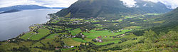

Coat of armsMøre og Romsdal within Norway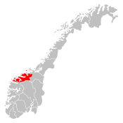
Country Norway County Møre og Romsdal Region Vestlandet County ID NO-15 Official language form Nynorsk[1] Demonym Møringer or Romsdalinger Administrative centre Molde Government – Governor Lodve Solholm
...
(2009–present)– County mayor Olav Bratland
Høyre
(2007–present)Area(#11 in Norway, 4.79% of Norway's land area) – Total 15,121 km2 (5,838.3 sq mi) – Land 14,590 km2 (5,633.2 sq mi) Population (2008) – Total 257,500 – Density 17/km2 (44.1/sq mi) – Change (10 years) 2.0 % – Rank in Norway 8 (5.24% of country) Time zone CET (UTC+01) – Summer (DST) CEST (UTC+02) Income (per capita) 139,200 NOK GDP (per capita) 243,412 NOK (2001) National Rank: 6 (3.89% of country) Website www.mrfylke.no Data from Statistics Norway Historical populations Year Pop. ±% 1951 191,621 — 1961 213,286 +11.3% 1971 223,709 +4.9% 1981 236,062 +5.5% 1991 238,278 +0.9% 2001 243,810 +2.3% 2011 253,904 +4.1% 2021? 282,661 +11.3% 2031? 303,810 +7.5% Source: Statistics Norway[2].[1]  Møre og Romsdal (help·info) is a county in the northernmost part of Western Norway. It borders the counties of Sør-Trøndelag, Oppland and Sogn og Fjordane. The county administration is located in Molde, while Ålesund is the largest city.
Contents
The name
The name Møre og Romsdal was created in 1936. The first element refers to the districts of Nordmøre and Sunnmøre, and the last element refers to Romsdal. Until 1919, the county was called "Romsdal amt", and from 1919-1935 "Møre fylke".
For the meanings of the names see Diocese of Møre and Romsdal.
Coat-of-arms
The coat-of-arms is from 1978. It shows three Viking ships (where the masts and the yards creates three crosses). The number of three represents the three districts of the county: Sunnmøre, Romsdal and Nordmøre.
History
Ragnvald Eysteinsson, earl of Møre until 890 and the founder of the Earldom of Orkney. Ragnvald might also have been the father of Rollo of Normandy.
Geography
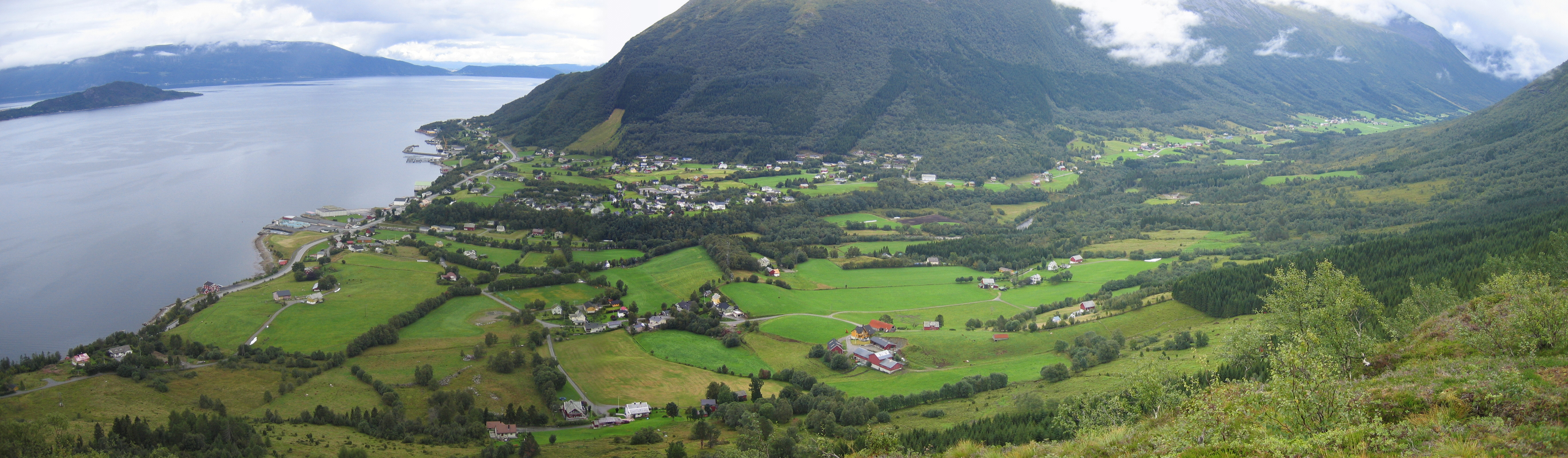
Traditionally, the county has been divided into three districts. From north to south, these are Nordmøre, Romsdal and Sunnmøre. Although the districts do not have separate governments and despite modern road, sea and air connections throughout the county, the three districts still have their own identities in many ways. Historically speaking, connections have been stronger between Nordmøre and Sør-Trøndelag to the north, Romsdal and Oppland to the east, and Sunnmøre and Sogn og Fjordane to the south, than internally. Differences in dialects between the three districts bear clear evidence of this. Due to geographical features, the county has many populated islands and is intersected by several deep fjords. Due to its difficult terrain, Møre og Romsdal has been very dependent on boat traffic, and its main car ferry company, MRF, has existed since 1921.
Settlements
Møre og Romsdal has six settlements with city status. The largest three were cities before 1993 when municipalities were allowed to grant city status which led to an increase in the number of cities. The county contains multiple other urban settlements (as defined by Statistics Norway) without city status, every municipality except for Halsa and Smøla containing at least one. As of 1 January 2009, 166,374 people (66.8 percent of the population) lived in an urban settlement.[4] The population density is highest near the coast, with all of the county's cities located on saltwater.
The largest city in the county is Ålesund, with a population of 42,317 in the municipality and 46,471 in the agglomeration which it forms together with parts of Sula.
Rank Community Kommune/Kommunar Region Population (2009) 1 Ålesund Ålesund, Sula Sunnmøre 46,471 2 Molde Molde Romsdal 19,353 3 Kristiansund Kristiansund Nordmøre 17,002 4 Ørsta Ørsta Sunnmøre 6,495 5 Volda Volda Sunnmøre 5,739 6 Ulsteinvik Ulstein Sunnmøre 5,251 7 Sunndalsøra Sunndal Nordmøre 4,240 8 Sykkylven Sykkylven Sunnmøre 4,083 9 Hareid Hareid Sunnmøre 3,773 10 Fosnavåg/Leinstrand Herøy Sunnmøre 3,521 Infrastructure
Møre og Romsdal is served by nine airports, of which only the airports located near the four largest centres have regular domestic flights. The largest airport in the county is Ålesund Airport, Vigra, which offers the only scheduled international routes from any airport in Møre og Romsdal. Ålesund Airport had 732,614 passengers in 2006. Kristiansund Airport, Kvernberget had 364,350 passengers in 2007, while Molde Airport, Årø had 401,292, down from 444,677 in 2006. Ørsta-Volda airport had 49,842 passengers in 2006. None of the airports in Møre og Romsdal offer regular flights to each other.[5]
In 2007, Møre og Romsdal had 6339 kilometres of public roads, an increase of 5 km since the previous year, as well as 4258 kilometres of private roads, 7 km more than in 2006.[6]
Municipalities
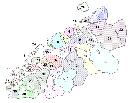
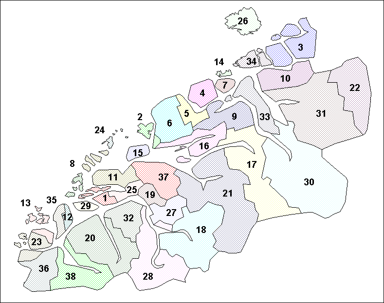
Møre og Romsdal has a total of 36 municipalities:
References
- ^ Projected population - Statistics Norway
- ^ Statistics Norway - Church of Norway.
- ^ Statistics Norway - Members of religious and life stance communities outside the Church of Norway, by religion/life stance. County. 2006-2010
- ^ "2 Population and area in urban settlements. Municipality. 1 January 2009" (in Norwegian). Statistics Norway. 2009. http://www.ssb.no/emner/02/01/10/beftett/tab-2009-06-16-02.html. Retrieved 7 November 2009.
- ^ Avinor.no
- ^ "Statistikkbanken" (in Norwegian). Statistics Norway. 2007. http://statbank.ssb.no/statistikkbanken/Default_FR.asp?PXSid=0&nvl=true&PLanguage=0&tilside=selectvarval/define.asp&Tabellid=06492. Retrieved 11 June 2008.
External links
 Media related to Møre og Romsdal at Wikimedia Commons
- Møre og Romsdal county
Coordinates: 62°30′00″N 07°10′00″E / 62.5°N 7.1666667°E
Counties of Norway Akershus · Aust-Agder · Buskerud · Finnmark · Hedmark · Hordaland · Møre og Romsdal · Nordland · Nord-Trøndelag · Oppland · Oslo · Østfold · Rogaland · Sogn og Fjordane · Sør-Trøndelag · Telemark · Troms · Vest-Agder · Vestfold
 Categories:


Wikimedia Foundation. 2010.