- Surnadal
Infobox_Kommune
name = Surnadal
idnumber = 1566
county = Møre og Romsdal
landscape = Nordmøre
capital = Skei
governor = Mons Otnes (Ap)
governor_as_of = 2007
arearank = 64
area = 1365
arealand = 1314
areapercent = 0.42
population_as_of = 2004
populationrank = 161
population = 6,209
populationpercent = 0.14
populationdensity = 5
populationincrease = -4.7
language = Nynorsk
lat_deg = 62 | lat_min = 56 | lat_sec = 51 | lon_deg = 8 | lon_min = 46 | lon_sec = 12
utm_zone = 32V | utm_northing = 6979766 | utm_easting = 0488342 | geo_cat = adm2nd
munwebpage = www.surnadal.kommune.noAudio|Surnadal.ogg|Surnadal is a municipality in the county ofMøre og Romsdal ,Norway .Surnadal was established as a municipality January 1, 1838 (see
formannskapsdistrikt ).Rindal was separated from Surnadal 1858.Stangvik andÅsskard (separated from Stangvik May 1, 1895) were merged with Surnadal January 1, 1965.The name
The
Old Norse form of the name was "Surnardalr". The first element is the genitive case of the rivername Surna, the last element is "dalr" m 'valley, dale'. The meaning of the rivername is unknown.Until 1918 the name was written "Surendalen".
Geography
The municipality is made up by the main valley of Surnadal and many smaller valleys and villages, such as Bæverfjord, Bæverdalen, Bøfjorden, Østbødalen, Todalen, Stangvik and Øvre Surnadal. The municipality is bordered by the mountain range
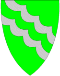
Trollheimen and the municipalitySunndal to the south, the neighbouring municipalityRindal to the east, the municipalityHalsa to the north and fjords to the west.Coat-of-arms
The coat-of-arms is from modern times (1989). The silver lines represent the many rivers in the municipality.
Nature
The nature is a combination of forests, fjords and mountains. The highest mountain peak is
Snota , 1,668 m.a.s. The river Surna runs through the valley from the east to the west, and forms a large delta where it enters the fjord. This river is rich onsalmon , which attract tourists from the rest of the country and abroad. A mild climate and rich soil make Surnadal well suited for agriculture. The local economy is based on agriculture, forestry and industrial production, in addition to services. The administrative centre is Skei. Communications include ferries to the southwest and the northwest, which lead to the coastal areas of Møre og Romsdal, and a highway to the city ofTrondheim to the east.Famous residents
Surnadal is noted for strong traditions in the field of poetry and folklore, and is the home of the late
Hans Hyldbakk , a nationally recognized author of poetry and local history.Explorer
Rune Gjeldnes is also from Surnadal.
Wikimedia Foundation. 2010.