- Herøy, Møre og Romsdal
Infobox_Kommune
name=Herøy
idnumber=1515
county=Møre og Romsdal
landscape=Sunnmøre
capital=Fosnavåg
governor=Arnulf Goksøyr (H)
governor_as_of=2003
arearank=372
area=135
arealand=118
areapercent=0.04
population_as_of=April 2008
populationrank=
population=8,338
populationpercent=0.18
populationdensity=71
populationincrease=0.8
demonym=Herøværing
language=Nynorsk
lat_deg=62| lat_min=21| lat_sec=20| lon_deg=5| lon_min=32| lon_sec=40
utm_zone=32V| utm_northing=6918572 |utm_easting=0321183| geo_cat=adm2nd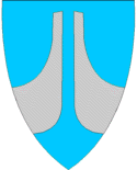
munwebpage=www.heroy.kommune.noHerøy is a municipality in the county of
Møre og Romsdal ,Norway .Herøy was established as a municipality January 1, 1838 (see
formannskapsdistrikt ). Sande was separated from Herøy 1867.Geography
The main population and administrative centre of the municipality is the town of
Fosnavåg , located on the island of Bergsøya. Herøy consists of eight islands, among themRunde , notable for its large seabird colonies andSkorpa , famous for its role as a station for theShetland bus .The
Herøyfjord bisects Herøy municipality. A fishing station,Flåvær is located on a group of islets andskerries in the Herøyfjord, It includes the islets "Flåvær", "Husholmen", "Torvholmen" and "Varholmen" ["Flåvær" light house is located on "Varholmen".] .Name
The municipality (originally the parish) is named after a
archipelago of small islands (Old Norse "Herøyjar"). For the meaning of the first element seeHerøy, Nordland , the last element is the plural form of "øy" f 'island'.Until 1918 the name was written "Herø".
Coat-of-arms
The coat-of-arms is from 1987. It shows two stems, which represent the 7th century
Kvalsund boats found in the municipality.External links
* [http://www.insel-runde.de The Bird Island of Runde (German language website)]
* [http://www.heroy.kommune.no/ Herøy Kommune (Norwegian)]References
Wikimedia Foundation. 2010.