- Nesset
-
Nesset kommune — Municipality — 

Coat of arms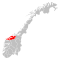
Møre og Romsdal within
NorwayNesset within Møre og Romsdal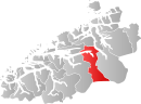
Coordinates: 62°39′31″N 8°7′13″E / 62.65861°N 8.12028°ECoordinates: 62°39′31″N 8°7′13″E / 62.65861°N 8.12028°E Country Norway County Møre og Romsdal District Romsdal Administrative centre Eidsvåg Government - Mayor (2007) Rolf Jonas Hurlen (H) Area - Total 1,046.32 km2 (404 sq mi) - Land 985.87 km2 (380.6 sq mi) - Water 60.45 km2 (23.3 sq mi) Area rank 98 in Norway Population (2010) - Total 3,074 - Rank 261 in Norway - Density 3.1/km2 (8/sq mi) - Change (10 years) -6.5 % Demonym Nessetgjelding[1] Time zone CET (UTC+1) - Summer (DST) CEST (UTC+2) ISO 3166 code NO-1543 Official language form Nynorsk Website nesset.kommune.no Data from Statistics Norway Nesset is a municipality in Møre og Romsdal county, Norway on the Romsdal Peninsula. The administrative centre is the village of Eidsvåg. Other population centers include Rausand, Boggestranda, Myklebostad, Eresfjord, and Eikesdalen.
Mardalsfossen, one of Norway's tallest waterfalls, a popular tourist attraction during the tourist season, is located in Nesset, along the shores of the lake Eikesdalsvatnet.
Contents
General information
Nesset was established as a municipality on 1 January 1838 (see formannskapsdistrikt). On 1 January 1890, all of Nesset south of the Langfjorden was separated to form the new municipality of Eresfjord og Vistdal. This split left Nesset with 1,706 residents. On 1 January 1877, the Sotnakken farm on the Romsdal peninsula (population: 19) was transferred from Nesset to neighboring Bolsøy municipality. Also on that date, the Tiltereidet and Meisalstranda areas (population: 212) of Tingvoll, along the west coast of the Tingvollfjorden, were transferred to Nesset. On 1 January 1890, the Bersås, Nævergjeld, Rausandhaugen, and Rausand area (population: 101) was transferred from Tingvoll (along the Tingvollfjorden) to Nesset. Then on 1 January 1964, Eresfjord og Vistdal was merged back into Nesset. Prior to the merger, Nesset had 2,360 residents.[2]
Name
The municipality (originally the parish) is named after the old Nesset farm and vicarage (Old Norse: Nøytisætr, spelled "Nødesetter" in 1520). The first element is probably nes which means "headlands" (since the farm is lying on a prominent headland) and the last element is setr or sætr which means "farm". Before 1889, the name was written Næsset.[3]
Coat-of-arms
The coat-of-arms is from modern times. They were granted on 10 March 1986. The broken gray line symbolizes the two stage drop on one of Europe's highest waterfalls, the Mardalsfossen, which is located in the municipality. The designer was Olav Sandø, from Eidsvåg.[4]
Churches
The Church of Norway has four parishes within the municipality of Nesset. It is part of the Diocese of Møre and the Rural Deanery (Prosti) of Indre Romsdal.
Churches in Nesset Parish
(Sokn)Church Name Year Built Location
of the ChurchEikesdal Eikesdal kyrkje 1866 Eikesdalen Eresfjord Sira kyrkje 1869 Eresfjord Nesset Nesset kyrkje 1878 Eidsvåg Vistdal Vistdal kyrkje 1869 Myklebostad Geography
 View of Boggestranda
The municipality is made up mostly of the Eikesdalen valley which surrounds the lake Eikesdalsvatnet. The lake is fed from the lake Aursjøen on the border of Oppland. The water then flows through the river Aura into Eikesdalsvatnet. That water then flows into the Eira River and then on to the Eresfjorden, a branch of the Langfjorden. The mountains Skjorta, Fløtatinden, and Gjuratinden surround the main valley.
Birdlife
From the shores of the fjord, to the towering mountains at 1,800 metres (5,900 ft) above sea level, the rural community of Nesset offers the visiting birder a range of habitats, and several interesting areas. One area worth checking is Eidsvågleirene. Though the selection of species will not be high, several of the commoner species can be found. Grey Heron is a characteristic species in the area along with Mallard.
References
- ^ "Personnemningar til stadnamn i Noreg" (in Norwegian). Språkrådet. http://www.sprakrad.no/nb-no/Sprakhjelp/Rettskrivning_Ordboeker/Innbyggjarnamn/.
- ^ Jukvam, Dag (1999). "Historisk oversikt over endringer i kommune- og fylkesinndelingen" (in Norwegian). Statistisk sentralbyrå. http://www.ssb.no/emner/00/90/rapp_9913/rapp_9913.pdf.
- ^ Rygh, Oluf (1908) (in Norwegian). Norske gaardnavne: Romsdals amt (13 ed.). Kristiania, Norge: W. C. Fabritius & sønners bogtrikkeri. pp. 275. http://books.google.com/books?id=yGtBAAAAIAAJ.
- ^ "Kommunevåpen - Nesset kommune". Nesset Kommune. http://www.nesset.kommune.no/artikkel.aspx?AId=26&back=1&MId1=6&MId2=14. Retrieved 2008-10-19.
External links
 Media related to Nesset at Wikimedia Commons
- Møre og Romsdal travel guide from Wikitravel
- Municipal fact sheet from Statistics Norway
Municipalities of Møre og Romsdal Ålesund · Aukra · Aure · Averøy · Eide · Fræna · Giske · Gjemnes · Halsa · Haram · Hareid · Herøy · Kristiansund · Midsund · Molde · Nesset · Norddal · Ørskog · Ørsta · Rauma · Rindal · Sande · Sandøy · Skodje · Smøla · Stordal · Stranda · Sula · Sunndal · Surnadal · Sykkylven · Tingvoll · Ulstein · Vanylven · Vestnes · VoldaCategories:- Nesset
- Municipalities of Møre og Romsdal


Wikimedia Foundation. 2010.