- Ørsta
-
Ørsta kommune — Municipality — Ørsta kommune 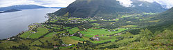
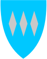
Coat of arms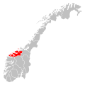
Møre og Romsdal within
NorwayØrsta within Møre og Romsdal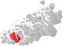
Coordinates: 62°12′01″N 06°07′56″E / 62.20028°N 6.13222°ECoordinates: 62°12′01″N 06°07′56″E / 62.20028°N 6.13222°E Country Norway County Møre og Romsdal District Sunnmøre Administrative centre Ørsta Government – Mayor (2007) Gødny Fagerhull (Ap) Area – Total 804.90 km2 (310.8 sq mi) – Land 785.50 km2 (303.3 sq mi) – Water 19.40 km2 (7.5 sq mi) Area rank 136 in Norway Population (2010) – Total 10,347 – Rank 99 in Norway – Density 13.2/km2 (34.2/sq mi) – Change (10 years) 0.65 % Demonym Ørsting[1] Time zone CET (UTC+1) – Summer (DST) CEST (UTC+2) ISO 3166 code NO-1520 Official language form Nynorsk Website www.orsta.kommune.no Data from Statistics Norway  Ørsta (help·info) is a village and municipality in Møre og Romsdal county, Norway. It is part of the Sunnmøre region of Western Norway. The administrative centre of the municipality is the village of Ørsta. Other villages in the municipality include Hovdebygda, Flåskjer, Leira, Urke, Bjørke, Sæbø, Sætre, and Store-Standal.
The village of Ørsta is located at the end of the Ørstafjorden, just south of the mountain Saudehornet. The 5.63-square-kilometre (2.17 sq mi) village has a population (2009) of 6,495.[2]
Contents
General information
The municipality was established on 1 August 1883 when it was separated from the municipality of Volda. The initial population was 2,070. On 1 January 1893, the Ytrestølen farm (population: 13) was transferred from Ørsta to Volda. On 1 January 1964, the municipalities of Hjørundfjord and Vartdal were also merged together with Ørsta. The new, larger municipality of Ørsta had a population of 9,252.[3]
Name
The municipality is named after the Ørstafjorden (Old Norse: Œrstr). The meaning of the name is unknown. Before 1918, the name was written Ørsten.[4]
Coat-of-arms
The coat-of-arms is from modern times. They were granted on 13 July 1984. The arms consist of three silver diamonds on a blue background. The three diamonds represent the mountains reflecting in the waters of the fjord.[5]
Churches
The Church of Norway has four parishes within the municipality of Ørsta. It is part of the Diocese of Møre and the Rural Deanery (Prosti) of Søre Sunnmøre.[6]
Churches in Ørsta Parish
(Sokn)Church Name Year Built Location
of the ChurchØrsta Ørsta kyrkje 1864 Ørsta Vartdal Vartdal kyrkje 1876 Nordre Vartdal Hjørundfjord Hjørundfjord kyrkje 1880 Sæbø Storfjorden Bjørke kyrkje 1919 Bjørke Geography
Of the total area, 48% (or 386 square kilometres / 149 square miles) is at an altitude of 600 metres (2,000 ft) or more above sea level.
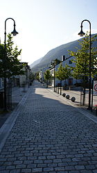 Ørsta centrum
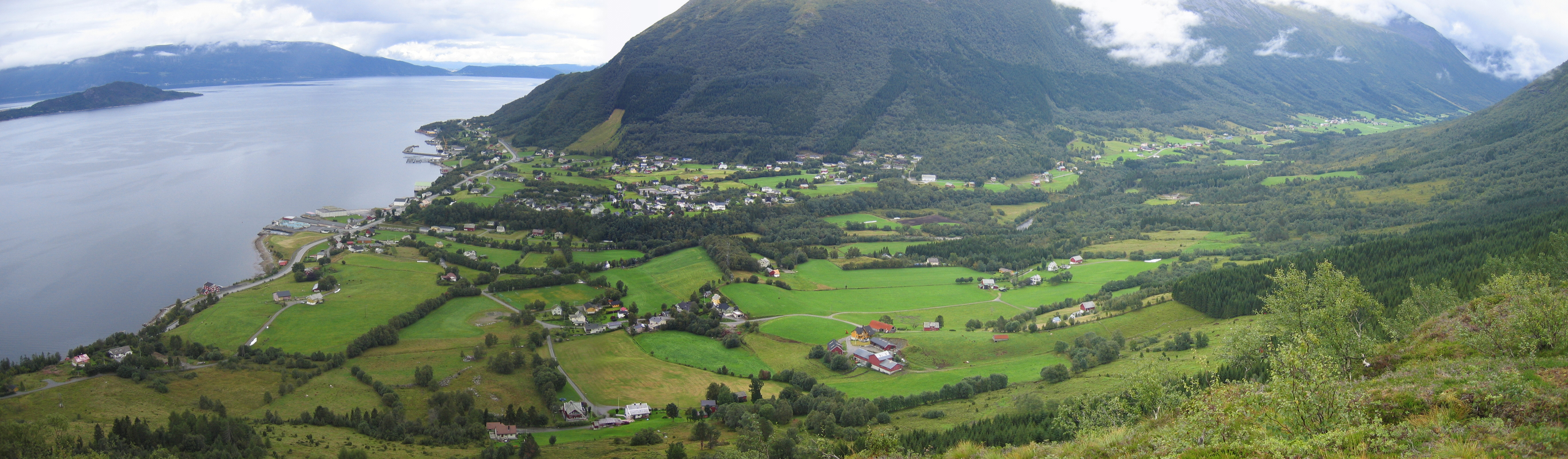
Apart from the mountains, Ørsta's dominant geographical feature is fjords: Storfjorden in the north, Vartdalsfjorden, Ørstafjorden in the west, and Hjørundfjorden in the east. Only in the south is it connected by land to neighbouring Volda. Otherwise, it borders to Sula in the north, Hareid and Ulstein (by sea only) in the west, Sykkylven to the northeast, Stranda to the southeast and Sogn og Fjordane county to the south-southeast.
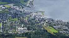 Ørsta seen from Vallahornet
Population centres include Sætre, Barstadvik, Hovdebygda, Sæbø, Åmdal, and the administrative centre Ørsta, from which the municipality is named.
The municipality is also the heartland of the Sunnmørsalpene mountains, a particularly rugged and wild area of mountains in the southern part of Møre og Romsdal. Prolific peaks include Slogen at 1,564 metres (5,131 ft), Skårasalen at 1,542 metres (5,059 ft), Kolåstinden at 1,432 metres (4,698 ft), Ramoen at 1,419 metres (4,656 ft), Saudehornet at 1,303 metres (4,275 ft), and Romedalstinden at 1,295 metres (4,249 ft). Other mountains include Hornindalsrokken, Kvitegga, and Jakta.
Economy
Important sectors are mechanical industry and furniture maufacturing, agriculture, commercial fishing, and aquaculture. The first two are predominant in the village Ørsta while agriculture dominates in adjacent valleys like Follestaddalen, Åmdalen and the Bondalen valley. On the other hand, the northern part of the municipality has strong naval traditions, with Vartdal being the home of one of the largest factory trawler fleets in Norway.
Transportation
These include Ørsta-Volda Airport, Hovden at Hovdebygda which is the regional airport for people living in the municipalities Ørsta, Volda, Vanylven, Sande, Ulstein, Hareid and Herøy, and European Route E39 which transects the municipality in a north–south direction. Ørsta is linked to Sula and Sykkylven by ferry on its northernmost extreme Festøy. It is also linked to Ulstein by the Eiksund Tunnel, an undersea tunnel that opened on 23 February 2008 that is, currently, the world's deepest at 287 meter below the sea surface.
Famous residents
Main category: People from Ørsta- Ivar Aasen, Norwegian philologist and lexicographer, creator of the Nynorsk language
- Helge Barstad, politician
- Anders Hovden, Norwegian priest an poet, creator of psalms like Fagert er landet.
References
- ^ "Personnemningar til stadnamn i Noreg" (in Norwegian). Språkrådet. http://www.sprakrad.no/nb-no/Sprakhjelp/Rettskrivning_Ordboeker/Innbyggjarnamn/.
- ^ Statistisk sentralbyrå (1 January 2009). "Urban settlements. Population and area, by municipality.". http://www.ssb.no/beftett_en/tab-2009-06-16-01-en.html.
- ^ Jukvam, Dag (1999). "Historisk oversikt over endringer i kommune- og fylkesinndelingen" (in Norwegian). Statistisk sentralbyrå. http://www.ssb.no/emner/00/90/rapp_9913/rapp_9913.pdf.
- ^ Rygh, Oluf (1908) (in Norwegian). Norske gaardnavne: Romsdals amt (13 ed.). Kristiania, Norge: W. C. Fabritius & sønners bogtrikkeri. pp. 86. http://books.google.com/books?id=yGtBAAAAIAAJ.
- ^ Norske Kommunevåpen (1990). "Nye kommunevåbener i Norden". http://www.ngw.nl/int/nor/o/orsta.htm. Retrieved 19 October 2008.
- ^ "Kyrkjelydane i Ørsta" (in Norwegian). Den Norske Kyrkja. http://www.ikyrkja.no/view.cgi?&link_id=0.1000.5261&session_id=0. Retrieved 2010-09-23.
External links
- Official site of Ørsta Tourist Board
- Ørsta kommune (Norwegian)
Municipalities of Møre og Romsdal Ålesund · Aukra · Aure · Averøy · Eide · Fræna · Giske · Gjemnes · Halsa · Haram · Hareid · Herøy · Kristiansund · Midsund · Molde · Nesset · Norddal · Ørskog · Ørsta · Rauma · Rindal · Sande · Sandøy · Skodje · Smøla · Stordal · Stranda · Sula · Sunndal · Surnadal · Sykkylven · Tingvoll · Ulstein · Vanylven · Vestnes · VoldaCategories:- Ørsta
- Municipalities of Møre og Romsdal
- Villages in Møre og Romsdal


Wikimedia Foundation. 2010.