- Sunnmørsalpene
Geobox | Range
name = Sunnmørsalpene
native_name =
other_name =
other_name1 =
image_size =
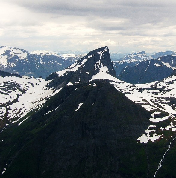
image_caption =Jakta seen fromSlogen in the summer.
country =Norway
country1 =
state =
state1 =
region =
region1 =
district =Møre og Romsdal
district_type = County
city =
city1 =
unit =
unit1 =
part_count =
part =
part1 =
border =
border1 =
geology =
geology1 =
period =
period1 =
orogeny =
orogeny1 =
area =
length =
length_orientation =
width =
width_orientation =
highest =Kvitegga
highest location =
highest_country =
highest_state =
highest_region =
highest_district =
highest_elevation = 1717
highest_lat_d =
highest_lat_m =
highest_lat_s =
highest_lat_NS =
highest_long_d =
highest_long_m =
highest_long_s =
highest_long_WE =
lowest =
lowest_location =
lowest_country =
lowest_state =
lowest_region =
lowest_district =
lowest_elevation =
lowest_lat_d =
lowest_lat_m =
lowest_lat_s =
lowest_lat_NS =
lowest_long_d =
lowest_long_m =
lowest_long_s =
lowest_long_WE =
woods =
free_name =
free_value =
map_size =
map_caption =
map_first =Sunnmørsalpene is a collective term for the mountains in
Sunnmøre , the mountains around the Hjørundfjord in the municipalitiesVolda ,Ørsta ,Stranda andSykkylven , with peaks reaching 1700 m straight up from the fjord. The most well-known peaks areSlogen , Randers Topp,Jakta ,Kolåstinden ,Hornindalsrokken ,Skårasalen andRåna . The area is well known to hiking and skiing enthusiasts. Specially for its long skiing season until beginning of June.
Wikimedia Foundation. 2010.