- Omaha Air Force Station
-
Omaha Air Force Station 
Part of Air Defense Command (ADC) Type Air Force Station Coordinates 41°21′39″N 096°01′28″W / 41.36083°N 96.02444°W Built 1951 In use 1951-1968 Controlled by  United States Air Force
Garrison 789th Aircraft Control and Warning (later Radar) Squadron 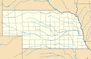
 Omaha AFSLocation of Omaha AFS, Nebraska
Omaha Air Force Station (ADC ID: P-71, NORAD ID: Z-71) is a closed United States Air Force General Surveillance Radar station. It is located 7.5 miles (12.1 km) north of Omaha, Nebraska. It was closed in 1968.
Contents
History
Omaha Air Force Station was one of twenty-eight stations built as part of the second segment of the Air Defense Command permanent radar network. Prompted by the start of the Korean War, on July 11, 1950, the Secretary of the Air Force asked the Secretary of Defense for approval to expedite construction of the permanent network. Receiving the Defense Secretary’s approval on July 21, the Air Force directed the Corps of Engineers to proceed with construction.
The 789th Aircraft Control and Warning Squadron was activated at the station on 1 May 1951. The squadron activated an AN/CPS-4 and AN/FPS-3 radar at Omaha in April 1952, and initially the station functioned as a Ground-Control Intercept (GCI) and warning station. As a GCI station, the squadron's role was to guide interceptor aircraft toward unidentified intruders picked up on the unit's radar scopes. Eventually the Air Force replaced the height-finder radar with an AN/FPS-6, and replaced the AN/FPS-3 search radar with an AN/FPS-20. In late 1959 this station was also performing air-traffic-control duties for the FAA.
An Army Air-Defense Command Post (AADCP) was established at Omaha AFS in 1959 for Nike missile command-and-control functions as part of the Offutt AFB Defense Area. The site was equipped with the AN/GSG-5(V) BIRDIE solid-state computer system. The Army Nike radars were fully integrated with the Air Force sets. Semi Automatic Ground Environment (SAGE) operations began in 1961, initially feeding data to DC-08 at Richards-Gebaur AFB, Missouri. After joining, the squadron was re-designated as the 789th Radar Squadron (SAGE) on 1 January 1962. The radar squadron provided information 24/7 the SAGE Direction Center where it was analyzed to determine range, direction altitude speed and whether or not aircraft were friendly or hostile. A second height-finder radar (AN/FPS-6A) was installed in 1962. On 31 July 1963, the site was redesignated as NORAD ID Z-71
In addition to the main facility, Omaha AFS operated the AN/FPS-18 Gap Filler site:
- Dallas Center AFS, IA (P-71D) 41°43′05″N 093°54′19″W / 41.71806°N 93.90528°W
Dallas Center was taken over in 1957 after its closure as M-122. It was operated until its final closure in December 1967.
In 1964 the AN/FPS-20A radar was upgraded to become an AN/FPS-66, then updated again to an AN/FPS-66A in 1967. The 789th Radar Squadron (SAGE) was deactivated 8 September 1968, and the search radar was transferred to the FAA. Today, Omaha AFS is an FAA site, still using the Air Force AN/FPS-66A radar as part of the Joint Surveillance System (JSS)
Air Force units and assignments
Units:
- 789th Aircraft Control and Warning Squadron, Activated on 1 May 1951
- Re-designated 789th Radar Squadron (SAGE), 1 January 1962
- Discontinued on 8 September 1968
Assignments:
- 543d Aircraft Control and Warning Group, 1 May 1951
- 31st Air Division, 6 February 1952
- 20th Air Division, 1 March 1956
- Kansas City Air Defense Sector, 1 July 1961
- 30th Air Division, 1 April 1966-8 September 1968
See also
- List of USAF Aerospace Defense Command General Surveillance Radar Stations
References
 This article incorporates public domain material from websites or documents of the Air Force Historical Research Agency.
- A Handbook of Aerospace Defense Organization 1946 - 1980, by Lloyd H. Cornett and Mildred W. Johnson, Office of History, Aerospace Defense Center, Peterson Air Force Base, Colorado
- Winkler, David F. (1997), Searching the skies: the legacy of the United States Cold War defense radar program. Prepared for United States Air Force Headquarters Air Combat Command.
- Information for Omaha AFS, NE
External links
Bases CONUSAdair · Beale · Bong (unbuilt) · Charleston · Davis-Monthan · Dobbins · Dover · Dow · Duluth · England · Ent · Ethan Allen · Fairfax · Fort Lee · Geiger · George · Glasgow · Grand Forks · Grenier · Griffiss · Gunter · Hamilton · Hancock · Homestead · Hurlburt · Imeson · K.I. Sawyer · Kincheloe · Kingsley · Kirtland · Larson · Luke · March · Malmstrom · McCoy · McChord · McClellan · McGhee Tyson · McGuire · Minneapolis-St. Paul · Minot · Mitchel · New Castle · Niagara Falls · Norton · O'Hare · Oklahoma City · Otis · Oxnard · Paine · Perrin · Peterson · Pittsburgh · Pope · Portland · Presque Isle · Richards-Gebaur · Selfridge · Seymour Johnson · Sioux City · Snelling · Stead · Stewart · Suffolk County · Tinker · Travis · Truax · Tyndall · Vandenburg · Webb · Westover · Willow Run · Wright-Patterson · Wurtsmith · Youngstown
OverseasErnest Harmon · Frobisher Bay · Goose Bay · Keflavik · Pepperrell · Thule · Topsham

Stations CONUSAlmaden · Charleston · Clear · Cross City · Benton · Empire · Mill Valley · Montauk · Mount Hebo · North Truro · Point Arena · Rye · Thomasville · Watertown
OverseasAlbrook
Air
Defense
unitsForcesAir
DivisionsSectorsAlbuquerque · Bangor · Boston · Chicago · Detroit · Duluth · Goose · Grand Forks · Great Falls · Iceland · Kansas City · Los Angeles · Minot · Montgomery · New York · Oklahoma City · Phoenix · Portland · Reno · Sault Sainte Marie · San Francisco · Seattle · Sioux City · Spokane · Stewart · Syracuse · Washington
WingsGroups1st · 4th · 10th · 14th · 15th · 23rd · 32nd · 33rd · 50th · 52nd · 53rd · 54th · 56th · 57th · 73rd · 78th · 79th · 81st · 82nd · 84th · 325th · 326th · 327th · 328th · 329th · 337th · 355th · 408th · 412th · 414th · 473rd · 475th · 476th · 478th · 500th · 501st · 502d · 503d · 507th · 514th · 515th · 516th · 517th · 518th · 519th · 520th · 521st · 525th · 527th · 528th · 529th · 530th · 533d · 534th · 564th · 566th · 567th · 568th · 575th · 678th · 701st · 4676th · 4700th · 4721st · 4722d · 4727th · 4728th · 4729th · 4730th · 4731st · 4732d · 4733d · 4734th · 4735th · 4756th
SquadronsAerospace Defense Command Fighter Squadrons · Aircraft Control and Warning Squadrons
Major
weapon
systemsElectronicFightersMissiles1 · 2 · 3 · 4 · 5
ShipsGuardian · Interceptor · Interdictor · Interpreter · Investigator · Locator · Lookout · Outpost · Pickett · Protector · Scanner · Searcher · Skywatcher · Tracer · Watchman · Vigil
Miscellaneous Air Defense Command Emblem Gallery (On Wikimedia Commons) · General Surveillance Radar StationsCategories:- SAGE sites
- Radar stations of the United States Air Force
- Closed facilities of the United States Air Force
- Military facilities in Nebraska
- Aerospace Defense Command

Wikimedia Foundation. 2010.