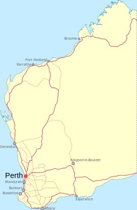
Noongar, Western Australia

Noongar, Western Australia
Noongar
Western Australia
Noongar is located in Western Australia
{{{alt}}}
Noongar
Established: 1925
Postcode: 6427
Elevation: 399 m (1,309 ft)
Location:
LGA: Shire of Yilgarn
State District: Eyre
Federal Division: O'Connor

Coordinates: 31°19′59″S 118°58′01″E / 31.333°S 118.967°E / -31.333; 118.967

Noongar is a small town located around half way between Merredin and Southern Cross along the Great Eastern Highway in Wheatbelt region of Western Australia.

Originating as a railway siding in 1899 along the Merredin to Yilgarn line the area was largely developed for agricultural purposes in 1924 and the need for a townsite became apparent. Lots were surveyed early in 1925 the townsite was gazetted later the same year.[1]

The name of the town is Aboriginal in origin and means big tree near small waterhole.

References

  1. ^ Western Australian Land Information Authority. "History of country town names". http://www.landgate.wa.gov.au/corporate.nsf/web/History+of+country+town+names. Retrieved 2011-06-11. 

Wikimedia Foundation. 2010.

Игры ⚽ Поможем сделать НИР

Look at other dictionaries:

  • Western Australia — Flagge Wappen (Details) …   Deutsch Wikipedia

  • Perth, Western Australia — Perth, Australia redirects here. For the town in Tasmania, see Perth, Tasmania. For other uses, see Perth (disambiguation) and Perth, Western Australia (disambiguation). Perth Western Australia …   Wikipedia

  • Denmark, Western Australia — This article is about the town of Denmark. For the local government area, see Shire of Denmark. Denmark Western Australia Denmark Western Australia …   Wikipedia

  • Busselton, Western Australia — Infobox Australian Place | type = town name = Busselton state = wa caption = lga = Shire of Busselton postcode = 6280 pop = 15,386 Census 2006 AUS|id=UCL503200|name=Busselton (Urban Centre/Locality)|accessdate=2007 10 02] est = 1832 stategov =… …   Wikipedia

  • Mindarie, Western Australia — Coordinates: 31°41′17″S 115°42′25″E / 31.688°S 115.707°E / 31.688; 115.707 …   Wikipedia

  • Albany, Western Australia — Infobox Australian Place | type = city name = Albany state = wa caption = pop = 25,196 pop footnotes = (2006 census) area = 89.8 density = 281 maxtemp = 19.4 mintemp = 11.6 rainfall = 930.5 postcode = 6330 est = 1826 area = timezone = AWST utc =… …   Wikipedia

  • Neerabup, Western Australia — Neerabup Perth, Western Australia Agricultural land on Wattle Avenue …   Wikipedia

  • Manjimup, Western Australia — Manjimup Western Australia Entrance to Manjimup, late afternoon …   Wikipedia

  • Toodyay, Western Australia — Toodyay Western Australia …   Wikipedia

  • Mullalyup, Western Australia — Mullalyup Western Australia …   Wikipedia

Share the article and excerpts

Direct link
Do a right-click on the link above
and select “Copy Link”