- Moorine Rock, Western Australia
-
Moorine Rock
Western AustraliaPopulation: 188 (2006 Census))[1] Established: 1925 Postcode: 6425 Elevation: 377 m (1,237 ft) Location: - 347 km (216 mi) E of Perth
- 22 km (14 mi) WSW of Southern Cross
- 83 km (52 mi) E of Merredin
LGA: Shire of Yilgarn State District: Eyre Federal Division: O'Connor Coordinates: 31°19′01″S 119°04′34″E / 31.317°S 119.076°E
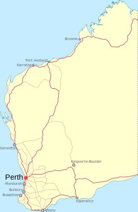
Moorine Rock is located in the eastern agricultural region of Western Australia, 347 km east of Perth and 22 km west south west of Southern Cross. It is located on the Great Eastern Highway and the railway line from Northam to Southern Cross. When the line was opened in 1895 a railway station was established here and named Parkers Road after a nearby road. The road led to Parker Range, an area where Mr W M Parker made a gold find in 1888. In 1923 the district surveyor for the area reported there was a need to survey some lots at Parkers Road station. The survey was carried out the following year, and in 1925 the area was gazetted as the townsite of Parker Road.
In 1926 the local member of Parliament advised the name of the townsite was causing confusion because it was too similar to Parker Range, a nearby goldmining area, and was also the name of a road in Southern Cross. He suggested the alternative name of Moorine, after Moorine Rock. This name was too similar to Moora, but was accepted with the full name Moorine Rock. The change of name of the townsite was gazetted in 1926. Moorine Rock is the Aboriginal name of some rocks near the townsite, first recorded by an explorer in 1865. The meaning of the name is not known.
Moorine Rock also serves as a stop on the Prospector rural train service.
References
- ^ Australian Bureau of Statistics (25 October 2007). "Moorine Rock (State Suburb)". 2006 Census QuickStats. http://www.censusdata.abs.gov.au/ABSNavigation/prenav/LocationSearch?collection=Census&period=2006&areacode=SSC54831&producttype=QuickStats&breadcrumb=PL&action=401. Retrieved 2008-09-16.
- Western Australian Land Information Authority. "History of country town names". http://www.landgate.wa.gov.au/corporate.nsf/web/History+of+country+town+names. Retrieved 2007-06-08.
Preceding station Transwa Trains network Following station towards East PerthProspector towards KalgoorlieCategories:- Towns in Western Australia
- Australian Aboriginal placenames
Wikimedia Foundation. 2010.

